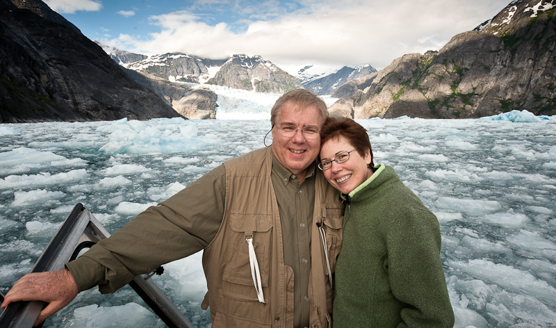
Cedar Bight to Gut Bay

Karen has taken over the blog, because Bob is cooking up a storm from our cozy anchorage in Gut Bay.

We awoke in Cedar Bight to light rain and clouds…of course. It always seems that way when we want to launch the kayaks. But we haven’t yet christened them on this trip, and time was awastin!  So after a quick breakfast, we got the 12ft Pungos  in the water and the rain stopped for a while. When Bob was making breakfast, I saw that crazy black bear again on the beach.

20100624_Cedar Bight to Gut Bay_0021

Karen loves her new Pungo Kayak

20100625_Cedar Bight to Gut Bay_0122-Edit

Cedar Bight makes for a good paddle

20100625_Cedar Bight to Gut Bay_0092-Edit

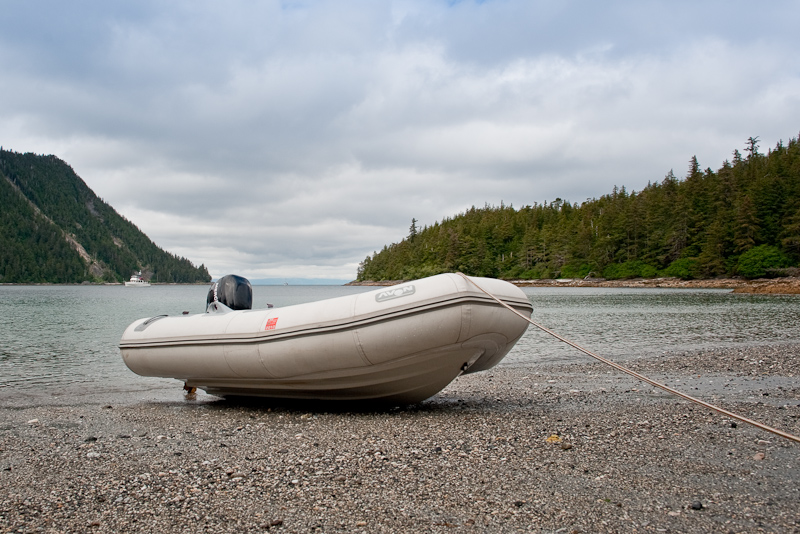
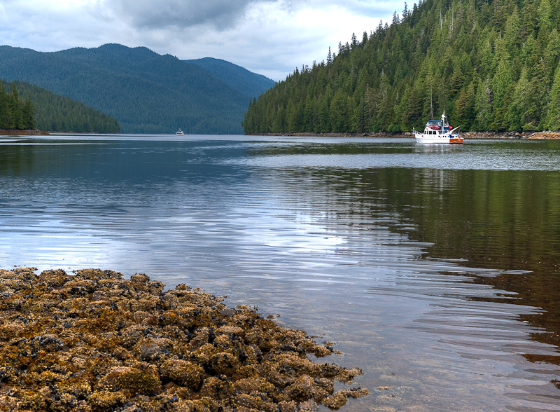
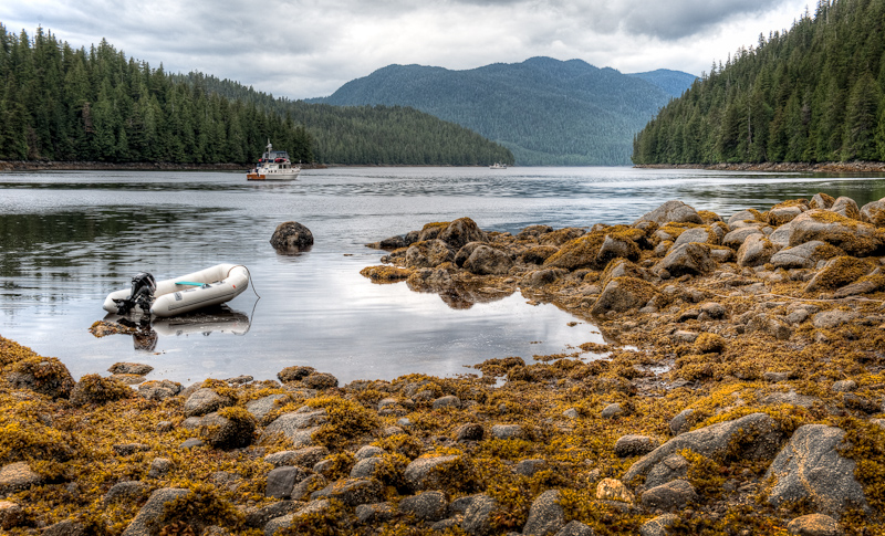
Arctic Star sits at anchor in Cedar Bight…notice the seal head just to the left of our boat

It was super to be back in the kayaks again. There is something magical about the peaceful sound of paddling and the fact that you are so near to the waterline. We decided to paddle to the head of the bay to check out what looked like a freshwater creek and then head for the small inlet we saw via dinghy the day before. As we were just starting to paddle…yes…you guessed it, I saw the black bear again, over on the east shore this time.

Bob set off paddling at a good clip, because we have been too far away for good bear pictures on this trip. The bear was unaware of us at first, but as he approached, the bear raised his head and kind of looked poised for action. What action? I wasn’t sure…but I surely let Bob take the lead in his kayak. I floated behind, ready to backpaddle at a moment’s notice.

20100624_Cedar Bight to Gut Bay_0004-Edit

Mr. Bear takes notice of us

The bear apparently didn’t like the sound of Bob’s camera clicking, and he started to amble away.  A few more splashes from the kayak paddles and he disappeared into the woods. That was OK with me.

20100625_Cedar Bight to Gut Bay_0049-Edit

Bob poses for a picture

20100625_Cedar Bight to Gut Bay_0039-Edit

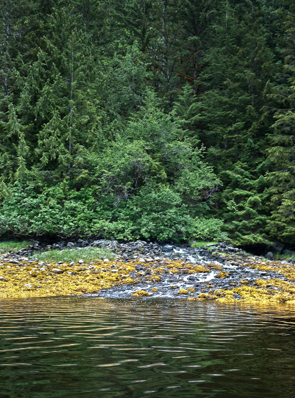
The stream that feeds he head of the bay…good exploring by foot from here…bring the bear spray

We explored the head of the bay, and what we could of the creek. The entire time, a lone grey seal was following us, kind of tracking us but diving and making a fuss if he got closer than he intended. We thought the bear had a great beach, and as we departed the creek area I heard this bubbling sound and it was like a small fountain was under the water. The water wasn’t more than a few inches deep…and then all around there were smaller bubbles. We have no idea if it was a hot springs or really big geoducks. It was cool, though.

We headed over to the  inlet, crossing a shallow and rocky entrance to see a small inner bay, perhaps part of the bear’s beach patrol area. The seal followed us faithfully. We decided to just drift a while and see what happened with the seal.  It came closer and closer. It did NOT like the sound of Bob’s camera, but it seemed to like my “hey, sealie, sealie” voice, and it got close enough to be within two kayak lengths away. Bob got a pretty good picture of that.

20100625_Cedar Bight to Gut Bay_0159

Our curious friend followed us the whole time were explored the area

Back to the boat after about an hour, and we secured the kayaks before heading off to see Happy Cove, another anchorage in Tebenkof that sounded both small and nice. WRONG. It was pretty unappealing and I just wanted to get out. Bob liked Tebenkof, but had commented how it all looked pretty much “alike”…and with forecasts for rain on Saturday with wind, we decided to head off two days early for the east side of Baranof Island and Gut Bay.

We departed Tebenkof about 1:30. It was a long run across the Strait and we were glad our stabilizers helped offset the beam seas we faced. Behind us, Kuiu Island was enshrouded in fog and clouds, but we could see the mountains of Baranof beckoning. We saw eagles swooping and dive bombing some areas out in the Strait…we didn’t see them catch anything, and can’t imagine how long a flight they’ve have back to their crazy rocks in the Bay’s entrance if they actually caught something. Bob worked on pictures while I drove over to Mist Cove, the supposed site of a lovely waterfall.

20100625_Cedar Bight to Gut Bay_0300-Edit-Edit

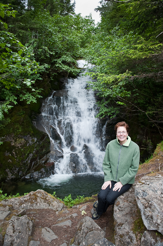
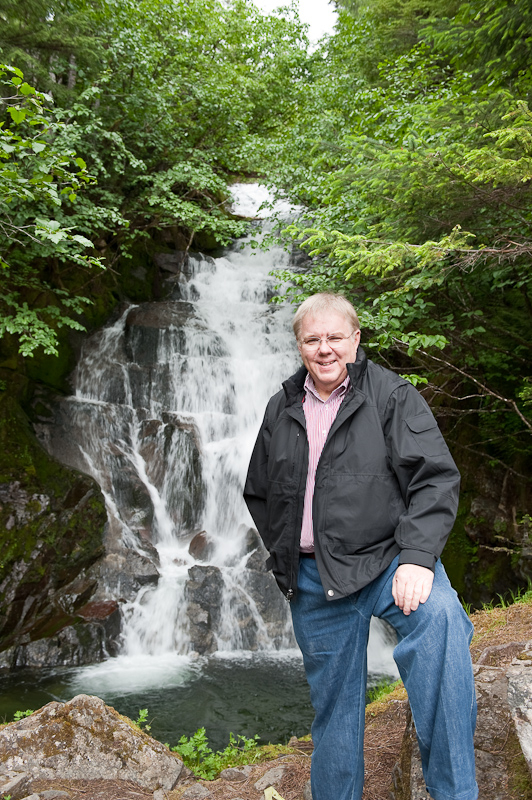
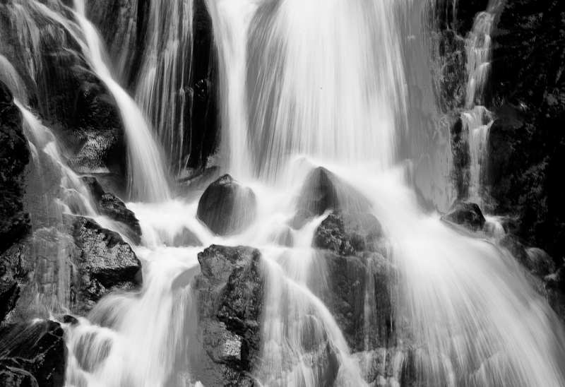
The waterfall at Mist Cove

Sometimes I get a bit frustrated at the lack of info on Alaska…I love to research things to do and places to see, so I search published books as well as boater blogs. Guess I messed up somehow, because although we saw the pretty waterfall from the Strait, as soon as we entered the Cove, the waterfall was completely obscured by the trees, and the Cove was tiny and the head was now taken up by somebody’s float. So we left, me driving again, so Bob could get a few pix from back out in the Strait.

Another two  hours or so and we arrived at the entrance to Gut Bay. This was one that sounded pretty good, a remote and quiet Bay with few anchoring spots and some serious granite mountains on either side. It was absolutely impressive upon entering, and we actually had some blue skies peeking through the clouds to illuminate our way.  After the last two days in Tebenkof, we had seen no other boats at all – not pleasure boats, not fishing boats. I saw no boats either on the crossing of the Strait. Imagine our surprise to find a little fishing boat trawling away inside Gut Bay! He headed off for the head of the bay while we made our way down towards Mickie’s Winter Basin.

20100625_Cedar Bight to Gut Bay_0310_1_2-Edit-Edit

Entrance to Gut Bay…topography promises to be interesting

Gut bay entrance pano 1

The scenery get better around every turn

20100625_Gut Bay_0015-Edit

The view from our first anchorage in Gut Bay

20100625_Gut Bay_0079_80_81

The rain makes the waterfall sing

This Basin was the site where a Frenchwoman and her companion wintered over in the ice(!!) in 1995. I can only imagine what that was like. By the time we approached the Basin, the tide was too low to enter over the narrow and shallow bar. So we decided to drop the anchor outside the basin. It was DEEP almost right to shore. Shore was dominated by tall mountains and multiple waterfalls, with trees right down to the shoreline. It was again…impressive. We ended up having to anchor in 70’, which still put us quite close to shore depending on how the wind blew. We were really tired though, and decided to stay put after watching the boat spin about and deciding we’d be safe for the evening. I made tuna fish melts to spell the chef, and we enjoyed the scenery and the bits of blue sky until about 10pm. The forecast for Saturday was Rain and Wind…and we expect to see at least the rain when we awake.

20100625_Gut Bay to Red Bluff Bay_0358-Edit-Edit

Bob helps the satellite phone make a connection to send and receive emails

20100625_Gut Bay to Red Bluff Bay_0362-Edit

An easy dinner…tuna melt

Shelter Cove to Cedar Bight

Alaska is Big. No, I mean REALLY BIG!!!!!

We’re in Tebenkof Bay. When you look at a chart of Alaska, Tebenkof does not appear to be all that large. But once you are here, it is enormous.  As we make our way to the various anchorages in Tebenkof, we continue to be bewildered by the distances. What looks like a mile is 6 miles…or more.

20100624_Eye of the Needle to Cedar Bight_0089-Edit

Baranof Island as seen from the entrance to Tebenkof

We’ll see a humpback feeding and decide to investigate further, and 45 minutes later we‘ll just be close enough to take some pictures. We’ve been out twenty days and our internal distance scale has not yet recalibrated. I wonder if when we get home after five weeks in Alaska, if everything will seem too close and cramped. Karen often feels that way anyway…so I suspect this time in Alaska will just intensify that feeling.

20100624_Eye of the Needle to Cedar Bight_0292

My first every frittata was a success

We left Shelter Cove late morning with a goal to visit the Eye of the Needle in Tebenkof. Now the Eye of the Needle sounds small and narrow. And when you look at the charts (and read the sole “guidebook”), it appears exactly that. However, due to the distorted perception of space and distance here, it’s not really that small. Relative to all of Alaska it is small, but in the absolute we have been through much narrower passes, with much less water with critical timings for tides and currents.

20100624_Eye of the Needle to Cedar Bight_0297-Edit

Entering the Eye of the Needle

20100624_Eye of the Needle to Cedar Bight_0038

Karen keeping warm at the Eye of the Needle

Our trip started at a plus 6 foot tide and that made the trip very comfortable. At the end, or the Eye, you anchor in 12 feet of water behind a small islet. It is beautiful and almost certainly you will be alone. Although we only stayed for an hour, we would definitely come back and plan to stay a couple of days and explore the back bay via Kayak – especially if the weather was sunny.

Another note on navigation. The word is that much of the charts of Alaska are incomplete in that there are rocks and other obstructions that are not charted. Knock on wood so far… but I have to say that the Nobeltec electronic charts we are using are spot on. Thus far, what we see on the charts matches what we see out our cabin windows. That is reassuring, although we are keenly skeptical and err on the cautious side.

Scale is also impacting our fuel calculations. When we’re in the Broughton Archipelago for three weeks, we never worry about fuel. At the end of our travels, we pull up to the fuel docks and we usually have half tanks or better. If my calculations are correct we have used 250 gallons of diesel to go 218 miles. That means 58% of our fuel remains. So today we did a little planning to make certain we’ll make it to our fuel stop in Kake with a good safety margin. The only way to calculate fuel usage is to look at the site gauge and, using a tape measure, determine how full the tanks are. Old fashioned methodology but compared to the electronic Computank device we have onboard that says we added six gallons of fuel today, I’ll definitely place more trust in the tried and true methods.

As we were entering The Eye of the Needle Karen, who has become quite a critter spotter, had sighted a humpback feeding out toward the entrance to Tebenkof Bay. So after the Eye and before we made our way down Petrof Bay for the day’s anchor spot, we took a detour to see what the humpback was up to. Sure enough, he was still there. We made our way over and sat and watched and took pictures for a while. He would come up from the depths, show his flipper, pound the surface of the water with it, and then emerge, mouth wide open, before submerging again. He traveled in a large circle near a shallow (60 foot) area. As we looked at our Nobeltec charts, it turns out that this is exactly the same spot we saw a humpback yesterday on our way into Tebenkof. I suspect that this fellow has staked out this area as his own.

20100624_Eye of the Needle to Cedar Bight_0142-Edit

Humpback feeding

20100624_Eye of the Needle to Cedar Bight_0193-Edit

High-Five from our friendly humpback

Petrof Bay is much larger than Shelter Cove, almost too large for us. However, Karen did spot two black bears at the head. Therefore it might be worth a return trip to anchor overnight and wait for low tide with hopes of seeing more bears feeding on the beach.

Our next stop was Cedar Bight, the next anchorage west of the head of Petrof bay. We took a small detour to visit a rocky outcropping where we had spotted seals earlier. They had deserted their small rock, but we were able to add seals (other than the ones floating on icebergs in Le Conte glacier) to the list of critters spotted on this trip. So far, seals are much less prevalent here than what we see in British Columbia. I don’t know if it’s just normal or the large population of sea otters keeps them at bay.

Cedar Bight is a cozy (by Alaska standards) anchorage. The large drying area at the south end features a freshwater creek. It has all the makings of a bear beach: flat, fresh water and lots of surface revealed at low tide. As I was fixing dinner in the galley below, Karen found her third black bear of the day. That fellow spent the better part of two hours combing every inch of the beach looking for tasty morsels.

The other big event that occurred while I was making dinner was the appearance of some sun and blue skies. What a change happens to the landscape and your mood when the sun comes out. We took lots of pictures and ran around the boat admiring what seems like a completely new environment. However, an hour later the clouds rolled back in and secured their rightful place in the Alaskan landscape. We come here expecting clouds and rain and tell ourselves we can deal with it. But in reality, we long for some sun.

20100624_Eye of the Needle to Cedar Bight_0323_4_5

Yes! We found the sun.

20100624_Eye of the Needle to Cedar Bight_0277_8_9-Edit

The mix of sun and clouds can be stunning

20100624_Eye of the Needle to Cedar Bight_0313-Edit

Karen ready to go exploring in the dinghy

Our spirits were lifted for a while and we enjoyed some curried chicken salad with flatbread. A no-cook (since I grilled the chicken last night with the pork) dinner.

20100624_Eye of the Needle to Cedar Bight_0357

Karen's favorite thing to eat on this trip. Curried chicken salad.

With our fuel plan secure and 50 foot of additional chain sitting on the bottom, we settled in for a quiet night. Tomorrow, we’ll  launch the kayaks and explore the small inlet to our east.

By the way…all we did today was “tool around” Tebenkof Bay. We put on over 28 miles.


Mud Hole to Shelter Cove

Looking out across Mud Hole bay this morning, all but two of the fishing vessels had departed by 7:30 am.

20100623_Mud Hole to Shelter Cove_0129-Edit

Mud Hole morning

We expected a good ride north today with winds forecast 25 knots and seas four feet on our stern. I plotted our course out of Port Malmesbury so we could go back and check out the beach where we spotted the bear feeding two days ago.

To our surprise, as we were making good the course to the “bear beach”,  Karen spotted a humpback whale. Naturally, we slowed and watched and we paralleled his course in the opposite direction. We watched for a while, but he was not in a mood to put on much of a show.

20100623_Mud Hole to Shelter Cove_0433

He was a shy critter. More interesting in eating then us.

With four foot seas predicted, we made certain the stabilizers were up and running long before we arrived at the end of Port Malmesbury and entered Chatham Strait. Looking out as we rounded Port Harris into Chatham Strait, we spotted a fishing fleet, at least twelve boats making a North-South, counterclockwise racetrack pattern with their gear in the water. Arctic Star had to make a run along the shoreline to keep out of the racetrack and the fishermen’s lines they trolled behind their boats. On VHF channel 10, we overheard one captain talking with another that so far they had only landed “a few small ones”.

20100623_Mud Hole to Shelter Cove_0204-Edit-Edit

A tough way to make a living, but you can't top the scenery

Eagle eye Karen let out a shriek. She had spotted a large humpback breaching out of the water just south of Point Cosmos. We steered a course 15 degrees to the west to get a closer look. Breaching whales are something both of us had only seen on TV. It was on our wish list of things to see on this trip, but the odds are thin that you should be so lucky. As you can see from the photos, we were indeed lucky. I counted four breaches, and one was close enough to the boat to get a good picture.

20100623_Mud Hole to Shelter Cove_0224-Edit

What a show! If I was a girl whale I would be impressed.

I suspect that the male was courting his companion. He would breach, and then slap one, then the other of his fins on the water in an attempt to make an impression. Then the pair would swim alongside one another for a while, disappear, and then the display would repeat. It takes a lot of energy to thrust a humpback whale out of the water, so after about 35 minutes things quieted down. Either he was resting, or his advances were successful and they got a room.

20100623_Mud Hole to Shelter Cove_0276

After a lot of splashing and jumping, the two would swim side by side

20100623_Mud Hole to Shelter Cove_0291

Of they went, I'm certain they'll be happy together

Critters were everywhere today. A sea lion surfaced just 30 feet from the boat to the surprise of both us and himself. As we approached the large entrance to Tebenkof bay, there are rocks on both sides of the entrance. Sitting on top of each rock were large birds. Out came the binoculars to determine the species. It was misty and with the reduced visibility, it was impossible to see any color, but the silhouettes looked just like Bald Eagles. It seemed improbable to us that bald eagles would be fishing out here in the ocean. Usually you see them sitting in a quiet cove fishing calm water. But yes, as we neared, there was no doubt that these were eagles.

20100623_Mud Hole to Shelter Cove_0328

Eagle Rock One

20100623_Mud Hole to Shelter Cove_0409

Eagle Rock Two

Continuing into Tebenkof bay, Karen again spotted humpbacks. We sighted at least one pair and a couple of solo animals. Eagles, Whales, a Sea Lion and lots of sea otters -- what a critter day.

Karen took the wheel and practiced her helmsmanship as we wove our way though slalom of islands back into Shelter Cove. Karen was musing that we wanted to see a raft of sea otters. Apparently they will congregate into a large group and float together. Sometimes they will even join up, flipper to flipper I guess, for reasons I know not why. Sure enough, there was a large group, maybe 30 animals floating as one. Not hanging on to one another, but still a tight group. I guess Karen has the magic touch today. Maybe she should ask for some sunshine and we’ll see what transpires.

20100623_Mud Hole to Shelter Cove_0503-Edit

They are all personality

Shelter Cove is just that. Nestled deep in Tebenkof, it is a medium sized cove, flat bottomed with twenty feet of water. We are protected on all sides, it is a great place to anchor.

We launched the dinghy in the rain and proceeded back though a narrow channel to the south that takes you to an inner bay. The channel is narrow and has its shallow spots, but at the right tide you could take a boat as large as Arctic Star in and anchor in the southern-most bay.

At the end is a stream that feeds into the salt water. We got out and walked a short distance up the stream to see what we could see.

20100623_Mud Hole to Shelter Cove_0394-2_5-2_6-2

Karen scopes out the beach and freshwater stream. The streams undermine the roots of the trees on its banks so there are always downed trees on the banks or fallen over the stream.

20100623_Mud Hole to Shelter Cove_0382-2-Edit

Freshwater streams make for great walks. They also signal bear might be in the area.

Karen found this rather large rock on the beach that had been dislodged and turned over. A bear?  We’ll never know, but we always yelled out “Yo bear” when were ashore and near a fresh water stream.

Yo Bear? After all, we’re from Philadelphia!

20100623_Mud Hole to Shelter Cove_0401-2-Edit

How big a bear does it take to lift this size granite rock?

Its dinnertime now…this is a truly spectacular anchorage. There are great views in all directions and the water now is mirror calm. Off for a glass of wine!

 20100623_Mud Hole to Shelter Cove_0494-2_5-2_6-2-Edit

A peaceful anchorage in Mud Hole


Mud Hole

Today was scheduled to be a lazy day. Rain was forecast for most of the day, with clouds and low ceilings. We have been on the go since we left Philadelphia, so today the plan was to do nothing and go nowhere. After all, it’s our vacation.

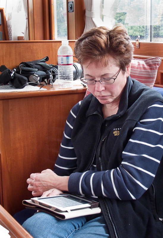
Karen devoured three books on her Nook. It was always with her. It remains a great purchase for such a voracious reader.

20100622_Mud Hole_0005

Karen and her Nook. What a great addition to travel. Imagine packing 50+ books.

I spent the day working on my pictures and catching up with this blog. It’s easy to get behind, and once you do, it’s the devil to pay to get caught up. We’re in vacation mode, and trying to remember what you did yesterday is a real challenge.

I did check the engine room. Both engines surprised me in that they needed no oil. I guess these long runs are good for them. The fuel is sitting around 75%. Again, given the amount of time we have been underway, this seems about right. We will need to get fuel before the trip concludes in Juneau, but we have that on our agenda. Note to self, the boat I buy will have both fuel flow for each engine and a fuel totalizer. Measuring the site gauge with fuel and then doing some quick calculations is an OK method, but this a perfect function for modern technology.

Last night four fishing boats joined us in the anchorage. We know there is an active fleet fishing just north of Point Harris, so we figure they are part of that group.

We needed a day of rest and we got it. In addition to reading and working on the blog, we did a load of laundry and also watched Chicago, one of my favorite movies and one whose staging never ceases to amaze me.

Tomorrow we’re on the move again up to Tebenkof Bay. This is one of the highlights of the trip. We have set aside three or four days to explore the many anchorages in this large bay. It is regarded as a great place to dinghy and kayak, so we’re excited to do just that. The weather is predicted to be Alaska –like with clouds and a chance of rain, but the weather patterns look better than that to me on the XM Satellite weather charts. It’s anybody’s guess up here, and so far the official weather has been less than spot on.

20100622_Mud Hole_0102

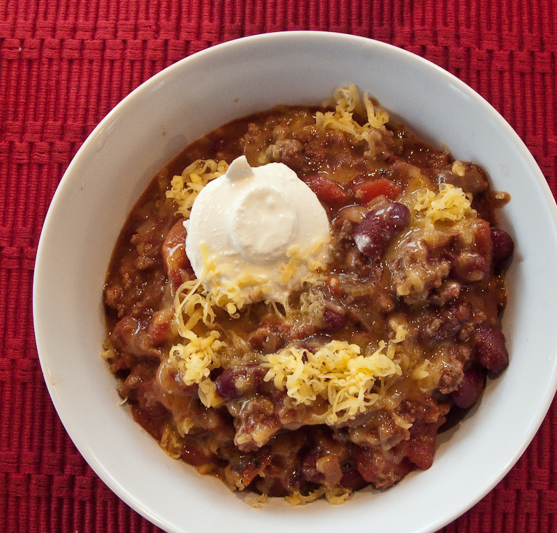
An easy dinner of chili

Egg Harbor, Coronation Island to Mud Hole to Port Malmesbury, Kuiu Island

There was a small swell on and off during the night. There were times also when it was dead calm. Overall it was a moderately peaceful night, though the anchor alarm went off at 2:44am for no good reason.

Egg Harbor has more bird life then we have seen so far this trip. When we awoke, Karen spotted a bald eagle on the shore devouring his catch. Two other mature birds and a juvenile looked longingly at his breakfast. From time to time, there would be a test of the pecking order, feathers would fly and then they would settle back into the established hierarchy. I think everyone eventually got a taste, but not before the dominant bird had his fill.

20100621_Ehh Harbor to Mud Hole_1697

Egg scramble with onion, sausage, green peppers and tomatoes. It makes for a hearty breakfast that holds you until dinner.

The wind is up to 10 knots this morning and the temperature is sitting around 55F. So when you poke you head outside the cabin, it feels cold. The skies are grey, an  interesting mix of low clouds hugging the tops of the 1785 foot mountain at the south end, to peeks of blue skies to the west. When the sun peeks through the clouds, then dances across the water and the pine trees, it’s beautiful. When the sun retreats, the scenery is beautiful in a grey way. We once overheard a conversation about appreciating the S.E. Alaska weather. Once you develop an eye for the beauty contained in all the various shades of grey, you then can understand the full beauty of this place.

20100621_Egg Harbor to Med Hole_1341_2_3_4

Egg Harbor, big and open to the north, but a good anchorage in south winds

Our plan is to explore the beaches and find the caves to visit. The last time we were here in 2006, we were so tired from our travels we slept the day away and never got out to enjoy what Egg Harbor has to offer.

The dinghy was launched in a 15 knot breeze from the SE. We put on our long underwear and multiple layers of fleece and jackets to shield ourselves from the wind. The large beach at the SE end of the harbor is a great place to walk and explore. The beach is gravel, large and flat. In fact it is almost a quarter of a mile at the head. It looks as if you can also continue back up the shoreline to the northwest. And…unlike the forecast, the sun firmly came out and the skies turned blue.

20100621_Egg Harbor to Med Hole_1365-Edit

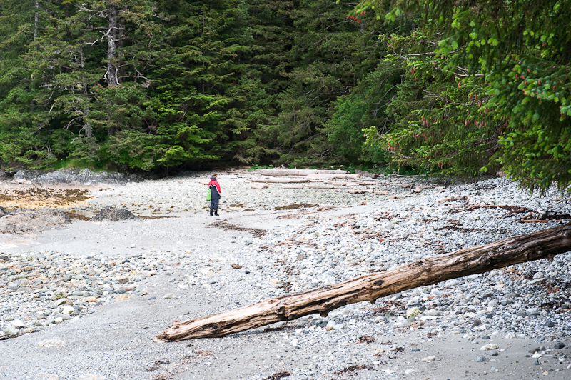
Karen kept saying “You look so small” because the beach is so large. So I took a picture of her because she too looked small

In the SE corner of the beach, you’ll find a stream coming down from the mountain to the south. It is wide and flat. Looking at the topographic maps, it seems to extend that way for a good distance. We only walked about a hundred yards due to the downed trees in the way, but it was an easy hike.

20100621_Egg Harbor to Med Hole_1278-Edit

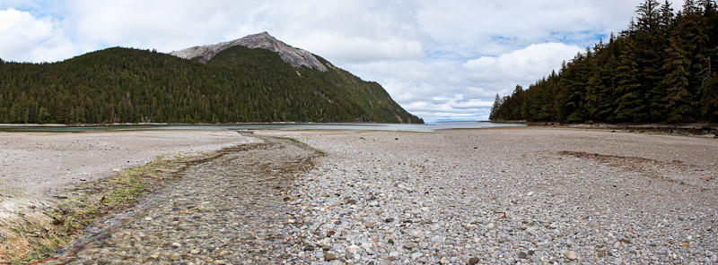
The freshwater stream makes its way to the ocean over the drying flats

20100621_Egg Harbor to Med Hole_1311_2_3

The creek made for great exploring

20100621_Ehh Harbor to Mud Hole_1701

Bob dressed for pictures. Note the Neos Foot ware.

One of the great additions to our gear this year were Neos overboots. We had tried the Xtratuf boots that you see everywhere in Alaska. But the fit and feel were not to our liking. They were too hard to get your pants tucked in and they had all the discomforts of big rubber boots. Neos slips over your own shoes so they are very comfortable. They open wide with Velcro seams making it easy to get over any number s of layers of pants and foul weather gear. They are completely waterproof and provided good footing on anything were have encountered. They have our highest recommendation.

20100621_Egg Harbor to Med Hole_1296

Karen taking the above picture. She's also sporting her Neos footwear

The other unusual and welcomed feature of this area is the openness of the forests. I suspect because the forest floor is muskeg, soft underfoot, the tree density is much less than many other places. It was any easy walk with lots of open areas with interesting flora and pretty light filtering into the forest to showcase the moss and ferns.

20100621_Egg Harbor to Med Hole_1331_2_3_4-Edit

The forest floor is like walking on a very firm mattress

Egg Harbor Forrest Pano

You can actually walk though these forests

20100621_Egg Harbor to Med Hole_1271-Edit-Edit-Edit-Edit-Edit

The forest undergrowth can be beautiful

20100621_Ehh Harbor to Mud Hole_1703-Edit

Always keeping looking down to find the smallest details of the large variety of plants

20100621_Egg Harbor to Med Hole_1465_6-Edit

They call this newspaper kelp because of the way it lays flat

20100621_Egg Harbor to Med Hole_1454_5_6-Edit

Karen takes in the rugged spectacle of Egg Harbor

20100621_Egg Harbor to Med Hole_1469-Edit

As expected, the dinghy was high and dry after our long walk

After an hour of exploring the beach, creek and forest, we set off in the dinghy to explore the caves on the west shore. Unfortunately the wind was blowing too strong for a safe approach. They will be on the list for next time. We would have remained at anchor for another days except for the fact the winds were forecast to increase, with rain. Neither of those components of the forecast would make getting to the caves or exploring deeper in to the forest an enjoyable adventure.

So rather than being stuck at Coronation Island, we made our course good to Port Malmesbury and a cove called Mud Hole. It’s well protected for all winds and puts us closer to our next scheduled layover in Tebenkof Bay. And if the winds and waves do come up tomorrow, we should be able to continue north by staying close to shore in the lee. 

20100621_Egg Harbor to Med Hole_1473-Edit

The island that guards the entrance to Egg Harbor were named Bird Island for obvious reasons

As we made our way into Port Malmesbury, Karen spotted a black bear on the shore. We slowed, changed course and made our way over to the beach. He was busy turning over rocks looking for dinner. I don't think he ever bothered to take notice of use. We left him to his foraging after about ten minutes.

20100621_Egg Harbor to Med Hole_1508-Edit

Dinner on bear beach

20100621_Ehh Harbor to Mud Hole_1716

Dinner on Arctic Star

20100621_Egg Harbor to Med Hole_1677-Edit

Sunset at Mud Hole, Port Malmesbuty

Labourchere Bay to Egg Harbor

I slept until 9:30 and I might have gone longer except that Karen came in to see if I was still alive and woke me in the process.

I fixed breakfast out a bunch of bits and pieces I found in the refrigerator. That was all I was up for this morning. Today we wanted to explore this bay given the high recommendation from the crew of the Coastal Messenger. We launched the dinghy and proceeded to land on the central beach on a falling tide. This beach was an easy walk compared to Santa Anna Inlet. It’s easy to traverse over to the “outside” and take a look at Sumner Strait. We saw one humpback whale blow and dive a couple of times as he made his way southwest. And the sun came out!!

20100620_Labouchere Bay to Egg Harbor_1022_3_4

The geology of this area fascinates me

20100620_Labouchere Bay to Egg Harbor_1054_5

The “walk” on the beach is sometimes a bit crunchy as you have to walk over these

20100620_Labouchere Bay to Egg Harbor_1108-Edit

This bay has one of great “beach” to explore. Coastal Messenger was right!

20100620_Labouchere Bay to Egg Harbor_1135_6_7-Edit

Beachcombing” in Labourchere Bay

20100620_Labouchere Bay to Egg Harbor_1121-Edit

Vistas abound around every corner

We then took the dinghy over toward the bay in the northeast corner where there was once a large logging camp. The only remnant now is a road that goes to Port Protection. As we approached the bay, we noticed some movement along the shore. It was strange in that it was white, a color most often found on a bird, but it moved like a mammal. I told Karen to keep an on the critter and I kept an eye on the GPS for any obstructions. As we approached our target, we realized that it was a man, dressed in a white hoodie. He, along with a couple of his friends , were walking the rocky shore. This reinforces the large scale of everything here in Alaska. What we thought was a small mammal with a white patch was just a local out on a Sunday Father’s Day afternoon.

Back to the boat and a decision was made to forego a shower and get underway for Egg Harbor on Coronation Island, some forty miles southwest.

20100620_Labouchere Bay to Egg Harbor_1160-Edit

This guy was looking to hitch a ride to Egg Harbor

The weather was perfect, not as forecast. The skies were partly cloudy and the winds light. We had a fairly good ride with a few 3 foot swells along the way, though as always, they got rougher when Karen was at the helm. Once we were in the lee of the Spanish Islands, it all quieted down.

20100620_Labouchere Bay to Egg Harbor_1162-Edit-Edit

Passing Cape Decision Light

As we approached the entrance to Egg Harbor, two fishing boats that we were watching fishing south of the island headed in to the harbor. They set their anchor and we found a spot between. Egg Harbor is a very popular spot for working fishermen to overnight.

20100620_Labouchere Bay to Egg Harbor_1241

Orange-Sesame Glazed Salmon with Grilled Asparagus

After dinner we were joined by another fishing vessel, the Rosie M. She came in a little too fast for my taste and gave us a bounce or two from her wake. We watched otters play and saw a few eagles before heading off to bed.20100620_Labouchere Bay to Egg Harbor_1234_5_6_7-Edit

 Evening blankets Egg Harbor

Wrangell to Labouchere Bay


O.M.G; we awoke to sunny skies this morning. After a breakfast of scrambled eggs with sweet sausage, onions, green peppers, fresh rosemary sun-dried tomatoes and cheddar cheese (our last meal before dinner, so it had to last) we walked into town for the last time to find some more long underwear for Karen. Despite multiple layers, she’s been cold, so another layer is in order to make the remainder of our journey more comfortable.

20100619_Wrangell to Labourchere Bay_0001

The Reliance Docks in the sunshine

20100619_Wrangell to Labourchere Bay_0002_3_4

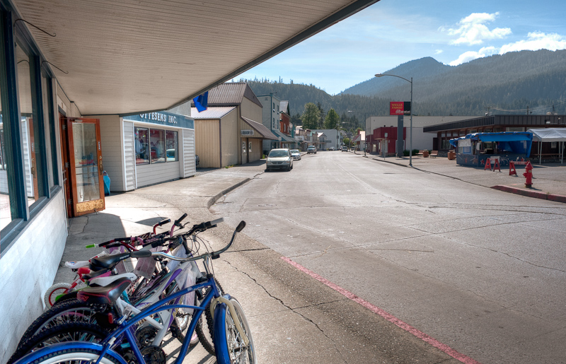
Main Street Wrangell

As we returned to the docks we passed our new friend Ken, talking with Uncle Roy on Coastal Messenger. We stopped to say goodbye and soon the conversation turned to everyone’s next destination.

20100619_Wrangell to Labourchere Bay_0006

Uncle Roy of the Coastal Messenger

Petunia from the M/V Coastal Messenger invited us onboard to show us their pictures of our next destination, Labouchere Bay, or as the locals call it “Lab Bay”. After seeing the pictures and hearing the stories about the logging camp that was once at the north end  (now removed, with a road over to Port Protection the only remaining evidence that it ever existed), we were truly excited about our choice of anchorages for the night.

Petunia also brought a chart from the wheel house and pointed out the best place to anchor. She went on to inform us that as we round Point Baker we should be on the lookout for humpback whales. Apparently they always spot them as they round the Point.

20100619_Wrangell to Labourchere Bay_0008

Saying farewell to the crew of the Coastal Messenger

After clearing the entrance to harbor at Wrangell we took a southerly detour to visit the new docks at Wrangell. There are behind a massive breakwater and are large, with lots of power, water and the wonderful look and feel of “new docks”. The only problem is they are twice the distance from town as the Reliance Dock. I’m not certain the best way back into town; walk, cab, dinghy? I’ll leave that up to the industrious Wrangell Port authority to work out the details of making these docks both appealing and convenient.

20100619_Wrangell to Labourchere Bay_0016-Edit

Wrangell from the decks of Arctic Star

20100619_Wrangell to Labourchere Bay_0027_8_9

What a picturesque setting for the town of Wrangell

Our trip today is about 50 nautical miles or about 5 and a half hours. Karen and I split helm duty into two hour shifts. The time certainly passes much faster when you’re “off duty” and reading or working on this blog and sitting and watching the Alaskan wilderness pass by.

As predicted by Petunia, as we rounded Point Baker, we saw three humpbacks. No big show from these guys, just a blow or two and a half hearted peek at their tails.

The wind had picked up and the waves also, but not enough to make for an uncomfortable ride. We did turn on the stabilizers for the last third of the trip and everything settled down.

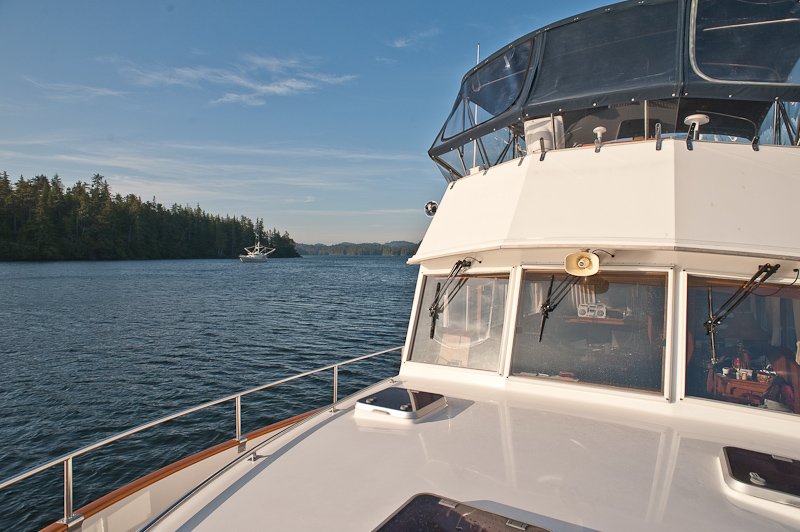
The anchorage in the Southeast end of Lab Bay is very beautiful. You look back though the trees to Sumner Strait. There is a nice stretch of beach and you can walk it on the inside and look over to the outside beach. The wind was still blowing 15-20 knots so we did not launch the dinghy to go explore as was our original plan. We waiting all evening for things to calm down but they never did.

Upon our arrival we did spot a single Kayaker who had just landed on the inside beach I mentioned. Sea kayaking is close to an extreme sport around here, but doing it solo is too much from me to consider. An hour or so later we watched as our neighbor launched his kayak, went out into the Strait and went fishing. I guess you must catch what you can’t carry.

We were joined by a small Nordhavn that anchored about 180 yards to our northeast. Like us, it took him two attempts to set the anchor.

20100619_Wrangell to Labourchere Bay_0042

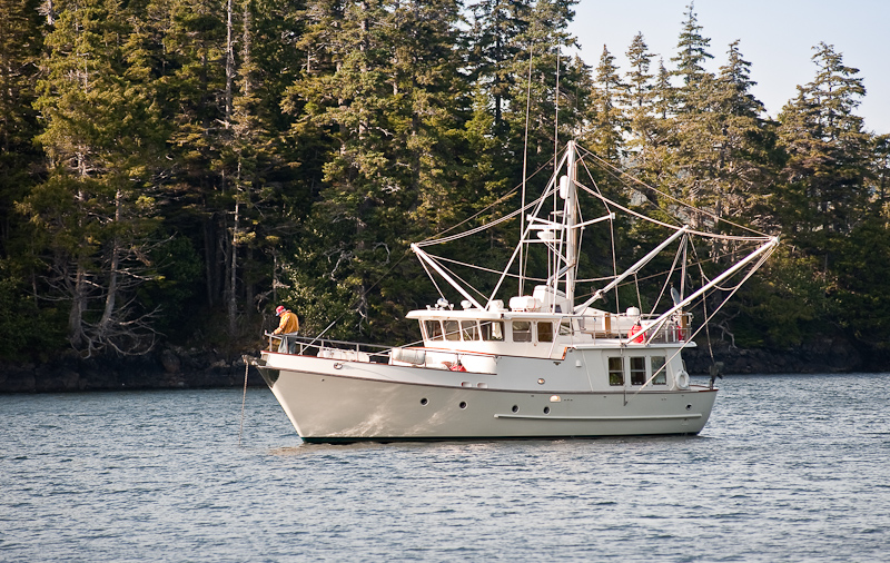
Our neighbor in Labouchere Bay in full cruising regalia

The remainder of the afternoon and evening we caught up on reading and writing. The wind never did die down enough to launch the dinghy.

20100619_Wrangell to Labourchere Bay_0059

Lots of room in this anchorage

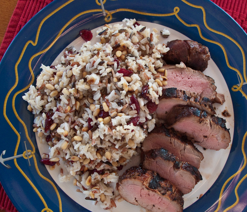
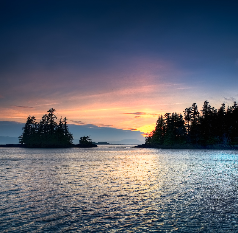
Dinner was marinated pork tenderloin accompanied by a mixed rich to which I added toasted pine nuts and dried craisins. I waited for the sunset that was good but not great for photos.

A sea otter give us some welcome entertainment as he lay on his back and floated while devouring whatever he had brought up from the bottom. As the light faded we spotted three Sitka Black Tail deer grazing on the shore line. Karen called it Mutual of Omaha’s Wild Kingdom. As least she checked off the sea otter on her critter list for this trip.

20100619_Wrangell to Labourchere Bay_0086-Edit

The day is coming to a beautiful end

We were still spinning on the hook when we went to bed around 10:30. Tomorrow we have some weather-related planning to do as the forecast is predicting the winds will start to blow toward 25 knots just about the time we want to go to Coronation Island.

20100619_Labouchere Bay to Egg Harbor_1240

Mustard Glazed Grilled Pork Tenderloin with wild rice, pine nuts, and dried cranberries

20100619_Wrangell to Labourchere Bay_0138_39_40-Edit-Edit

It doesn't get much better than this. Although you have to stay up late in Alaska to see a sunset this time of the year. And a 4am sunrise is out of the question.


Wrangell

Today our main activity was a trip to the Le Conte Glacier via jet boat. As our departure time was not until 4pm, we busied ourselves with tasks around the boat and Wrangell.

The day before, John from Alaska Charters and Adventures, www.AlaskaUpClose.com, had offered to let me draft off his wireless in order to download the upgrade patch for my Nobeltec. We waited until 12:30pm, when the visitors from the cruise ship were back on board and walked the length of town to his office and his wife’s gallery.

The patch download and installation went without a hitch and we were now equipped with Nobeltec software that should perform as advertised.

As the download process unfolded, John told us tales of hunting, fishing, trapping and catching or shooting all manner of wildlife. All of which were butchered by him and consumed during the year. In the summer, they have three large gardens at their cabin on the Stikine River where they grow and then put up vegetables for the winter. In Alaska, even in one of the top ten populated towns in Alaska, the citizens still live off the land.

We made our way back to the boat with stops in the various shops in town. Souvenirs were on the list along with a couple of fresh produce items.

The trip on the jet boat was much anticipated. Our original plan was to take the trip up the Stikine River to see the wildlife, but the river was too low to get to the spots they usually visit. The snowfall was light this winter in the mountains and the resulting limited runoff had left the river very low.

Eric from Breakaway Adventures suggested we try the 4-5 hour trip to the Le Conte Glacier instead. We were at bit disappointed as we had visited the glacier at the head of Tracy Arm in 2006 on our Grand Banks. This seemed it might be a bit “me too”, but we’re always game for adventure.

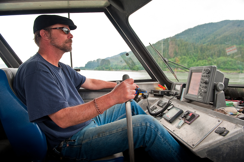
Norm and Karen and I set out in the little jet boat at 4pm. We had to cross Dry Strait (mud flats) at high enough water and must return back across before 8pm in order to have at least a foot of water in the lowest spots. The jet boat only draws 6 inches but sometimes that is not enough in these tidal flats. Norm was more excited about this trip than the “river” trip. He said we picked the best one. We were still a bit skeptical.

 20100617_Wrangell_0004

Norm at the helm of the jet boat. It steers like an air boat. Push the lever forward to go right.

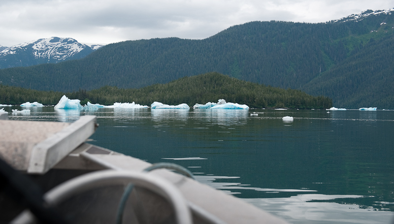
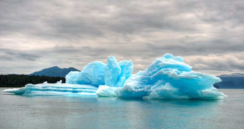
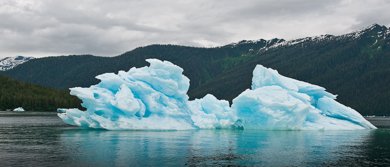
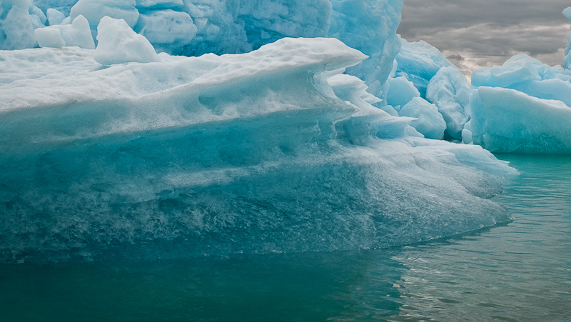
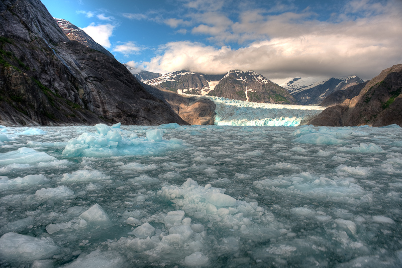
The traverse over the flats was interesting. Given that they constantly shift and move, it was great to have an experienced captain skilled in finding his way in the shallows. Our doubts quickly faded as we approached the entrance to Le Conte Bay and spotted a half dozen freight car sized glaciers stuck on the shallow terminal moraine. These were huge. Many times the size of anything we had experienced in Tracy Arm. And that beautiful blue color that signifies glacier ice.

20100617_Wrangell_0013

The first sign of icebergs

20100617_Wrangell_0050_1

As big a freight cars is not an understatement

[Group 4]-20100617_Wrangell_0031_20100617_Wrangell_0032-2 images

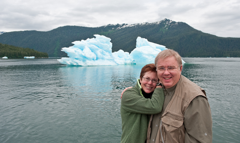
Karen and Norm picking out their next berg to visit

20100617_Wrangell_0056

Got to get the picture

20100617_Wrangell_0062

More glaciers guarding the entrance to the La Conte Bay

20100617_Wrangell_0066-Edit

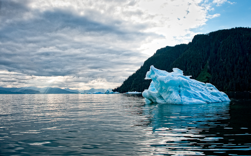
I could sit and look at these for hours. There are endless variations and details.

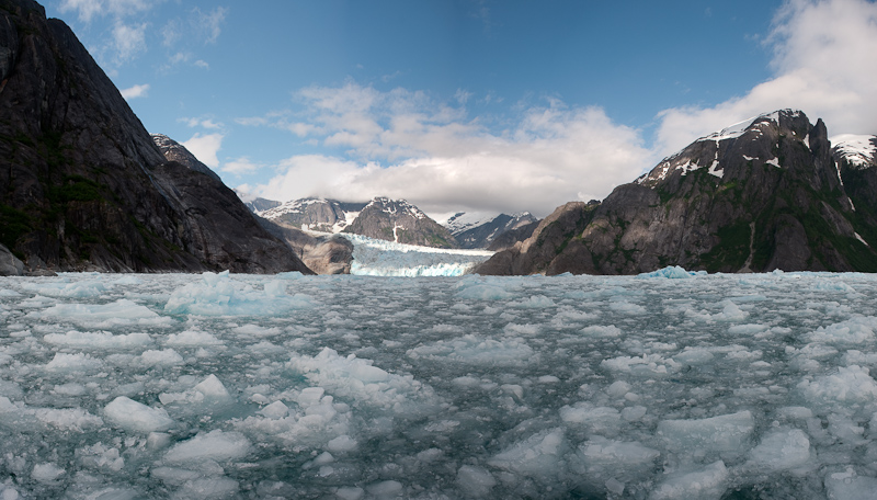
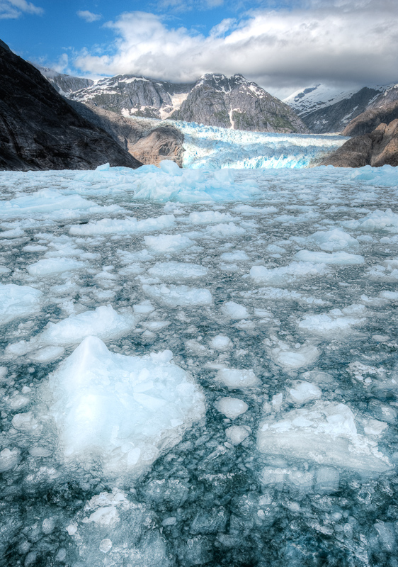
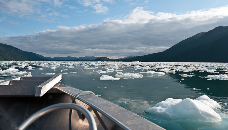
After taking a few pictures, we began the seven mile trip up the bay to the glacier. I was surprised to see the density of the ice before us. Glad this is not my boat! And I had no idea how we were going to get very far based on the amount of ice I saw.

Norm did a masterful job of weaving his way through the thinner distributions and when it got thick, he slowed done and bumped his way along from bergy bit to bergy bit.

20100617_Wrangell_0079

This was the easy stuff to get through. I would have turned around right then.

This is a very impressive valley, carved by millions of years of glacier activity. I lost track of time, but I suspect it took us an hour to go the seven miles in a boat that travels 33 miles an hour in open water.

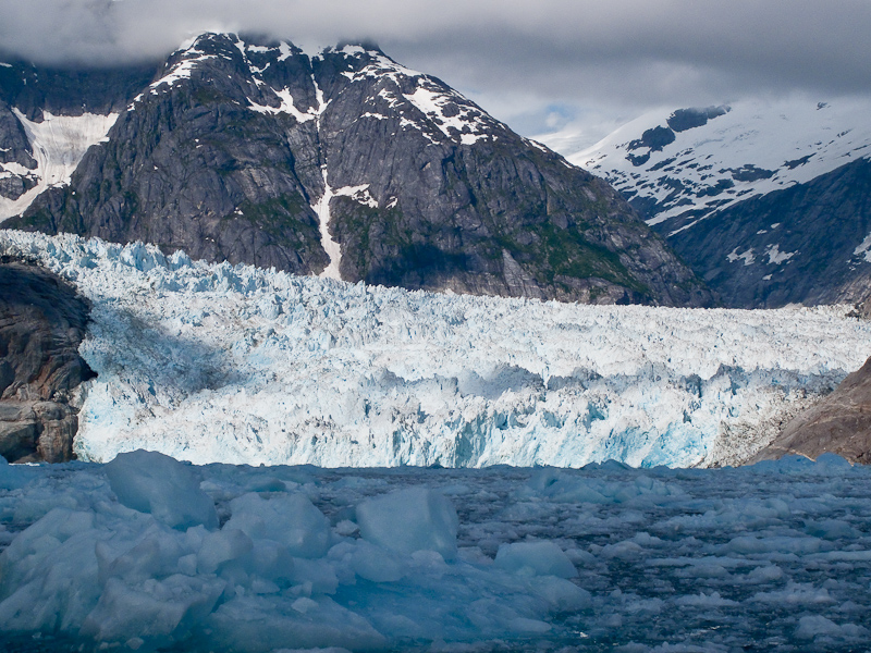
Norm pushed on. His goal was to get in a position so we could see the complete face of the glacier. Long after I thought we could go no further, Norm found a way. “As long as you can see water, we’re OK!” Norm’s definition of water and mine diverged. I thought a spot of clear water the size of your fist might be the right unit of measure. I think Norm’s definition was more a thimble.

20100618_Wrangell_0205_6_7_8

Good to go for Norm and his jet boat

As you’ll see in the pictures, the trip exceeded our every expectation. It was a true adventure. A trip we could never have made on our own. No dinghy, no Kayak could have made it as close as we did to the face.

20100618_Wrangell_0140_1_2_3

Approaching the glacier

I forgot to mention that Norm has a cell phone with God’s number in his speed dial list. As we proceeded up to the glacier face, the clouds continued to dissipate and the sun shined bright across the ice. We enjoyed blue skies and light winds. After almost a week of Alaska cloudy skies, it seemed a miracle.

20100618_Wrangell_0036

The glacier's face

20100618_Wrangell_0146-Edit

Sitting in the ice, admiring this glacier and the valley it carved over the millennium

20100618_Wrangell_0243_4_5_6-Edit

Ice, ice everywhere. I had no idea we could go though this stuff.

20100618_Wrangell_0227-Edit

The record shot, just to prove we did it

We sat for about a half an hour taking pictures and listening to the low rumbles from the glacier that echoed though the valley and just sitting in awe of such a site. 

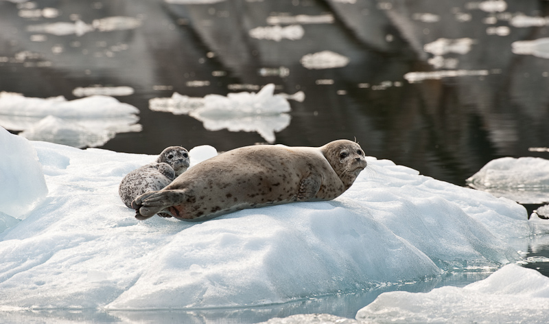
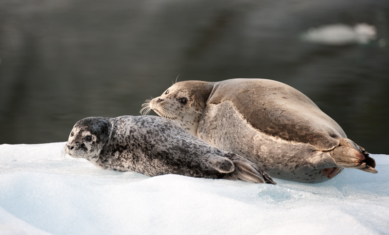
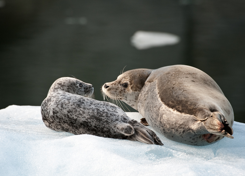
On our return we stopped and took pictures of the numerous seal pups and their moms peppered throughout the ice fields.  

20100618_Wrangell_0325

Moms and pups were hauled out everywhere

20100618_Wrangell_0354-Edit

Who you looking at?

20100618_Wrangell_0342-Edit

I would love to know what they said about us

20100618_Wrangell_0383-Edit

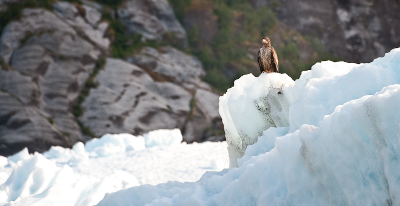
We passed one lone immature eagle on the ice. Seal pups beware!

20100618_Wrangell_1019

The ice is starting to thin our as we made our way back to the entrance of the bay

20100618_Wrangell_1042-Edit

We revisited some of the “big boys” on our departure from Le Conte Bay

20100618_Wrangell_1020

Do you think the seagull in front thinks he's the Captain of the iceberg

We stopped briefly at the seal trappers’ cabin remains to stretch our legs before heading back.

20100618_Wrangell_1036-Edit-Edit

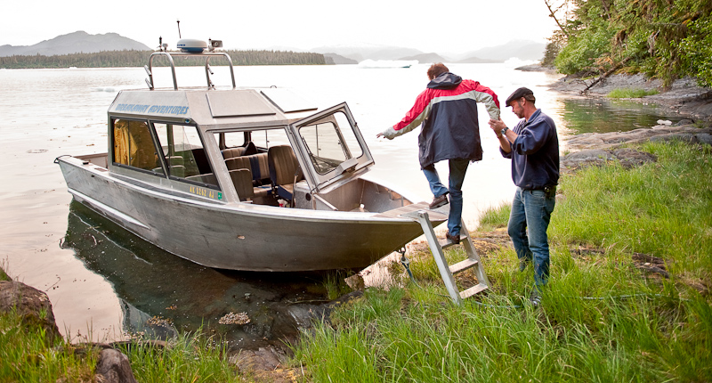
Back on the boat after our stop. This gives you a good look at the jet boat.

20100618_Wrangell_1076-Edit-Edit

Perfect end to a perfect day of glacier exploring

Dinner? Nachos at the Hungry Beaver and 2 Alaskan Ambers!


Madan Bay To Wrangell

At my usual sunrise (4am) trip to the head, there were light showers. By the time we awoke for real at 7:30am, the rain had stopped with a low cloud deck hugging the mountains at about 1000 feet. I love to watch the clouds play among the pine trees as they make their way carried by the soft winds of morning.

We have observed so far on this trip that the amount of critters is noticeably less than in the Broughton Archipelago, the Gulf Islands or the San Juan Islands. We see the occasional Bald Eagle or a sea gull or two. We hear the passing raven and spot an occasional Murrelet and a few other small water birds. It will be interesting to see if this holds true for the entire trip or is just a function of where we are. Remember this area is considered a temperate rain forest. That may well account for the limited populations.

Madan Bay was a very peaceful anchorage. The wind lay down as sunset approached and we enjoyed a quiet night. The holding is good in silky mud with small shells in 40-50 feet of water. The land drops quickly into the water so you’ll anchor within 150 feet of shore without problem. We found no hidden obstruction in our little portion of the bay. Probably a good thing, as the charts for the bay have no depth soundings!

The trip to Wrangell was uneventful.  Karen drove most of the way. We did a little sightseeing as we approached Wrangell. A few homesteads along Eastern Passage provided some diversion. It’s always fun to scope out the locals with the binoculars. At the head of Eastern Passage you see the Wrangell airport. At the north end, they removed half a mountain to make room for the runway. We spotted two airplanes taking off. It was different to see aircraft with wheels rather than floats.

Wrangell is a busy harbor. When we arrived, the docks were mostly full with commercial vehicles and a spattering of pleasure craft. We found a spot at the south end of the Reliance docks. They offer full services with water and electricity. However, these are the only docks we’ve ever visited that had individual meters for the electricity. Our location was perfect to see all the traffic in and out of the harbor, and also for Eagle Watching. There are many to watch in the harbor.

20100617_Madan Bay to Wrangell_0168-Edit

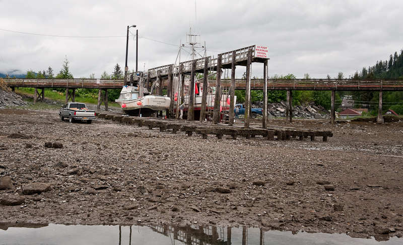
The Grid in Wrangell. It's a hard working port.

20100617_Madan Bay to Wrangell_0196_7_8-Edit-Edit

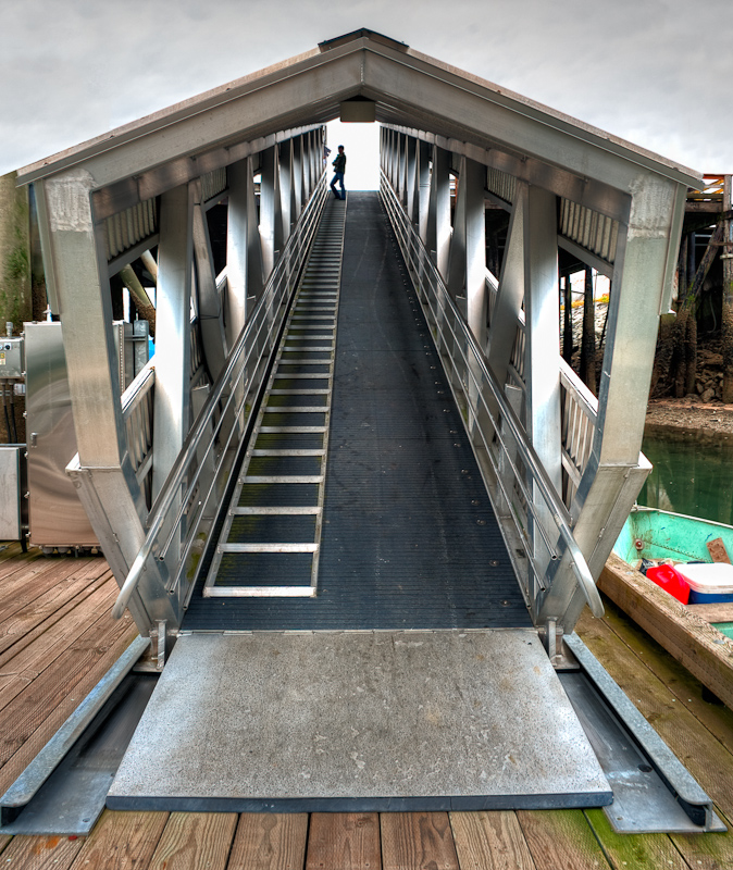
The aluminum work in Wrangell is a work of art

20100618_Wrangell_0041-Edit

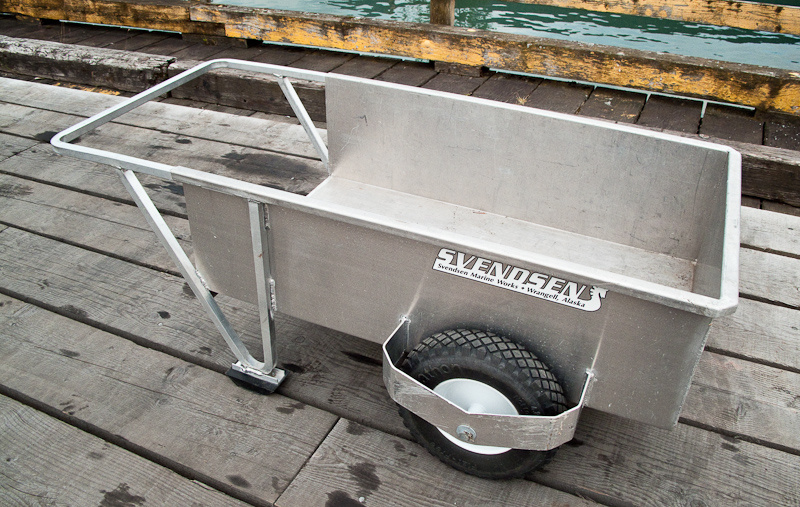
Even the small aluminum constructions area work of art. I think I'll have my tender built here.

The harbor master, LaDonna, is a highlight of Wrangell. She’s friendly and knows everything there is to know about Wrangell and what to do.

The provisioning is very good here. Bob’s IGA is OK but we did best at City Market. They also deliver to the boat. One thing we have noticed is that everyone is very friendly. Sometimes the people in remote locations can be a bit standoff-ish. That is certainly not the case in Wrangell.

We walked around the town for a while. It has a nice main street flanked with some stores and several bars. 


20100617_Wrangell_0001

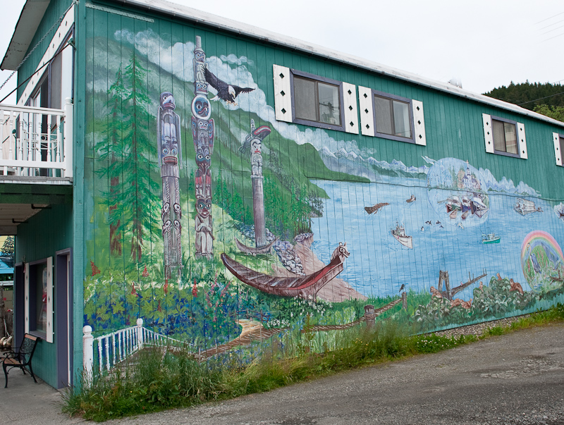
One of many murals in Wrangell

20100617_Madan Bay to Wrangell_0217-Edit

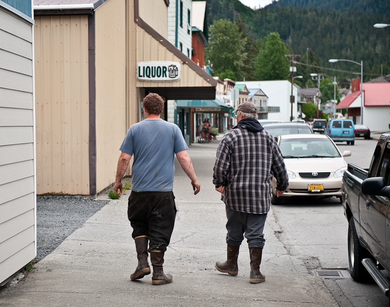
Everyone in Alaska wears Extra-tuf's. They are referred to as Alaskan Sneakers.

20100617_Madan Bay to Wrangell_0223

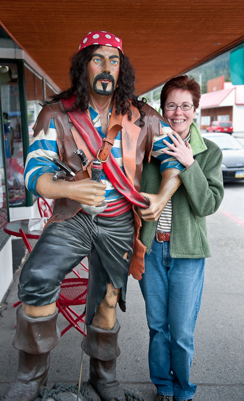
No Karen, that is Not Johnny Depp

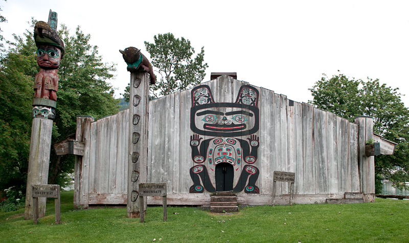
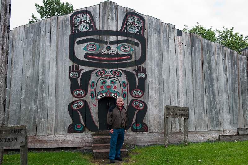
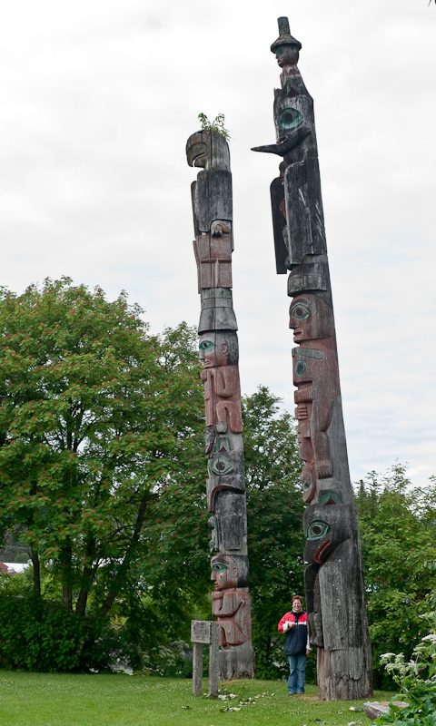
We walked out to Shakes Island to see Chief Shakes Tribal House and the totems.

20100617_Madan Bay to Wrangell_0235

Chief Shakes house

20100617_Madan Bay to Wrangell_0253

Check out the size of the door into Chief Shake's House.

20100617_Madan Bay to Wrangell_0248

Check out the size of the totems on Chief Shakes Island

20100617_Madan Bay to Wrangell_0240-Edit-Edit

The Reliance Docks at Wrangell as seen from Chief's Shake's House

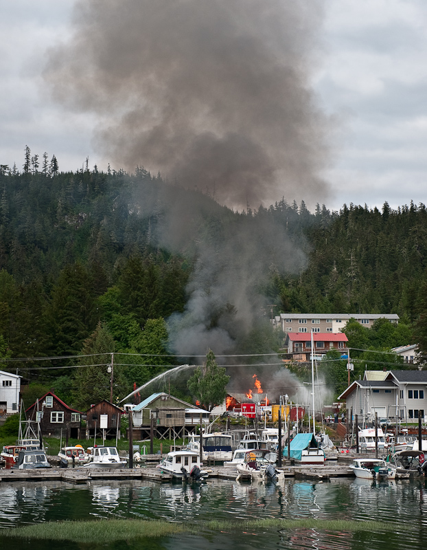
We also saw a house burning down off the inner harbor slips…apparently, it was a planned burn, but it certainly got our attention.

20100617_Madan Bay to Wrangell_0269-Edit

That got our attention before we found out it was a planned burn

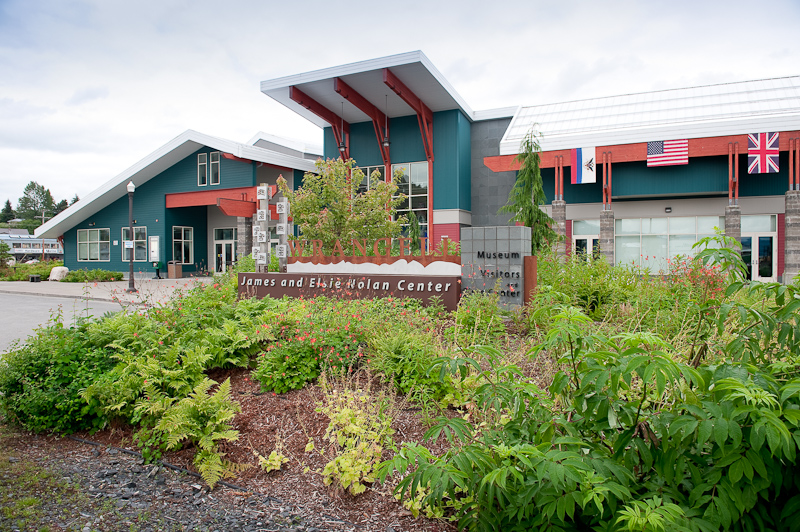
20100617_Madan Bay to Wrangell_0214

Make certain to visit the Museum. It also has a great book store inside with lots of Alaskan material.

20100617_Madan Bay to Wrangell_0212

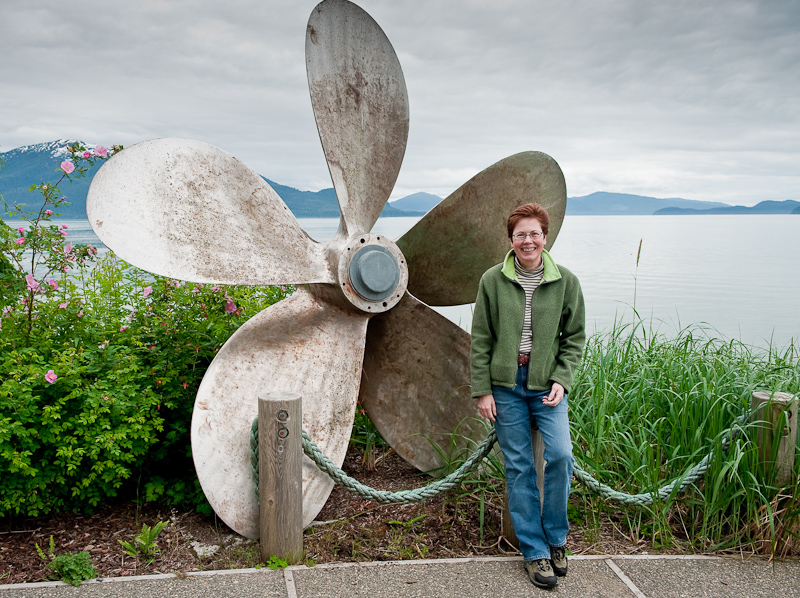
Karen wants the boat that goes with a prop this big

If you do find yourself in Wrangell, be certain to look up Alaska Charters and Adventures. (www.alaskaupclose.com). They offer exploration trips to see glaciers, or up the Stikine River and fishing trips for Salmon and Halibut.  John Yeager and his wife Brenda Schwartz (the watercolorist famous for local scenes done on marine charts) will certainly take good care of you.

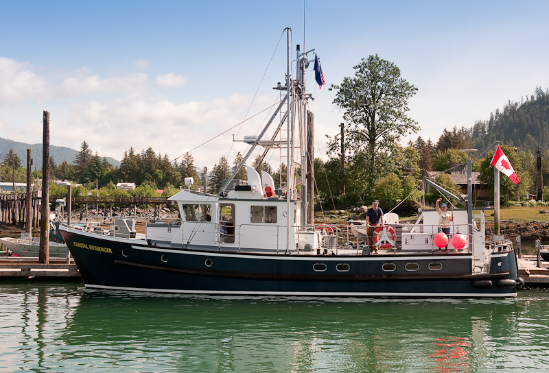
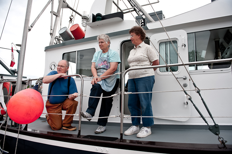
Walking the docks is always a great way to meet people. We met Uncle Roy, Petunia and Gloria aboard the Coastal Messenger, a missionary ship that is based in Chemainus, BC. This mission is about to celebrate its 30th anniversary…the area they serve runs from Olympia, WA up into SE Alaska. The stories they have about their experiences ministering to the logging and remote communities are fascinating. They know all the folks in the Broughtons that we’ve gotten to know, as well as many, many more. We also got a tour of the steel boat, which was designed by Uncle Roy and was really well thought out. You can find out more about their mission and www.CoastalMissions.ca.

20100617_Madan Bay to Wrangell_0230-Edit

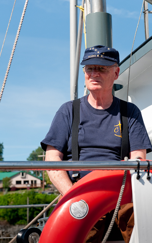
The crew of the Coastal Messenger: Uncle Roy, and Petunia

We also saw the Krogen out of Comox enter the harbor. This was the same boat we saw anchored in Santa Anna Inlet. The captain was singlehanding, so we went out to help him tie up. His name is Ken, and he is cruising for a while before meeting his wife in Juneau. He knows Don from Comox Valley Kayaks, where we normally rent kayaks for our trips to the Broughtons. Small world!!

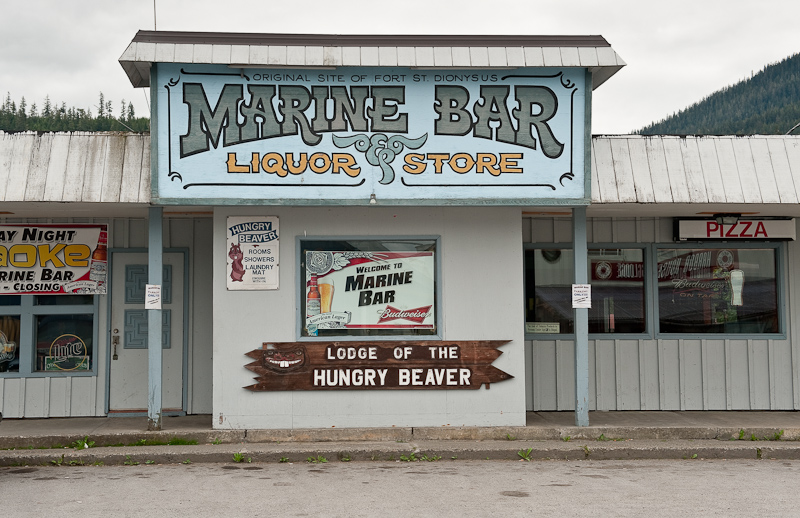
Dinner was chicken fajita pizza and Alaskan Amber ale at the Hungry Beaver, a great local bar and pizza joint with some really good pizza.

20100617_Madan Bay to Wrangell_0204

The Hungry Beaver, the best pizza in town

20100617_Madan Bay to Wrangell_0003

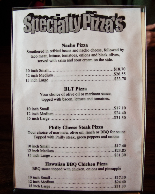
Pizza is not cheap in Alaska

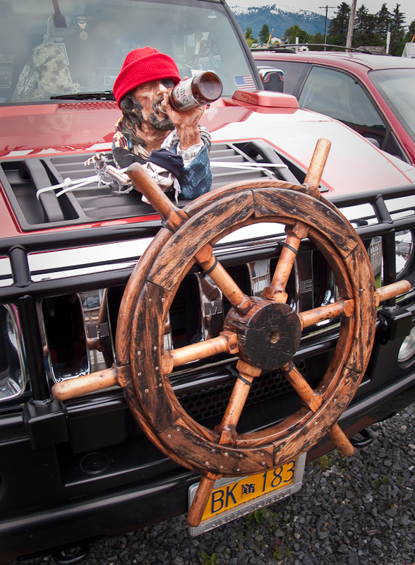
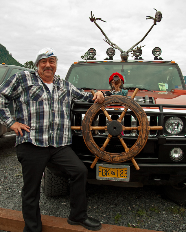
The highlight may have been the Hummer in the parking lot complete with antlers and some sort of drunken sailor on the hood with a boat’s wheel attached to the grill.

20100617_Madan Bay to Wrangell_0006

Options you can only order for an Alaskan Hummer

20100617_Madan Bay to Wrangell_0007

 He claimed he was the proud owner

Santa Anna Inlet to Berg Bay to Madan Bay

I awoke at 4 am to visit the head. The sun rose one minute before me, so it was light enough that if you wanted to get underway, you could with no visibility problems.

I, however, went back to bed after taking a picture of the mirror-like surface of Santa Anna Inlet.

We enjoyed a leisurely morning which consisted of devouring the second set of Cinnamon Buns from Meyers Chuck, a little reading, planning, picture taking, and watching the passing showers come and go.

The holding was good last night and the anchor came up mostly clean with a little mud for a keepsake. Just as the anchor came onboard, I looked out to the head of the inlet and saw a blow from a humpback whale in the crossing channel. As we motored out, we kept our gazed focused on the area watching for more whale signs. After a few minutes we saw no more signs of the whale. Our hope was that once we entered the channel we might see him or her again.

To our surprise, just as we reached the last quarter mile of the inlet, we saw a circle of bubbles forming 150 yards to starboard near the shore. Just then, up came the whale through the middle of the bubble circle, mouth wide open to capture as large a meal as possible. The whale continued this behavior for about twenty minutes allowing us to witness a total of four bubble feedings. For only our second day en route, we had already checked off a major goal of this trip: to see bubble feeding!

20100616_Santa Anna to Berg Bay_0061

The circle of bubbles forms

20100616_Santa Anna to Berg Bay_0064

The burst though the middle of the bubble net, mouth full of fish. The nest few images finish the sequence.

20100616_Santa Anna to Berg Bay_0065

20100616_Santa Anna to Berg Bay_0066

20100616_Santa Anna to Berg Bay_0067

20100616_Santa Anna to Berg Bay_0068

20100616_Santa Anna to Berg Bay_0095

“Farewell”, thanks for the show!

The scale of Alaska continues to amaze. We’re traveling in the smaller “back channels” and they are as large as some the widest channels down south in British Columbia. You’ll spot a landmark and guess how far it may be. What you think is a mile and a half turns out to be six miles according to the radar. I can’t hazard a guess as to how far the most distant mountains are that we can see.

There is not much traffic. We passed a small pocket cruiser, with maybe 120 guests, making its way south. But that was about all we saw of any signs of humanity. I think I saw one or two hills that look as if they had been logged in the last 10 years, but not much else. We vacillate between being lonely and peaceful.

20100616_Santa Anna to Berg Bay_0165-Edit

The “Pocket” Cruise Ship

20100616_Santa Anna to Berg Bay_0136-Edit

The Seagull Cruise Ship

We left the showers behind although a broken layer of clouds at about 3000 feet continued to linger. An occasionally glimmer of sunshine on a distant mountain give us hope, but that quickly fades. The temperature is 57F and the winds light. Not so bad for Alaska.

20100616_Santa Anna to Berg Bay_0167-Edit

The “Shark Log” we passed

Berg Bay was the first stop of the day. We were either going to anchor there or continue on to Madan Bay. Berg Bay is attractive. You could spend some time exploring the shore line and the Forest Service Cabin. The scenery is interesting with large mountains extending above the tree line; someone described them as alpine looking. Although it had nothing wrong with it, we decided to continue on to Madan Bay. There is not much information on this anchorage, and no soundings on the charts. Nevertheless, Karen found one report that cruisers were “enthusiastic” about the location, so off we went.

On the approach, the bay appears to be too open for anchoring, but at the head you curve back around to the small nook in the Northwest corner and drop anchor in about 50 ft of water, close to shore.

It took all this time to make a large amount of chili. This serves as our quick, stick it in the microwave and it’s a meal staple. Perfect when you don’t want to cook or want a hot pick me up on a cold day. As I was in the galley, I made a marinade and placed it and a pork tenderloin in a ziplock bag to cure in the refrigerator. Finally for dinner, I made Penne Chicken with Broccoli and Sun Dried Tomatoes. In our effort to eat lighter, this meal was chosen to be lighter than my special pasta concoction using gorgonzola. But have no fear ,that crowd pleaser will return later in the trip.

20100616_Madan Bay to Wrangell_0002

Penne Chicken with Broccoli and Sun Dried Tomatoes

The clouds persisted most of the afternoon but as sunset approached, they thinned a little in the West and gave us a blast of color. Blue with hot pink clouds were our send off to a fine day of cruising in Alaska.

20100616_Madan Bay to Wrangell_0038_39_40-Edit-2

 Sunset in Madan Bay

Santa Anna Inlet to Berg Bay to Madan Bay

I awoke at 4am to visit the head. The sun rose one minute before me, so it was light enough that if you wanted to get underway, you could with no visibility problems.

I, however, went back to bed after taking a picture of the mirror-like surface of Santa Anna Inlet.

We enjoyed a leisurely morning which consisted of devouring the second set of Cinnamon Buns from Meyers Chuck, a little reading, planning, picture taking, and watching the passing showers come and go.

The holding was good last night and the anchor came up mostly clean with a little mud for a keepsake. Just as the anchor came onboard, I looked out to the head of the inlet and saw a blow from a humpback whale in the crossing channel. As we motored out, we kept our gazed focused on the area watching for more whale signs. After a few minutes we saw no more signs of the whale. Our hope was that once we entered the channel we might see him or her again.

To our surprise, just as we reached the last quarter mile of the inlet, we saw a circle of bubbles forming 150 yards to starboard near the shore. Just then, up came the whale through the middle of the bubble circle, mouth wide open to capture as large a meal as possible. The whale continued this behavior for about twenty minutes allowing us to witness a total of four bubble feedings. For only our second day en route, we had already checked off a major goal of this trip: to see bubble feeding!

20100616_Santa Anna to Berg Bay_0061

The circle of bubbles forms

20100616_Santa Anna to Berg Bay_0064

The burst though the middle of the bubble net, mouth full of fish. The nest few images finish the sequence.

20100616_Santa Anna to Berg Bay_0065

20100616_Santa Anna to Berg Bay_0066

20100616_Santa Anna to Berg Bay_0067

20100616_Santa Anna to Berg Bay_0068

20100616_Santa Anna to Berg Bay_0095

“Farewell”, thanks for the show!

The scale of Alaska continues to amaze. We’re traveling in the smaller “back channels” and they are as large as some the widest channels down south in British Columbia. You’ll spot a landmark and guess how far it may be. What you think is a mile and a half turns out to be six miles according to the radar. I can’t hazard a guess as to how far the most distant mountains are that we can see.

There is not much traffic. We passed a small pocket cruiser, with maybe 120 guests, making its way south. But that was about all we saw of any signs of humanity. I think I saw one or two hills that look as if they had been logged in the last 10 years, but not much else. We vacillate between being lonely and peaceful.

20100616_Santa Anna to Berg Bay_0165-Edit

The “Pocket” Cruise Ship

20100616_Santa Anna to Berg Bay_0136-Edit

The Seagull Cruise Ship

We left the showers behind although a broken layer of clouds at about 3000 feet continued to linger. An occasionally glimmer of sunshine on a distant mountain give us hope, but that quickly fades. The temperature is 57F and the winds light. Not so bad for Alaska.

20100616_Santa Anna to Berg Bay_0167-Edit

The “Shark Log” we passed

Berg Bay was the first stop of the day. We were either going to anchor there or continue on to Madan Bay. Berg Bay is attractive. You could spend some time exploring the shore line and the Forest Service Cabin. The scenery is interesting with large mountains extending above the tree line; someone described them as alpine looking. Although it had nothing wrong with it, we decided to continue on to Madan Bay. There is not much information on this anchorage, and no soundings on the charts. Nevertheless, Karen found one report that cruisers were “enthusiastic” about the location, so off we went.

On the approach, the bay appears to be too open for anchoring, but at the head you curve back around to the small nook in the Northwest corner and drop anchor in about 50ft of water, close to shore.

It took all this time to make a large amount of chili. This serves as our quick, stick it in the microwave and it’s a meal staple. Perfect when you don’t want to cook or want a hot pick me up on a cold day. As I was in the galley, I made a marinade and placed it and a pork tenderloin in a ziplock bag to cure in the refrigerator. Finally for dinner, I made Penne Chicken with Broccoli and Sun Dried Tomatoes. In our effort to eat lighter, this meal was chosen to be lighter than my special pasta concoction using gorgonzola. But have no fear ,that crowd pleaser will return later in the trip.

20100616_Madan Bay to Wrangell_0002

Penne Chicken with Broccoli and Sun Dried Tomatoes

The clouds persisted most of the afternoon but as sunset approached, they thinned a little in the West and gave us a blast of color. Blue with hot pink clouds were our send off to a fine day of cruising in Alaska.

20100616_Madan Bay to Wrangell_0038_39_40-Edit-2

 Sunset in Madan Bay

Meyers Chuck to Santa Anna Inlet

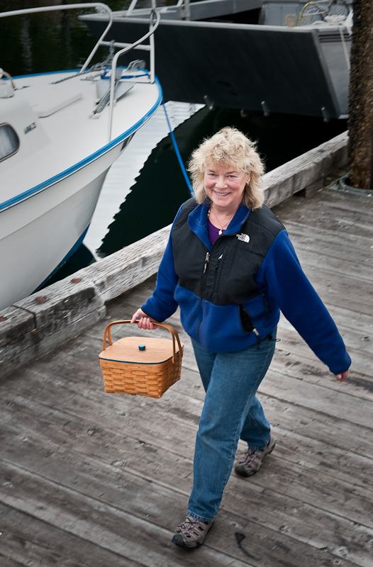
Precisely at our agreed upon time, 7:30am, Cassie arrived with her basket of Cinnamon Buns. First, she stopped at Inspiration, and then strolled down to our boat. She had a spring to her step and a big smile. That,combined with fresh baked, still warm, pecan covered cinnamon buns, made for a great start to the day.

20100614_Meyers Chuck_Santa Anna Inslet_0001

Cassie makes her morning rounds with fresh-baked cinnamon buns

We cast off the docks at Meyers Chuck at precisely the same time as we did yesterday in Ketchikan, 7:58am. We’ll need to work on that. It’s far too much precision and repetition for a holiday.

Three and a half hours north to Santa Anna Inlet. The weather was superb. Light winds and seas that ranged from 1 ½ feet to calm. Not much to see along the way. There was an occasional fishing boat and a bird or too. We did pass a large sea lion, it must have been a male given the size. He was just floating about a hundred yards offshore doing not much of anything. We did successfully run the watermaker, which was exciting – having it allows us to continue the more wilderness portion of our trip without having to worry about access to fresh water.

20100615_Meyers Chuck_Santa Anna Inslet_0008-Edit

Sometimes the most useful marks are the home grown variety

Santa Anna is a long inlet, well protected from the weather. Karen predicted that there would be boats anchored there due to its popularity. As we rounded Santa Anna Point we spotted a sail boat under way towing another smaller sail boat, leaving the inlet. We also passed three identical canoes paddling out of the inlet. We have no idea where they came from or where they were going.

Almost to the end of the inlet, a Krogen was anchored. We never saw any signs of life from the small Krogen, which was out of Comox, BC.

We continued down to the end of Santa Anna. According to my map reading , there was plenty of room in about 50 feet of water opposite the entrance up the creek to Lake Helen. As it was low tide, we had a clear view of all the obstructions, drying flats and anything else that might impinge on our swinging at anchor.

[Group 1]-20100615_Meyers Chuck_Santa Anna Inslet_0051_20100615_Meyers Chuck_Santa Anna Inslet_0057-7 images-Edit

The view from our anchorage at the head of Santa Anna Inlet

The anchor held well on the first set. We launched the dinghy to take advantage of the low tide and exploration opportunities along the shore. There was a vast amount of beach uncovered that would grant us access to areas not be available as the tide came up.

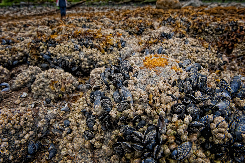
Of particular interest was the outflow area from Lake Helen. As we made our way over the mussel encrusted rocks that make up the “beach”, we found the walking tricky and tiring.

20100615_Meyers Chuck_Santa Anna Inslet_0024-Edit-Edit

The “beach” at low tide is tricky footing

The outflow from the Lake was running strong. We could find no information about whether you can navigate this at high slack tide in either a Kayak or a Dinghy. But looking at the portion we saw, I think it would be possible given the depth, the only remaining question is how strong the outflow current might be.

20100615_Meyers Chuck_Santa Anna Inslet_0012_3_4

Arctic Star and our neighbor, West Coast Spirit in Santa Anna Inlet

20100615_Meyers Chuck_Santa Anna Inslet_0037-Edit

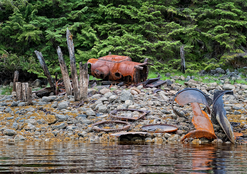
Some leftover hardware from an abandoned camp

20100615_Meyers Chuck_Santa Anna Inslet_0040-Edit-Edit

The final outflow from a large waterfall above that provided a constant soothing sound to the anchorage

20100615_Meyers Chuck_Santa Anna Inslet_0032_3_4_5

Tide coming in during our exploration of Santa Anna Inlet

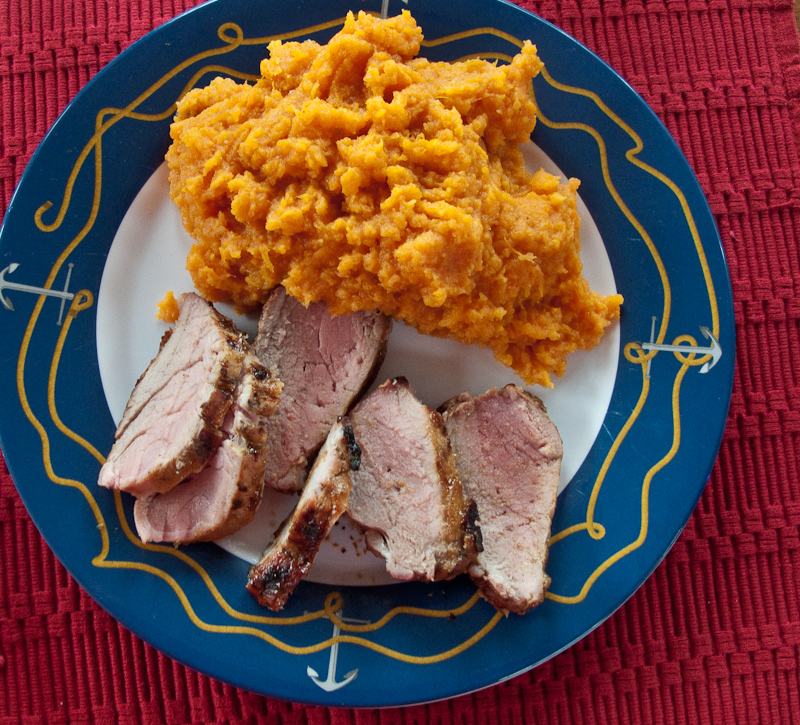
After tooling along in the dinghy for a while, we returned to the boat for some killer Curry Chicken salad I made, then Karen read up on the flybridge while I took a nap. Dinner was marinated honey Dijon pork tenderloin with maple-orange mashed sweet potatoes – Karen’s favorite treat.

20100615_Meyers Chuck_Santa Anna Inslet_0011

Marinated Honey Dijon Pork Tenderloin with Maple-orange Mashed Sweet Potatoes

It was a very peaceful evening, flat calm and a perfect scenario for a restful night of sleep.

Meyers Chuck to Santa Anna Inlet

Precisely at our agreed upon time, 7:30 am, Cassie arrived with her basket of Cinnamon Buns. First, she stopped at Inspiration, and then strolled down to our boat. She had a spring to her step and a big smile. That,combined with fresh baked, still warm, pecan covered cinnamon buns, made for a great start to the day.

20100614_Meyers Chuck_Santa Anna Inslet_0001

Cassie makes her morning rounds with fresh-baked cinnamon buns

We cast off the docks at Meyers Chuck at precisely the same time as we did yesterday in Ketchikan, 7:58 am. We’ll need to work on that. It’s far too much precision and repetition for a holiday.

Three and a half hours north to Santa Anna Inlet. The weather was superb. Light winds and seas that ranged from 1 ½ feet to calm. Not much to see along the way. There was an occasional fishing boat and a bird or too. We did pass a large sea lion, it must have been a male given the size. He was just floating about a hundred yards offshore doing not much of anything. We did successfully run the watermaker, which was exciting – having it allows us to continue the more wilderness portion of our trip without having to worry about access to fresh water.

20100615_Meyers Chuck_Santa Anna Inslet_0008-Edit

Sometimes the most useful marks are the home grown variety

Santa Anna is a long inlet, well protected from the weather. Karen predicted that there would be boats anchored there due to its popularity. As we rounded Santa Anna Point we spotted a sail boat under way towing another smaller sail boat, leaving the inlet. We also passed three identical canoes paddling out of the inlet. We have no idea where they came from or where they were going.

Almost to the end of the inlet, a Krogen was anchored. We never saw any signs of life from the small Krogen, which was out of Comox, BC.

We continued down to the end of Santa Anna. According to my map reading , there was plenty of room in about 50 feet of water opposite the entrance up the creek to Lake Helen. As it was low tide, we had a clear view of all the obstructions, drying flats and anything else that might impinge on our swinging at anchor.

[Group 1]-20100615_Meyers Chuck_Santa Anna Inslet_0051_20100615_Meyers Chuck_Santa Anna Inslet_0057-7 images-Edit

The view from our anchorage at the head of Santa Anna Inlet

The anchor held well on the first set. We launched the dinghy to take advantage of the low tide and exploration opportunities along the shore. There was a vast amount of beach uncovered that would grant us access to areas not be available as the tide came up.

Of particular interest was the outflow area from Lake Helen. As we made our way over the mussel encrusted rocks that make up the “beach”, we found the walking tricky and tiring.

20100615_Meyers Chuck_Santa Anna Inslet_0024-Edit-Edit

The “beach” at low tide is tricky footing

The outflow from the Lake was running strong. We could find no information about whether you can navigate this at high slack tide in either a Kayak or a Dinghy. But looking at the portion we saw, I think it would be possible given the depth, the only remaining question is how strong the outflow current might be.

20100615_Meyers Chuck_Santa Anna Inslet_0012_3_4

Arctic Star and our neighbor, West Coast Spirit in Santa Anna Inlet

20100615_Meyers Chuck_Santa Anna Inslet_0037-Edit

Some leftover hardware from an abandoned camp

20100615_Meyers Chuck_Santa Anna Inslet_0040-Edit-Edit

The final outflow from a large waterfall above that provided a constant soothing sound to the anchorage

20100615_Meyers Chuck_Santa Anna Inslet_0032_3_4_5

Tide coming in during our exploration of Santa Anna Inlet

After tooling along in the dinghy for a while, we returned to the boat for some killer Curry Chicken salad I made, then Karen read up on the flybridge while I took a nap. Dinner was marinated honey Dijon pork tenderloin with maple-orange mashed sweet potatoes – Karen’s favorite treat.

20100615_Meyers Chuck_Santa Anna Inslet_0011

Marinated Honey Dijon Pork Tenderloin with Maple-orange Mashed Sweet Potatoes

It was a very peaceful evening, flat calm and a perfect scenario for a restful night of sleep.

Ketchikan to Meyers Chuck

After a night of heavy rain, we awoke to calm winds and not a ripple in the marina. It is a good day to leave Ketchikan for Meyers Chuck.  

We cast off at 7:58am, two minutes before our planned departure. I guess we were excited to get on our way. The skies quickly went from mostly cloudy to partly cloudy to downright sunny. The winds were light ranging from 5 to 10 knots. A perfect day for cruising.  

20100614_Ketchikan_Meyers Chuck_0014  

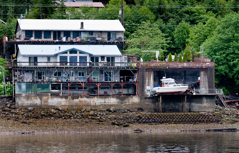
Just north of Ketchikan, the answer to the question: “Where do I keep my boat?”  

As we approached northern end of Tongass Narrows, a Norwegian cruise ship was starting to enter the head of Tongass Pass, southbound to Ketchikan. We called the bridge on channel 13 and worked out a plan for passing. They were very nice and appreciative of the call. There was not much traffic on our trip. We saw the occasional long liner and a couple of local go-fast aluminum runabouts, but not much else.  

20100614_Ketchikan_Meyers Chuck_0015-Edit  

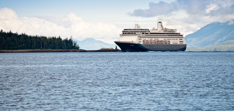
Our first cruise ship passing of this trip  

Karen did most of the helm work on this leg, as I was preoccupied with trying to find out why my Nobeltec navigation program would not display Course over ground nor Speed over ground. I invested a couple of hours trying everything I knew to solve the problem. We did have a cell signal at Meyers Chuck so, after a 35 minute wait in the queue, I talked to tech support only to find out that my problem was a known issue with version 10.5. The fix, downgrade to 10.2 or upgrade to 10.7. Given that I had recently just upgraded from 10.2 to 10.5 I expressed my disappointment with their bad computer code and reminded them that cruisers like use are seldom in internet access range to accomplish such an upgrade and that this problem was going to be with me a long time. Ever since Nobeltec’s upgrade to version 10, the program has been plagued with bugs. I’ve been a loyal customer for over 8 years, but my allegiance is waning.   

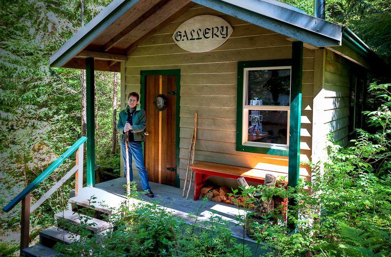
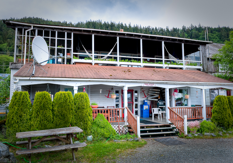
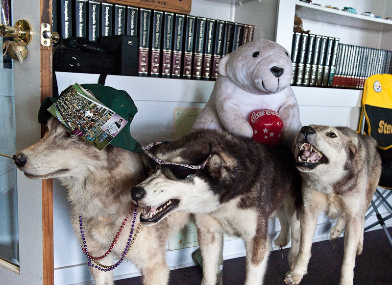
There was lots of space available on the docks at Meyers Chuck. This is not always the case, so we felt ourselves lucky. We secured Arctic Star and took a walk up to the “Gallery”. There we bought a postcard to send home and since the proprietor is also the postmistress, she was kind enough to make certain it got into tomorrow’s weekly pickup. She is also the cinnamon bun lady, so we placed our orders for delivery to the boat at 7:30am tomorrow. Although we are trying to eat lighter this trip, we justified indulging in this famous Meyers Chuck tradition because we skipped it last time we were here in 2006. How’s that for rationalization?  

20100614_Ketchikan_Meyers Chuck_0100_1_2  

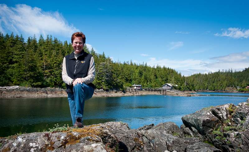
Karen at the Gallery  

20100614_Ketchikan_Meyers Chuck_0055-Edit  

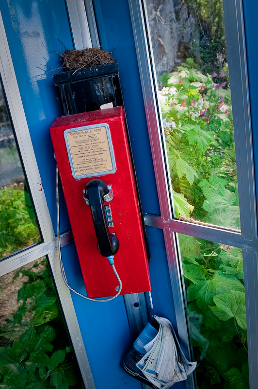
The “Pay Phone” at the head of the docks where you cna call to have the gallery opened or order cinnamon buns. I know pay phones are passe, but a bird's nest? Really!  

20100614_Ketchikan_Meyers Chuck_0044_5_6_7-Edit  

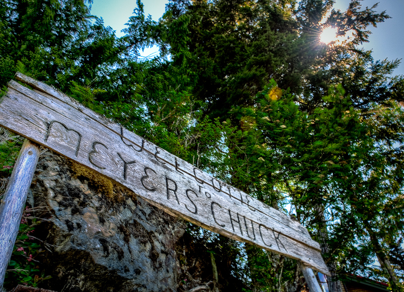
“Welcome to Meyers Chuck”  

The rest of the afternoon we explored the paths around the chuck. We made it over to “Back Chuck”, south of the main “chuck”. As it turns out, this is the high rent district. The homes are newer, larger and the floats most impressive. It’s fun to discover something new.  

20100614_Ketchikan_Meyers Chuck_0108-Edit  

A “souvenir” sign back on a dock in Back Chuck  

20100614_Ketchikan_Meyers Chuck_0080_1_2_3_4-Edit  

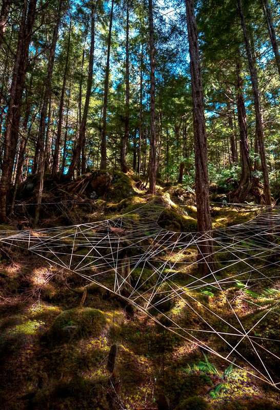
Some “spider art” along the trail around Meyers Chuck  

20100614_Ketchikan_Meyers Chuck_0030  

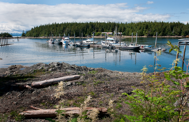
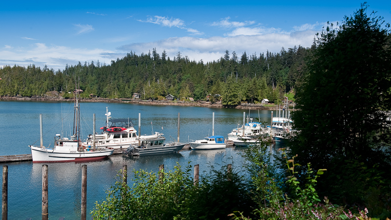
The docks at Meyers Chuck   


20100614_Ketchikan_Meyers Chuck_0060  

 You can see Arctic Star with our red Pungo 12 Kayaks  

20100614_Ketchikan_Meyers Chuck_0064  

The trails around Meters Chuck, Karen loves to check out see the “homesteads” of the year long residents  

20100614_Ketchikan_Meyers Chuck_0068-Edit  

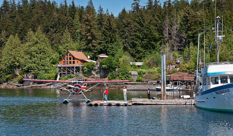
If it is at Meyers Chuck, it either came here on a boat or a sea plane

We met a very nice couple that tied up behind us. They were in Hull #1 of a Kristin 46 steel trawler named Inspiration that they commissioned. It’s a fine boat you seldom see, he told us that there only a handful made, before they went out of business. It had one of the finest looking, most nicely faired steel hulls I have ever seen. They were from Texas, and spend about four months a year cruising Alaska. They invited us aboard and Karen jumped at the chance to “snoop”. It always a delight to see a new boat and add it’s high points to our learning for what we want in our cruising vessel.  

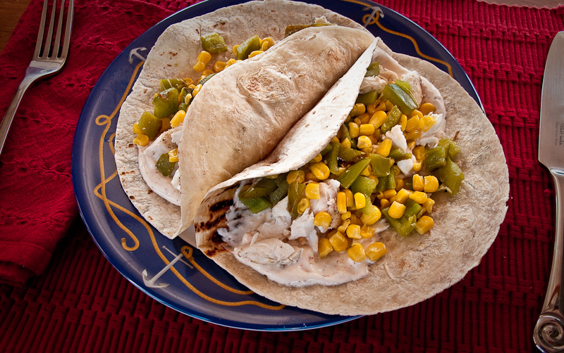
Dinner was halibut tacos with a chipotle “cream” sauce. There is nothing better than fish that’s fresh. The evening was beautiful, the day was perfect. Not a bad start to our five weeks in Alaska.  

20100614_Ketchikan_Meyers Chuck_0009  

Halibut tacos with a chipotle “cream” sauce


Ketchikan to Meyers Chuck

After a night of heavy rain, we awoke to calm winds and not a ripple in the marina. It is a good day to leave Ketchikan for Meyers Chuck.

We cast off at 7:58 am, two minutes before our planned departure. I guess we were excited to get on our way. The skies quickly went from mostly cloudy to partly cloudy to downright sunny. The winds were light ranging from 5 to 10 knots. A perfect day for cruising.

20100613_Ketchikan_Meyers Chuck_0004

Leaving Ketchikan

20100613_Ketchikan_Meyers Chuck_0009

Lots of activity at the airport. FED EX taking off, Alaska Air taxing in. We used both to get us and our gear here.

20100614_Ketchikan_Meyers Chuck_0014

Just north of Ketchikan, the answer to the question: “Where do I keep my boat?”

20100613_Ketchikan_Meyers Chuck_0010

Submarine Rock at the north end of Tongass Narrows. Obvious name, but it works.

As we approached northern end of Tongass Narrows, a Norwegian cruise ship was starting to enter the head of Tongass Pass, southbound to Ketchikan. We called the bridge on channel 13 and worked out a plan for passing. They were very nice and appreciative of the call. There was not much traffic on our trip. We saw the occasional long liner and a couple of local go-fast aluminum runabouts, but not much else.

20100614_Ketchikan_Meyers Chuck_0015-Edit

Our first cruise ship passing of this trip

Karen did most of the helm work on this leg, as I was preoccupied with trying to find out why my Nobeltec navigation program would not display Course over ground nor Speed over ground. I invested a couple of hours trying everything I knew to solve the problem. We did have a cell signal at Meyers Chuck so, after a 35 minute wait in the queue, I talked to tech support only to find out that my problem was a known issue with version 10.5. The fix, downgrade to 10.2 or upgrade to 10.7. Given that I had recently just upgraded from 10.2 to 10.5 I expressed my disappointment with their bad computer code and reminded them that cruisers like use are seldom in internet access range to accomplish such an upgrade and that this problem was going to be with me a long time. Ever since Nobeltec’s upgrade to version 10, the program has been plagued with bugs. I’ve been a loyal customer for over 8 years, but my allegiance is waning.

There was lots of space available on the docks at Meyers Chuck. This is not always the case, so we felt ourselves lucky. We secured Arctic Star and took a walk up to the “Gallery”. There we bought a postcard to send home and since the proprietor is also the postmistress, she was kind enough to make certain it got into tomorrow’s weekly pickup. She is also the cinnamon bun lady, so we placed our orders for delivery to the boat at 7:30am tomorrow. Although we are trying to eat lighter this trip, we justified indulging in this famous Meyers Chuck tradition because we skipped it last time we were here in 2006. How’s that for rationalization?

20100614_Ketchikan_Meyers Chuck_0100_1_2

Karen at the Gallery

20100614_Ketchikan_Meyers Chuck_0055-Edit

The “Pay Phone” at the head of the docks where you cna call to have the gallery opened or order cinnamon buns. I know pay phones are passe, but a bird's nest?; Really!

20100614_Ketchikan_Meyers Chuck_0044_5_6_7-Edit

“Welcome to Meyers Chuck”

The rest of the afternoon we explored the paths around the chuck. We made it over to “Back Chuck”, south of the main “chuck”. As it turns out, this is the high rent district. The homes are newer, larger and the floats most impressive. It’s fun to discover something new.

20100614_Ketchikan_Meyers Chuck_0108-Edit

A “souvenir” sign back on a dock in Back Chuck

20100614_Ketchikan_Meyers Chuck_0080_1_2_3_4-Edit

Some “spider art” along the trail around Meyers Chuck

20100614_Ketchikan_Meyers Chuck_0030

The docks at Meyers Chuck

20100614_Ketchikan_Meyers Chuck_0060

You can see Arctic Star with our red Pungo 12 Kayaks

20100614_Ketchikan_Meyers Chuck_0064

The trails around Meters Chuck, Karen loves to check out see the “homesteads” of the year long residents

20100614_Ketchikan_Meyers Chuck_0068-Edit

If it is at Meyers Chuck, it either came here on a boat or a sea plane

We met a very nice couple that tied up behind us. They were in Hull #1 of a Kristin 46 steel trawler named Inspiration that they commissioned. It’s a fine boat you seldom see, he told us that there only a handful made, before they went out of business. It had one of the finest looking, most nicely faired steel hulls I have ever seen. They were from Texas, and spend about four months a year cruising Alaska. They invited us aboard and Karen jumped at the chance to “snoop”. It always a delight to see a new boat and add it’s high points to our learning for what we want in our cruising vessel.

Dinner was halibut tacos with a chipotle “cream” sauce. There is nothing better than fish that’s fresh. The evening was beautiful, the day was perfect. Not a bad start to our five weeks in Alaska.

20100614_Ketchikan_Meyers Chuck_0009

Halibut tacos with a chipotle “cream” sauce

Ketchikan, Day 3

The rain is different in Ketchikan. I say different, not because it rained most all the day, but the drops themselves seem different. They are larger, often spread far apart, but certainly bigger than in the lower 48. They bounce off the pavement with a gregarious splash. They hit you hard. You feel as if sleet is starting to fall, or perhaps freezing rain. But no-- it’s just rain, Ketchikan style.

It did not rain all day today, in fact, as we walked to breakfast the sun made an appearance. It lasted just long enough for me to make a panorama photo of part the Bar Harbor marina. Breakfast was at Dave’s Red Anchor café. Very local vibe, very good. Walk in and sit yourself down if there is an open table. The décor, as you can see from the photos, is home grown and whimsical. The people are a great, although you have to appreciate the straight forward, no nonsense interaction. It’s friendly, but to the point. You quickly understand Sarah Palin’s demeanor.

20100613_Ketchikan_0083_4_5

Dave's Red Anchor

20100613_Ketchikan_0079

The “Greaters” as you enter Dave's

20100613_Ketchikan_0081

Barnacle Buck watches over us a we enjoy breakfast. Take a close look at his antlers.

Today was a day devoted to waiting for a break in the winds and the waves. The good news is the waves are down to 11 feet from 20-something yesterday. Given that we were still feeling less than energetic, the weather delay came at good time. We finished putting everything away on the boat. I detailed the galley and organized all the food in the two refrigerators and the freezer. On this trip I should not have to shout out to Karen…”Do you know where the XXX is?” As I stowed it, we are only at the mercy of my memory when it come to locating the components for dinner.

I followed the instructions included with Debbie’s Green Storage bags to the letter: first cleaning then drying all the fresh vegetables before placing them in these bags that promise longer life to our rare and precious cargo. Acquiring and keeping fresh veggies is the biggest negative of this type of wilderness cruising. I certainly don’t expect them to last all five weeks, but if I can get two weeks I will be happy. After that, frozen veggies will be on the menu.

We’re three days into our trip, and I think Karen has finished six books in her electronic library. The advertisements claim the Nook can hold 1500 books. Let’s hope that’s not just marketing hype.

In the afternoon, I got all the electronics up and running. I convinced the Bluetooth GPS to talk to the laptop. The satellite phone made contact and registered itself on the Iridium network. Everything else that takes a battery and blinks or flashes with technological delight is now fired up and running. We’ll see how long that lasts. Even Karen’s newest love, her Nook, is performing as advertised. To her, it seems magical that she can order a book from the Nook and seemingly, like magic, it downloads itself and appears ready for her to devour.

20100613_Ketchikan_Meyers Chuck_0001

I have more pictures of Karen in the rain, on the docks, as we provision for our trips

Dinner was at the Oceanview Restaurant, same as last night, but pizza was our choice rather than Mexican. It’s a popular place that serves almost anything you can imagine from the aforementioned Mexican to pasta, burgers, and who knows what. Oceanview is open seven days a week from 11 am to 11 pm, so it’s easy to see why it’s a favorite with the locals.

The Bar Harbor marina is big and a commercial dock. They squeeze in transient boats when slips open as the fisherman go out to sea. It’s only two days until Crab and some fishing seasons open, so the marina is busy with preparation. Pressure washers rumble, lines and nets are attended to, and engines are exercised in anticipation of going to work.

[Group 1]-20100613_Ketchikan_0069_20100613_Ketchikan_0076-8 images

Bar Harbor Docks

So tomorrow we’ve planned an 8 am departure with a stop at Meyers Chuck that will either become our final destination or simply a lunch stop, depending on our mood. We were there in 2006, but our memories of it are not particularly sharp, so we look forward to revisiting it and forming new memories.

Ketchikan, Day 2


Rain, Rain, Rain; accompanied by wind. That’s today’s forecast and it did not disappoint.

20100611_Ketchikan_0005

The dinning room at the Cape Fox Lodge; great views

Today is our day to provision. Five weeks is a long time, so we have a long list to fill.  Having done this many times, although usually for a maximum of three weeks, we have the task down to a tolerable marathon. The day before, we reconnoitered the three available sources for provisions. We did this with an eye to which is best for fresh items, meats and who has the best prices for staples.

The Safeway is without a doubt the clear winner with the best selection of meats and fresh veggies. It also had the widest selection of everything else. As for prices, they were pretty much h the same everywhere.

Despite our trio of stores, some things, such as dried mushrooms, were in scant supply. And others, such as half& half and asparagus, were sold out. Due to the fact they everything you see on the shelves has to come to Ketchikan on either a boat or a plane, it’s no surprise that some items are hard to find. We spent about four hours in the Safeway and about one more bouncing between the other sources trying to fill in some of the blanks. Oh well, the chef, that’s me, will just need to improvise.

Gathering the provisions is one thing, transporting them to the boat is another. The marina has oversized two wheeled big yellow plastic wheelbarrows at your disposal. The challenge is that it always seem as if it’s low tide (and raining hardest) when you want to wheel the goods from the car.  Sitting on the end of the pier, the cart is about twenty feet above the floating dock and the resulting angle on the ramp is approaching 45 degrees. Having once taken a spectacular spill in Port McNeill in just such a scenario, I now try to limit my loads. But smaller loads mean more trips. I think I made twenty trips up and down that precarious incline in the pouring rain. The joys of this phase of cruising escape me.

Karen and I were exhausted by the time 7 pm rolled around, our planned time to meet up for dinner with Brian Pemberton and the rest of the Northwest Explorations crowd still around from their Leg 1 trip from Bellingham to Ketchikan.  The location was the Oceanview restaurant, and margaritas were flying off the bar. We enjoyed good fajitas and good company; although by the end of the night we were both starting to fade. A quick trip back to the harbor and off to bed.

20100612_Ketchikan_0040

Our view from the Cap Fox Lodge back down to Ketchikan. The funicular is the easy way to go by foot.

Ketchikan

Today is a day to adjust the body clock, do some sightseeing and a preliminary provisioning run. We’ll buy some wine and beer, and check out the various sources for fish, meats, groceries and the like.

I always like to find out the best source so when the big day of shopping comes, it can be as easy and straightforward as possible.

Having a rental car (nice term for what was clearly an old beater),  we decided to drive out to the end of the road and see what there was too see. It was quite windy, with white caps along the Tongass Narrows. As the road changed from paved to gravel, we passed a few busses from the cruise ships obviously on same mission as us. We had a map of the various “points of interest” along the way. However, none were marked. Karen asked, “How do they expect you to find these spots?”  My reply, “They don’t,  but the bus drivers know where they are, that that’s what’s important.” Ketchikan is a cruise ship-centric little town. The area near the docks exists solely to serve the big ships.

When they arrive, no matter the time, the town opens up and welcomes the guests. The lumberjack display kicks in, even if it’s 7 am in the morning. I have been awakened a few times by the sound of the crowd cheering for one or another of the men dressed in plaid. The other change you notice is that when the cruise ships are in town, there are cross walk guards at every intersection. I wonder how many voyagers they ran over before they started that service?

We did find a waterfall along the road. It was not much to speak of, but after all our searching we had to get out and take a picture. Imagine if you came here on a cruise ship and then piled into a bus and this was the one the highlights of the excursion? To each his own.

20100611_Ketchikan_0010

Karen at The Falls

20100611_Ketchikan_0050

Bob joins in the tourist excitement

20100611_Ketchikan_0021-Edit

The Falls is all their glory

As we made our way back into town along the road that parallels Tongass Narrows, we spotted five Grand Banks heading north toward to town. It was the Mother Goose crowd from Northwest Explorations(www.NWExplorations.com), the charter company that we’re scheduled to pick up our boat from tomorrow. We stopped at a small marina with a dock and as the lead ship, Deception approached, we called the Captain, Brian Pemberton, owner of Northwest Explorations. We exchanged welcomes and offered to lend a hand tending lines as they docked as the wind and current were being the usual nuisance in Ketchikan. Mother Goose had come in a day early owing to the gales that were forecast to begin that night….but they declined our help and so we headed off for some provisioning. We checked out the Safeway (best), the Walmart (just OK, but not bad for cookware if needed) and bought a bunch of wine and beer. We were pleased to see our favorite, Alaskan Amber, readily available. It’s brewed in Juneau and really quite good.

20100611_Ketchikan_0053-Edit

The Mother Goose fleet makes it way north, up the Tongass Narrows

We joined the group from Mother Goose at Annabelle’s, one of the local attractions. The food is good, the atmosphere a bit touristy, but they do a good job of handling such a large group. Everyone was happy with their selection.

As usual with a Mother Goose “leg”, the boaters were a fun and interesting group that had bonded over their 3 week journey from Bellingham, WA to Ketchikan via the Western coastline of Vancouver Island. A very small percentage of cruisers can say they traveled “the outside” and now these lucky mariners can claim that accomplishment.

In case you were wondering, my missing bag did finally arrive at 3:15 pm today. This is only one reason we build in buffer days at the start of such a long and remote journey. We headed back to the Cape Fox Lodge well fed and ready to sleep.

Travel Day

As planned, the alarm sounded at 2:45 am. Our flight out of Philadelphia, via Chicago and Seattle on to Ketchikan, Alaska was showing an on-time departure of 6 am. Our day was to consist of 7 hours of flight time intermixed with 5 hours of layovers.

The clouds were low with a trace of fog as we left for the airport. It was a perfect preview of the weather in store for us in Alaska. All in all, the travel was uneventful and on time; just long and tiring.

20100610_Ketchikan_0001-2

We leave the clouds of Philadelphia behind

20100610_Ketchikan_0018-Edit-2

You always can tell when you're approaching Chicago buy the grid of the neighborhoods

The drama started upon our arrival at our Ketchikan. As we waited at the sole baggage claim conveyer, it quickly became apparent that our four bags, containing all our gear for the next five weeks, did not arrive when we did. A check with the Alaska Air baggage agent was promising in that she had a report in her hand listing our four bags. She said that she expected they would arrive in 6 hours on a later flight, and that they would deliver them to us at our hotel, the Cape Fox Lodge.

20100610_Ketchikan_0001

The Cap Fox Lodge. Every culture has guys with crazy party hats

We passed the time trying to wind down from our travels, enjoyed a beer and some shrimp at the hotel bar,  and then we had a wonderful dinner at The Bar Harbor Restaurant. If you ever find yourself in Ketchikan, visit this fine eatery, it’s the best we have found in this town. The halibut tacos Karen had were to die for, and my halibut with pecan maple cream sauce was also delicious. I won’t make you envious by talking about the bread pudding and the homemade cinnamon ice cream. Plus the wine list was really great.

20100610_Ketchikan_0004

Our favorite in Ketchikan, Bar Harbor Restaurant

Back at the hotel, we got good news; three bags were delivered to our hotel at 10 pm local time, 2 am body time. My bag, with all my clothes, repeat ALL MY CLOTHES, was the bad news. “Tomorrow morning at 8:30” said the agent when she delivered the bad news. With that I gave up, exhausted beyond measure, and went to bed. Karen had passed out from fatigue a few hours earlier. Total time from the call of the alarm in Pennsylvania to the sound of my head collapsing into the pillow in Alaska: 24 hrs.

20100610_Ketchikan_0003

Our base camp in Ketchikan while we provision for our trip