Santa Gertrudis Cove To Bottleneck Bay Via Hot Springs
/Alaska Dream was rocked by a few swells as we awoke at 6:30am. Karen checked the weather on the VHF radio and based on the forecast, we decided to go now to avoid the North West winds as we passed Estevan Point. To expedite our departure, we forego showers. Once underway, breakfast was reheated cornbread with butter and honey. It was a perfect quick and easy breakfast for an early start.

Saying goodbye to Nootka light
The sun was out and the sea and wind, although up, gave us a nice ride. Karen took the helm as we rounded Estevan Point and was greeted by a couple of whales. We did not see any other pleasure boats along our route as has been the case for most of our trip down the West Coast of Vancouver Island. However, as we headed into Hot Springs Cove, we discovered where all the people were. There were a few cruisers anchored and all manner of “go fast” boats shuttling people from Tofino to and from the Hot Springs. As the docks were a flurry of activity with the tourists coming and going, we anchored out behind “Innchanted”, a floating bed & breakfast that is permanently anchored in the bay It was pretty windy. First was lunch, and once we were confident that the anchor was well set, we deployed the bridle and launched the dinghy for our trip to the docks and, ultimately, the Hot Springs. We had some trepidation as we had watched a nearby sailboat drag extremely close to the rocks as her owners came dinghying back at full speed to save her.

Busy docks at Hot Springs
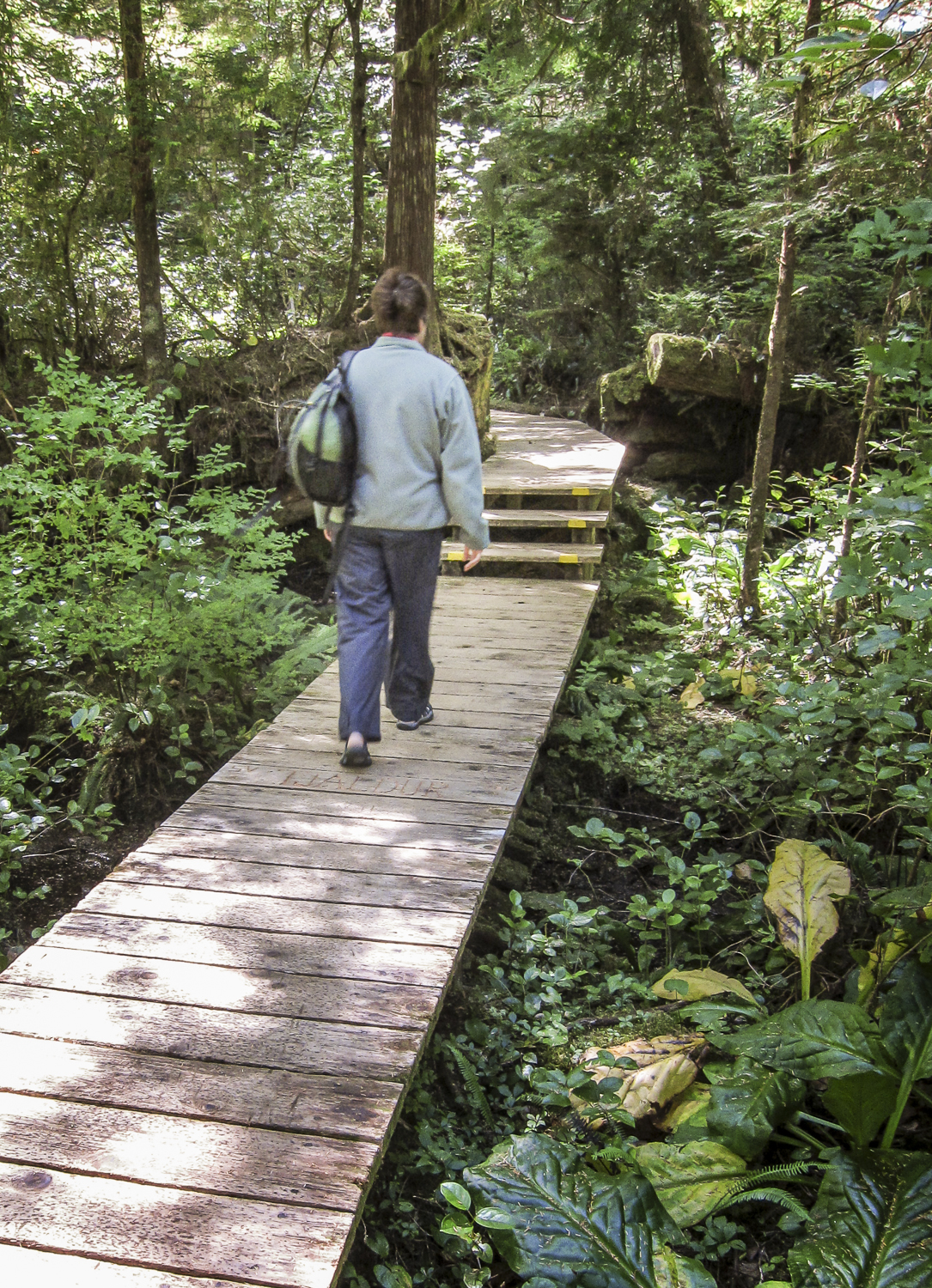
Karen treks along the boardwalk at Hot Springs
It took us 40 minutes to walk to the Hot Springs. It’s a long walk with lots of steps, both up and down. But the elevated walkway is well maintained and features endless planks that have been carved by the crews that have visited the Hot Springs. There was even one that said “Will you marry me?” I hope she said yes, because it would have been a very long walk back if not.
At the end of the trail, we found lots of people, but it was not overcrowded. Like all natural hot springs we have visited, you are at the mercy of Mother Nature for access and comfort. We first tried the closest and easiest to get to pool, but it was too cold. Then we tried our mountain goat impressions and made our way to the waterfall, but it was too hot. Karen continued her decent to the other pool, climbing over the other people that were, by necessity of the geological formations, were along her route.

"Come on in, the water is"...hot, cold, stinky...
I retreated and got dressed and explored the area with my camera. After a while I saw Karen emerging out from the other side of the Hot Springs, having climbed some very large boulders to make her exit. This is not our cup of tea, risking life and limb on craggy, slippery moss-covered rocks to sit in stinky hot mineral water with people you don’t know. Compared to the pristine and uncrowded hot springs experience in Haida Gwai, this didn't compare. But we checked the box and when asked if we have been here, we can say yes.

Beautiful view from the overlook at the Hot Springs

If it were not for these people, you would never know the Hot Springs are there when viewed from the sea.
Our return walk took about 45 minutes to make it back to the boat. The wind was fresh and we battled the dinghy as the gusts would give it a mind of its own. Finally safe in its cradle, we headed inside for a nice fresh water shower.

We found the boardwalk more interesting than the Hot Springs themselves
We relaxed and consumed a fresh monkey bar we purchased on the docks as we watched the endless parade of boats and seaplanes dropping off and picking up tourists. We started our trip to Bottleneck Bay about 4:30. The ride was chop on top of swells, but we were happy compared to the people in the little “go-fast” tourist boats that were getting slammed by the seas. Karen took us into Bottleneck Bay through a cute small entrance. Once inside, we found a large bay with one sailboat, Autumn Winds at anchor.
Dinner was “yummy” Thai peanut chicken accompanied by another episode of LOST. We were both tired and went to bed early.