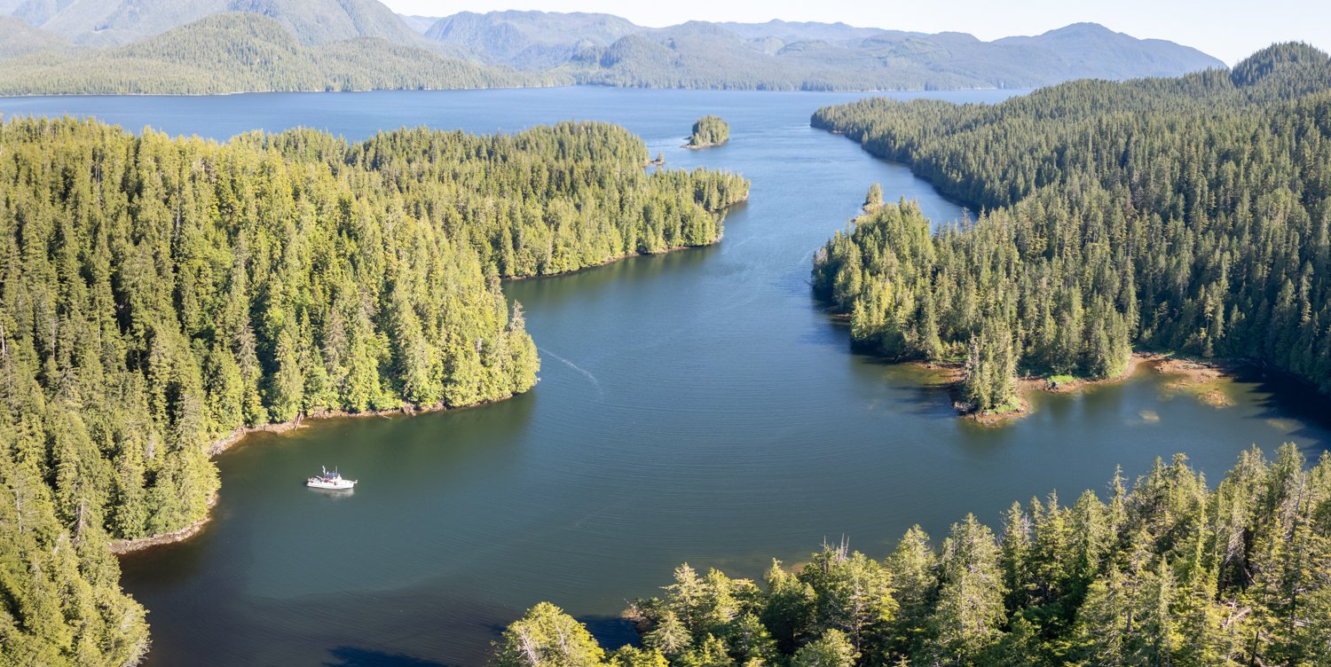
Bitter End Cove to Taylor Bay Via Dawsons Landing

After some morning low clouds, the sun took over and we were greeted with clear skies and bright sun. A noticeable change. Today we are positioning ourselves to be ready to enter Draney Inlet (in Rivers Inlet) at slack tomorrow morning.

clear and calm

We charted our course to take us past Dawsons Landing, to stop in and see the state of this iconic establishment in Rivers Inlet. As we have read in other sources and seen with our own eyes, Dawsons seems a little bit more run down each time we visit, although still fully operational. The store – though reasonably well stocked -  is still half the size of the old days,  a change made during Covid that was never undone.

dawsons landing

Fuel continues to be available, and we were able to pick up a few basics at the store to fill holes in our larder.

large green roofed building is the stor and the fuel dock at the red roofed building

the same logs always seems to be here, but how can you tell on from the other?

We knew virtually nothing about our final destination for the night, Taylor Bay.  Folks we met on the sailboat Aurora II told us they had heard there might be bears. Bears and close to Draney Inlet? Done. The anchorage in Taylor Bay turned out to be a bit cozier than our usual choice, but the holding was good in rock and mud and we were all alone.

Taylor Bay is smaller than it looks because of shoaling

looking back in talyor bay

Rivers Inlet in the distance

The promised bears never came but we enjoyed our brief stay nevertheless.

Bitter End Cove Lay Day

We had such great plans to dinghy-explore yesterday, but the gusty winds and whitecaps kept us boat bound. This morning, we were determined to get out and go exploring before the afternoon winds came up.

Karen had an itinerary for us: Oyster Bay (written up as a preferred spot), Fish Trap Bay and Waterfall Bay. So off we went!

We had visited Oyster Bay several years ago, but it was rainy and overcast, and we didn’t stay. We were looking forward to seeing it in the sun. Our opinion: it is fine, some views but not amazing. Lots of places to anchor, but the depths are such you have to anchor a good way off the small waterfall. Certainly protected from winds and fetch, but we definitely prefer Bitter End Cove.

head of oyster bay

On to Fish Trap Bay.  This was written up by the Hamiltons (Jennifer and James), and they liked it. We tend to agree with their POV, and this was no exception.  The anchorage feels quite open, but the views are nice and in the right weather, we definitely preferred it to Oyster Bay.

Last stop – Waterfall Inlet.  This is a longer inlet, and pretty much landlocked and we didn’t feel the need to go all the way to the head. Big, wide, open, OK.  But there is an interesting smaller anchorage not far from the entrance called Remotesville Cove (named by the Douglasses). It is in the SE corner of Waterfall Inlet, and if we were going to go to Waterfall Inlet, this is where we’d anchor. But once again, not nearly as appealing to us as Bitter End Cove.

oceanflyer in better end cove

looking back out of bitter end cove

 Did I mention we haven’t seen another boat on our journey?

As we headed back to OceanFlyer, the wind and waves had definitely picked up. We had timed our exploration well, and I had to tack the dinghy a few times to minimize the impact of the fetch.

Once back at Bitter End Cove, we went to the very head, to check it out again. Yesterday it felt narrow and not as interesting as where we dropped the hook. We still felt that way, as there is a large shoaling shallow area at the head that keeps you from getting close to the small creek and landing area.

looking up to the end of the head of Bitter End Cove

We then went back near the boat to check out the waterfall that makes up part of our view. It’s small, but lovely and has such a nice sound. Total round trip: 10.4 miles. Fun!

you can trace the path of the water by the light green foliage

the water fans out as it meets the rocky shore

looking down on the terminus of the waterfall

sunset in Bitter End Cove

South Sea Otter Cove to Bitter End Cove, Fish Egg Inlet

We were undecided where to go after Sea Otter Cove.  We were biding our time a bit, as we worked our way south toward Draney Narrows in Rivers Inlet, our next big adventure.

watching the clounds over fitz huh sound from sea otter cove

Karen left it up to me to choose our next anchorage, so I chose Bitter End Cove at the very far end of Fish Egg Inlet as our next stop because we have never been to this anchorage and it looked as if it might be a place to see bear.

Leaving Sea Otter Cove, we had sunshine for a change. The winds were calm as we entered Fitz Hugh Sound. The water was barely rippled, with just a slight swell in the water.

As we make our way south the wind begins to increase from our stern. The sound got confused and choppy as we are abeam Hakai Passage which is open to the pacific.

By the time we got into Fish Egg, there were whitecaps. As we approached the Narrows, we saw blows and slowed to enjoy the two humpbacks before continuing.

As we approached Bitter End Cove, it was clear that this cove was not protected from the wind or fetch. There were two possible anchor spots, and we chose the one opposite the small waterfall rather than the less attractive (to us) head.

I suspect many boaters would have decided to find a more protected spot, but the anchor bit soundly and OceanFlyer is heavy enough that the fetch wasn’t noticeable. The winds kept the boat cool in the sunshine and we were quite happy with our spot. There were views in all quadrants and not another boat in sight.

Our plan to fly the drone and go dinghy exploring was put on hold until tomorrow, due to the winds and the big whitecaps out in the bay where we planned to go.

Bitter end cove sunset

Fougner Inner Cove Sea Otter Cove

It was a quick one-hour cruise over to Sea Otter Cove, and the day started with sunshine. We could actually see up Burke channel toward the mountains there, unlike yesterday’s low clouds and fog. For a moment we were tempted to change our destination to Kwatna Bay, but there was little guarantee the sunny weather — very nice to have for Kwatna exploration — would hold. So Sea Otter Cove it was.

Karen heard about this anchorage while doing laundry at Shearwater.  There are three arms in Sea Otter Cove, and our plan was to anchor in the South Cove, opposite the “opening” which provides a view into Fitz Hugh Sound.  We knew from Marine Traffic and AIS that there was a sailboat at the head, which would leave us our target spot — right across from the “opening” — to anchor.

After a bit of calculation to determine exactly where to drop the anchor to maximize our view out the cut, we anchored in 60 feet. We were well away from the other sailboat, and it was nice to give them space.

looking out into fitz hugh sound from sea otter cove, south

s/V Aurora II at thehead of sea otter cove, south

looking south at the head of sea otter cove south

As soon as we arrived, Karen spotted a pair of sandhill cranes on the spit of low-tide shoreline where the cut to Fitz Hugh was. They were frequent visitors to this area throughout our stay.

sand hill cranes looking out to fitz hugh sound

Later in the day, we launched the dinghy to explore the other two arms of Sea Otter Cove. We quickly determined that we preferred our current location, the south arm.

One note is that in the dinghy, using Garmin Navionics charts, there was a bit of discrepancy in the location of the drying areas that extend from shore in both the west and north coves.

Add to this the fact that there were a couple of big boulders under the water at the edge of some of the drying areas reminds every mariner to continually monitor the charts and compare that to what you see around you and on the depth sounder.

On our way back to OceanFlyer we chatted with the folks on the Sailboat Aurora II. They were trying to get weather for their southbound rounding of Cape Caution and we happily offered up our Starlink connection.

there is a drying arm at the head you can explore at high tide in your dinghy or kayak

Kisameet Bay to Fougner Inner Cove

The dreary conditions continued this morning with low clouds, followed by some breaks, then the clouds would return. Our anchorage neighbor, the sailboat Leigh Ann, departed before we did, as we didn’t have very far to go and we were lazing about.

As we left the anchorage using the southern approach, we saw the Disney Wonder Cruise ship though the breaks in the islets in and near Kisameet Bay. Being twice as fast as OceanFlyer, we knew she would be past us long before we made our entrance into Fisher Channel. We snapped a few photos of her and didn’t think much more about her.

The disney wonder, a wake machine

To our surprise, our encounter with the Disney Wonder was not so fleeting.  Her wake managed to find us. One mile from her path, the wake was still 1 to 2 feet in height and breaking, requiring us to turn into them to minimize reorganizing the interior of OceanFlyer. We are spoiled by the nearly non-existent wake from the Alaska Ferries such as the Kennicott, even when close.

The Disney Wonder then soon disappeared into the fog. And so we put on our fog game hat (Nav lights, Fog horn, intense focus) and made our way to Fougner Cove.

Karen had read about this cove, found at the junction of Fisher Channel and Fitz Hugh Sound,  and it has been on our list to check out for several years.  We read that it was a one-boat hole and hoped that we would be the first to arrive.  There is a narrow pathway into the inner cove with some rocks guarding the SE edge of the path. We saw no less than 13.5-feet under our keel — on a +6.4-foot tide at Namu.

We were indeed the only boat in the cove, and we found a nice anchorage that would give us no less than 15’ below the boat at low tide. It felt a bit odd, as we’ve been used to anchoring in deeper water requiring more rode. Not that we were complaining.

I flew the drone to get a 3-D sense of the cove. There is a lagoon to one side, with a shallow dinghy entry ringed with rocks. The Douglass guidebook says that turbulent water runs through that entry at certain tides, but we did not see any current at all in the area during our stay.

fougner inner cove with the lagoon in the backgound

the lagoon look rather plain, so we did not go in

an aerial view of the entrance to the lagoon for the next explorer to reference

fougner innver cove with fits hugh sound to the west

fougner inner cove provides an easy resting place just off fitz hugh sound

Later we were joined by two small sport fishing boats and light rain. Fougner Inner Cove is a nice secure anchorage and we had a very peaceful night.