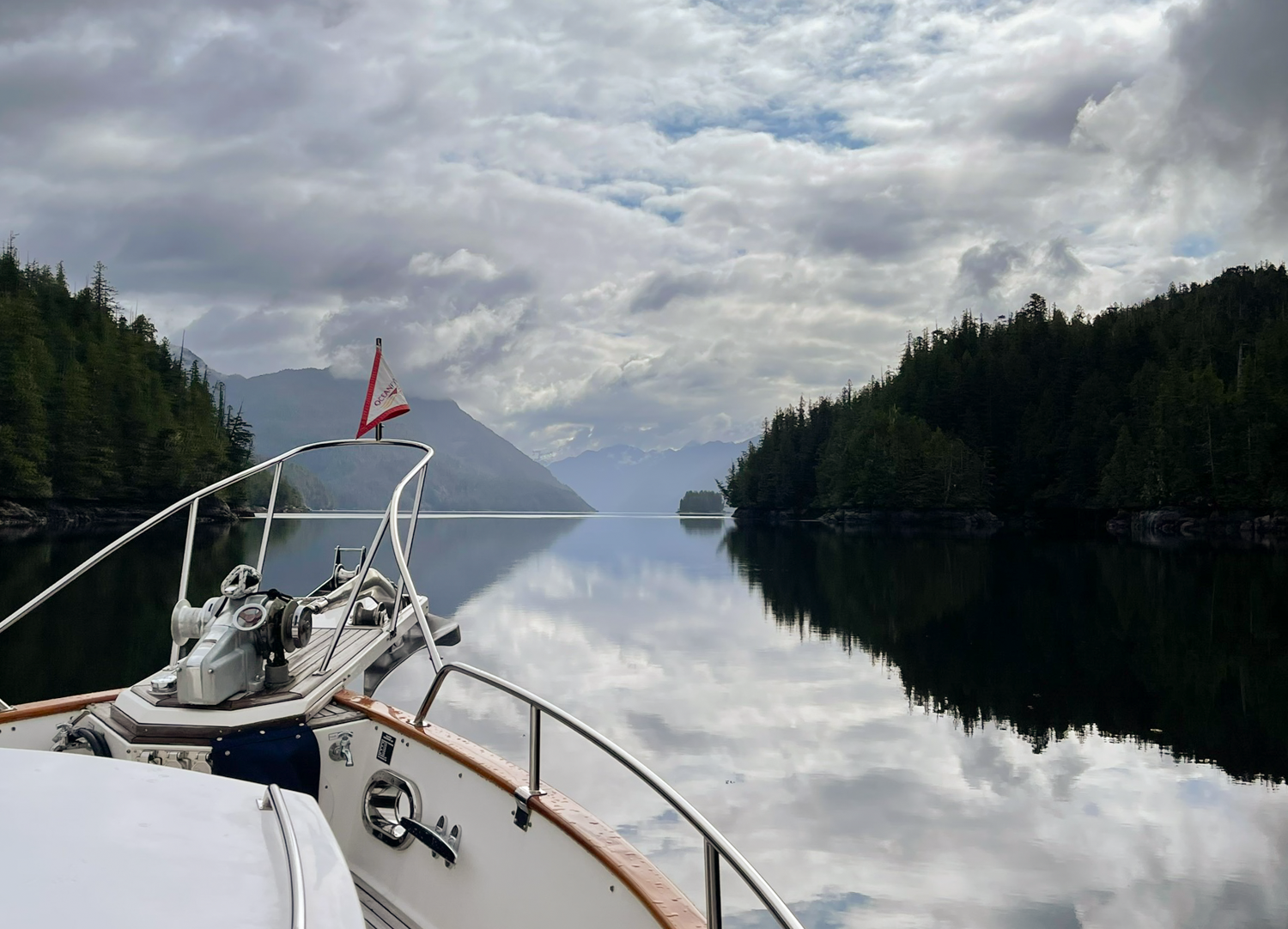
Green Island Anchorage Layday

Rain day = laundry day. having on board laundry is a must for extended cruising. OceanFlyer is particularly nice in that we have a full-size washer and dryer like you would have at home. They are in the engine, which Karen thought initially she would not like, but, as it turns out, it’s a more than acceptable compromise. We keep a large linen closet in the master stateroom, and the washer/dryer are out of the way until you need them. 

Most important is having the 220-volt dryer that is vented to the outside. Our clothes dry quickly and completely, unlike other options we have experienced aboard most boats.

Hunkered down day means I’ll work on photos, blog copy and boat projects. It’s a welcomed change from traveling long hours.  Karen is working on a research report for a client and has her head down.

I mentioned in my post yesterday that Green Island is one of our favorite anchorages. That’s because, although it looks small on the chart, there is plenty of room. We also like the views in all quadrants. You do not feel hemmed in. The only downside is that some swell can sneak in from Fitzhugh Sound when the rocks in the pass cover at higher tides. The fetch can also be reflected around in the anchorage, but we have never been uncomfortable. On the occasion you get beam-to the fetch, you’ll get a brief and gentle rolling motion.

looking out to fitz hugh sound from green island anchorage

Ahclakerho to Green Island Anchorage

Today is the day to move, the winds and seas are forecasted to come up tomorrow, so today we will leave Ahclakerho and go to Green Island Anchorage just off Fitz Hugh Sound.

 At high tide last night, 2am,  the anchor alarm sounded. We did touch the western boundary I marked on the anchor alarm. I checked all was well and as the tide retreated, we quickly moved east to the position we held most of yesterday. Happy that we didn’t have to do a re-anchoring dance in the middle of the night. Ask me how I know that is not fun.

We awoke to a high broken overcast and the occasional spot of sun. No rain, as forecasted, and light winds as we retrieved the stern tie and hauled anchor. It was a bit frustrating to see the sun and all the glorious upchannel views as we were leaving, but this anchorage is pretty in any weather. Next time!

our neighbor last night gets a early stert on a day of prawning

It would appear that slack in the Ahclakerho channel is 1.5 to 2 hours after slack at Leroy Bay on a 1-foot tide. When we transited at slack at Leroy Bay, we still had about 2+ knots of current on out stern. In the narrowest portions, the water swirled and required attention at the helm, but nothing to worry about. Most of the shoreline is steep to and the channel wide with well charted features.

As we were making our way back out to Smith Inlet, I spotted a blow and a whale breaching. We continued our heading and by the time we got there all the feeding activity had subsided. Nevertheless, the first humpback spotting of the season.

We had a good trip with some 2-foot ocean swells spaced at a nice distance. The only real confused water was when we rounded from Smith Inlet across the mouth of Rivers Inlet. It didn’t last long. Once we entered Fitz Hugh Sound, the swells stopped and the ride was pleasant.

Green Island anchorage is one of our favorites. It’s not far off of Fitz Hugh, so it’s quite convenient. It gets its name from the distinct bright green patch of some unknown shrub on a small island in the anchorage. It is so recognizable that you can spot it from space on Google Earth.

the unmistakable “green” island that gives this place its name

While in season this anchorage can be busy, we were alone with our pick of anchor spots. We chose to anchor between the island and the opening to Fitz Hugh sound, with great views in all quadrants. Later that afternoon another boat came in and anchored on the far side. That was it.

The weather turned cloudy and rainy, so we stayed cozy in the boat for the rest of the day.

evening approaches in green island anchorage

Ahclakerho Lay Day

The rain has set in. We may get a short break today so we can explore the anchorage. But the long-range forecast is mostly rain for many days. Still, its quite pretty here and we are securely tucked away.

rainy morning in the ahclackerho

The Commercial prawners are all around the Central Coast, and they even made it all the way down into the Ahclakerho. They seemed to be rewarded for their journey as we saw prawns in almost every trap as they pulled them onboard.   

Our stern-tie has worked well and accommodated the rise and fall of the 14-foot tidal range.

oceanflyer sits well on her stern tie in ahlackerho

the view of the stern tie from oceanflyer

the “ramp” up to the tree is handy in almost any tide height

and aerial view with the ebb current setting oceanflyer

As the rain decided to take a brief hiatus, we launched the dinghy. Karen wanted to go to the end of Broad Reach, but as we poked our nose into the Reach, the chop was just too much for a such a long ride. So, we explored the nearer confines of our anchorage. While we could go too far without encountering that wet chop, we did manage to find some interesting nooks and crannies to explore.

looking back up the ahclackero channel

We will definitely come back in better weather to explore all the way down to Ahclakerho basin!

a special place, seldom visited

Blunden Harbour to Ahclakerho

The Predict Wind forecast for our rounding of Cape Caution was favorable, and that is holding this morning as we depart Blunden Harbour. Winds are less than 10 knots and the seas less than 2 feet with gentle ocean swells. We started with wind and current at our stern, so the ride was very pleasant. Karen had me check to ensure we weren’t going hit an ebb out of Slingsby Channel, as that can make for an unnecessary rough patch before you get to the Cape.

The current was forecast to change, but the winds to remain favorable. As we shifted to wind over current, we expected the chop to build a bit, but nothing like our arrival day into Blunden Harbour.

As we approached Cape Caution with Karen at the helm, she had been watching the Alaska ferry Kennicott heading south. Our courses are opposite but offset by a safe distance. The Kennicott has been maintaining a steady course and it was clear we would pass without concern.

Suddenly, the Kennicott turned to the East, setting her course directly towards us. AIS says we now will have less than 400 feet when we pass.  We were within a mile of one another as I called her on the VHF to request her intentions. Immediately, she replied that she is dodging a whale and will be turning back on course quickly. I thanked the bridge for the fast response and as we cleared the frequency, she began her turn back to the west. We passed within 1000 yards, but these ferries do not produce significant wake. We’ve have passed much closer to these hulls in narrow Alaskan waterways and are always amazed at how little wake they produce.

Overall, we enjoyed a very nice ride, with the seas lying down as we approached Cape Caution light.

A couple of distant passenger ships and a Canadian Coast Guard ship laying off Cape Caution was the extent of the vessels we saw.

Our destination is Ahclakerho Channel, It’s a long way up Smith Inlet to make the turn into Broad Reach, channel almost an equally long way back down the Ahclakerho Channel to our anchor spot in the vee of the larger Ahclakerho Island.  It was 2011 when we were last here and we have fond memories. We learned about this special spot from James and Jennifer Hamilton in their “Cruising the Secret Coast” book.

one of the many fishing vessels prawning in this area

To reach the anchorage, you do have to pass though a narrows, which we timed for near high slack. Charting is excellent and there was no stress. We passed a commercial prawner above the first narrow spot, and he waved his thanks as we slowed down to avoid waking him as he was pulling pots.

karen found the little red totem on the shore side rocks in the narrows

The anchorage requires a stern tie, something we have not done in a very long time. The good: we are only a few feet below the high, so we do not have to scramble too far to reach a tree. The bad: the current and winds want to turn us away from the shore – far away. Also, there are not a lot of suitable trees to run our stern line around.

And did I mention it was raining? It took us a couple of hours to find a suitable place to tie that had a safe landing spot for Karen to scramble ashore and a decent tree within reach. We also set the anchor twice as the rocky bottom was a challenge to get a good set. Lots of scope was needed to get a firm grip on the bottom.

Once all was set up and both ends of the stern tie line were back on the boat, we still needed to haul away on the line to turn the boat against wind and current 90 degrees back towards the shore.

After getting out of our wet clothes, we settled in for the night. Even though rainy, the views from the anchorage are nice. And like last time we were here, not another pleasure craft in sight.

As it approached 7pm, the closing time for the commercial prawn fishery, the F/V Corey anchored in the north arm abeam the island. My guess is she sits in about 60 feet. Not a bad place to anchor if you do not want to stern tie.

sunset in the ahclackerho

Blunden Harbour Lay Day

We had a good night’s sleep despite the wind and white caps. We awoke to sun and 10-15 knots of wind but no white caps. We’ll spend the day in Blunden Harbour as the forecast for tomorrow is much more favorable for going around Cape Caution.

a perfect for a dinghy explore

The reason Blunden Harbour made our float plan this year is a long-standing desire to get into Bradley Lagoon. You need at least +11 feet to get past the rocks, and the lagoon is very large. It would be easy to miss the timing to get back out if you lose track of time.

Even through the winds were up again and small white caps were all around, we launched the dinghy to see if we could make it into the lagoon. We picked our route carefully, using the lee of several islands to get out of the chop.

We arrived an hour early for high tide. When we entered, the tide at the Raynor Group was 11.5 feet.  Although the current was still running into the lagoon, it seemed like there was enough water to get into the lagoon and not too much current to be a problem. Turns out it was just enough water. The rocks on either side of the main flow were quite visible under the surface, we rode the current in and kept the dinghy off the rocks. Definitely favor the right 1/3 of the channel when entering.

The wind was still quite strong, and touring the north or south arms of the lagoon would mean one direction would be a very wet ride. Therefore, we headed into the east arm of the lagoon. The arm is wide, and the water mostly greater than 15 feet on the +11.5-foot tide. The shallowest we saw was a 5.5-foot spot.

We arrived at the end of the charted water and continued on for another .9 mile. You feel like you’re the first person to explore the area when there is nothing shown on your chart.  It was pretty, remote and well sheltered from the wind. Very enjoyable.

After an hour we arrived back at the entrance of the lagoon. I wanted to test the theory that slack would be reasonably close to high tide at the Raynor Group. That didn’t come to pass.

preparing to exit bradley lagoon

The water was higher, but the current flowing in seemed even stronger than when we came in an hour earlier. We went back though the rapids right at the high tide predicted time, but the flow was very strong; maybe 8 knots. I had to continue to add power to make way and was happy we had a 30 hp Yamaha pushing us through. With the higher water, the flow was more linear and the rocks well covered, but the high flow rate and turbulence demanded all my attention at the helm.

current on our bow as we exit bradley lagoon

Our total dinghy trip was 6.9 nm. After we returned to OceanFlyer, I looked at Google Earth and saw that even though we thought we had reached the end of the east arm, if we had continued to explore the “end” a little further, we would have found a channel and could have continued further to the NE.  Next time!

Tomorrow, we think the weather will cooperate for our rounding of Cape Caution.