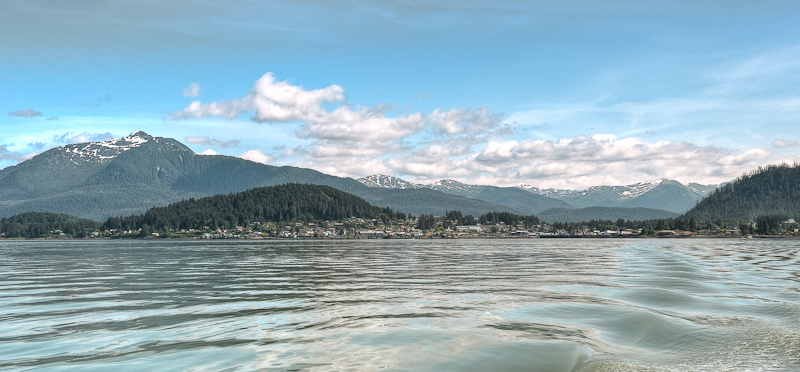
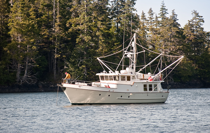
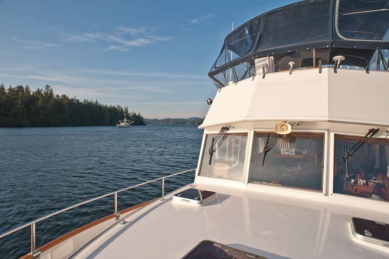
Egg Harbor, Coronation Island to Mud Hole to Port Malmesbury, Kuiu Island

There was a small swell on and off during the night. There were times also when it was dead calm. Overall it was a moderately peaceful night, though the anchor alarm went off at 2:44am for no good reason.

Egg Harbor has more bird life then we have seen so far this trip. When we awoke, Karen spotted a bald eagle on the shore devouring his catch. Two other mature birds and a juvenile looked longingly at his breakfast. From time to time, there would be a test of the pecking order, feathers would fly and then they would settle back into the established hierarchy. I think everyone eventually got a taste, but not before the dominant bird had his fill.

20100621_Ehh Harbor to Mud Hole_1697

Egg scramble with onion, sausage, green peppers and tomatoes. It makes for a hearty breakfast that holds you until dinner.

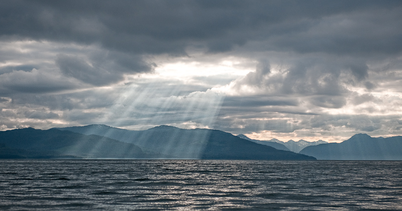
The wind is up to 10 knots this morning and the temperature is sitting around 55F. So when you poke you head outside the cabin, it feels cold. The skies are grey, an  interesting mix of low clouds hugging the tops of the 1785 foot mountain at the south end, to peeks of blue skies to the west. When the sun peeks through the clouds, then dances across the water and the pine trees, it’s beautiful. When the sun retreats, the scenery is beautiful in a grey way. We once overheard a conversation about appreciating the S.E. Alaska weather. Once you develop an eye for the beauty contained in all the various shades of grey, you then can understand the full beauty of this place.

20100621_Egg Harbor to Med Hole_1341_2_3_4

Egg Harbor, big and open to the north, but a good anchorage in south winds

Our plan is to explore the beaches and find the caves to visit. The last time we were here in 2006, we were so tired from our travels we slept the day away and never got out to enjoy what Egg Harbor has to offer.

The dinghy was launched in a 15 knot breeze from the SE. We put on our long underwear and multiple layers of fleece and jackets to shield ourselves from the wind. The large beach at the SE end of the harbor is a great place to walk and explore. The beach is gravel, large and flat. In fact it is almost a quarter of a mile at the head. It looks as if you can also continue back up the shoreline to the northwest. And…unlike the forecast, the sun firmly came out and the skies turned blue.

20100621_Egg Harbor to Med Hole_1365-Edit

Karen kept saying “You look so small” because the beach is so large. So I took a picture of her because she too looked small

In the SE corner of the beach, you’ll find a stream coming down from the mountain to the south. It is wide and flat. Looking at the topographic maps, it seems to extend that way for a good distance. We only walked about a hundred yards due to the downed trees in the way, but it was an easy hike.

20100621_Egg Harbor to Med Hole_1278-Edit

The freshwater stream makes its way to the ocean over the drying flats

20100621_Egg Harbor to Med Hole_1311_2_3

The creek made for great exploring

20100621_Ehh Harbor to Mud Hole_1701

Bob dressed for pictures. Note the Neos Foot ware.

One of the great additions to our gear this year were Neos overboots. We had tried the Xtratuf boots that you see everywhere in Alaska. But the fit and feel were not to our liking. They were too hard to get your pants tucked in and they had all the discomforts of big rubber boots. Neos slips over your own shoes so they are very comfortable. They open wide with Velcro seams making it easy to get over any number s of layers of pants and foul weather gear. They are completely waterproof and provided good footing on anything were have encountered. They have our highest recommendation.

20100621_Egg Harbor to Med Hole_1296

Karen taking the above picture. She's also sporting her Neos footwear

The other unusual and welcomed feature of this area is the openness of the forests. I suspect because the forest floor is muskeg, soft underfoot, the tree density is much less than many other places. It was any easy walk with lots of open areas with interesting flora and pretty light filtering into the forest to showcase the moss and ferns.

20100621_Egg Harbor to Med Hole_1331_2_3_4-Edit

The forest floor is like walking on a very firm mattress

Egg Harbor Forrest Pano

You can actually walk though these forests

20100621_Egg Harbor to Med Hole_1271-Edit-Edit-Edit-Edit-Edit

The forest undergrowth can be beautiful

20100621_Ehh Harbor to Mud Hole_1703-Edit

Always keeping looking down to find the smallest details of the large variety of plants

20100621_Egg Harbor to Med Hole_1465_6-Edit

They call this newspaper kelp because of the way it lays flat

20100621_Egg Harbor to Med Hole_1454_5_6-Edit

Karen takes in the rugged spectacle of Egg Harbor

20100621_Egg Harbor to Med Hole_1469-Edit

As expected, the dinghy was high and dry after our long walk

After an hour of exploring the beach, creek and forest, we set off in the dinghy to explore the caves on the west shore. Unfortunately the wind was blowing too strong for a safe approach. They will be on the list for next time. We would have remained at anchor for another days except for the fact the winds were forecast to increase, with rain. Neither of those components of the forecast would make getting to the caves or exploring deeper in to the forest an enjoyable adventure.

So rather than being stuck at Coronation Island, we made our course good to Port Malmesbury and a cove called Mud Hole. It’s well protected for all winds and puts us closer to our next scheduled layover in Tebenkof Bay. And if the winds and waves do come up tomorrow, we should be able to continue north by staying close to shore in the lee. 

20100621_Egg Harbor to Med Hole_1473-Edit

The island that guards the entrance to Egg Harbor were named Bird Island for obvious reasons

As we made our way into Port Malmesbury, Karen spotted a black bear on the shore. We slowed, changed course and made our way over to the beach. He was busy turning over rocks looking for dinner. I don't think he ever bothered to take notice of use. We left him to his foraging after about ten minutes.

20100621_Egg Harbor to Med Hole_1508-Edit

Dinner on bear beach

20100621_Ehh Harbor to Mud Hole_1716

Dinner on Arctic Star

20100621_Egg Harbor to Med Hole_1677-Edit

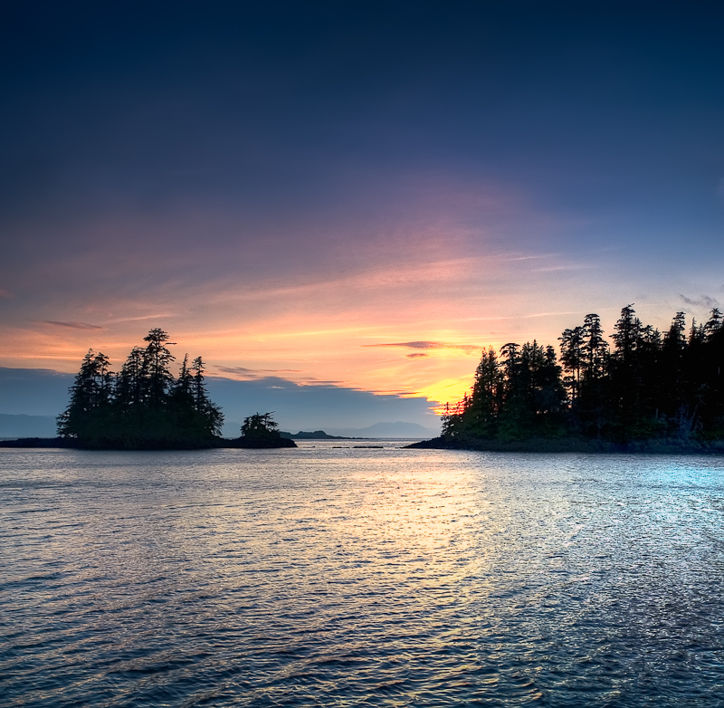
Sunset at Mud Hole, Port Malmesbuty
Labourchere Bay to Egg Harbor

I slept until 9:30 and I might have gone longer except that Karen came in to see if I was still alive and woke me in the process.

I fixed breakfast out a bunch of bits and pieces I found in the refrigerator. That was all I was up for this morning. Today we wanted to explore this bay given the high recommendation from the crew of the Coastal Messenger. We launched the dinghy and proceeded to land on the central beach on a falling tide. This beach was an easy walk compared to Santa Anna Inlet. It’s easy to traverse over to the “outside” and take a look at Sumner Strait. We saw one humpback whale blow and dive a couple of times as he made his way southwest. And the sun came out!!

20100620_Labouchere Bay to Egg Harbor_1022_3_4

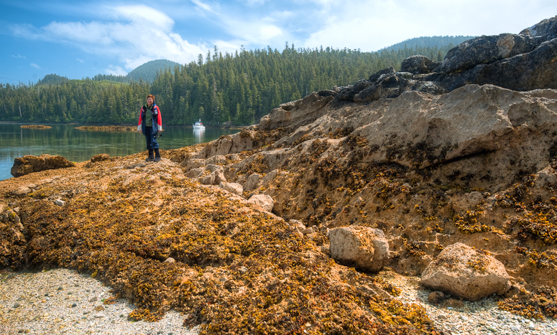
The geology of this area fascinates me

20100620_Labouchere Bay to Egg Harbor_1054_5

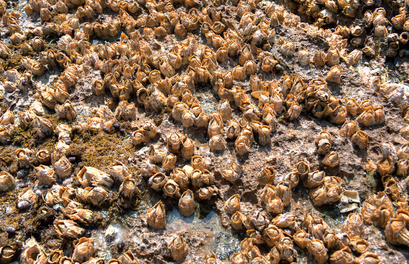
The “walk” on the beach is sometimes a bit crunchy as you have to walk over these

20100620_Labouchere Bay to Egg Harbor_1108-Edit

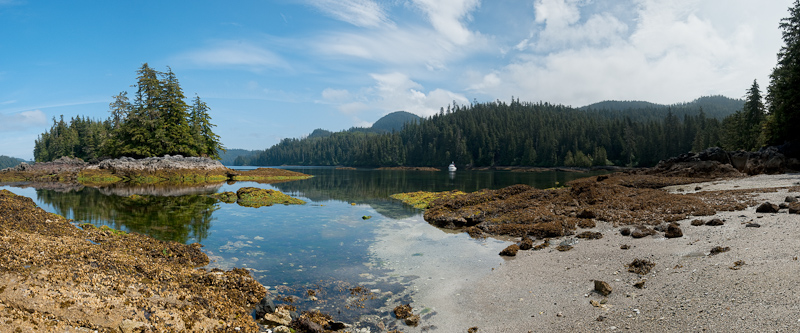
This bay has one of great “beach” to explore. Coastal Messenger was right!

20100620_Labouchere Bay to Egg Harbor_1135_6_7-Edit

Beachcombing” in Labourchere Bay

20100620_Labouchere Bay to Egg Harbor_1121-Edit

Vistas abound around every corner

We then took the dinghy over toward the bay in the northeast corner where there was once a large logging camp. The only remnant now is a road that goes to Port Protection. As we approached the bay, we noticed some movement along the shore. It was strange in that it was white, a color most often found on a bird, but it moved like a mammal. I told Karen to keep an on the critter and I kept an eye on the GPS for any obstructions. As we approached our target, we realized that it was a man, dressed in a white hoodie. He, along with a couple of his friends , were walking the rocky shore. This reinforces the large scale of everything here in Alaska. What we thought was a small mammal with a white patch was just a local out on a Sunday Father’s Day afternoon.

Back to the boat and a decision was made to forego a shower and get underway for Egg Harbor on Coronation Island, some forty miles southwest.

20100620_Labouchere Bay to Egg Harbor_1160-Edit

This guy was looking to hitch a ride to Egg Harbor

The weather was perfect, not as forecast. The skies were partly cloudy and the winds light. We had a fairly good ride with a few 3 foot swells along the way, though as always, they got rougher when Karen was at the helm. Once we were in the lee of the Spanish Islands, it all quieted down.

20100620_Labouchere Bay to Egg Harbor_1162-Edit-Edit

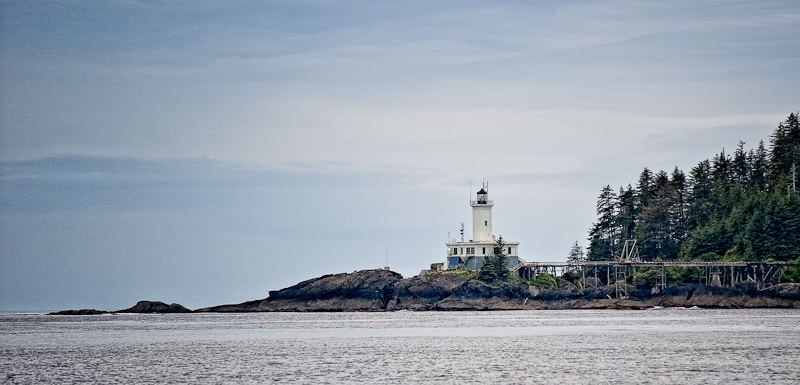
Passing Cape Decision Light

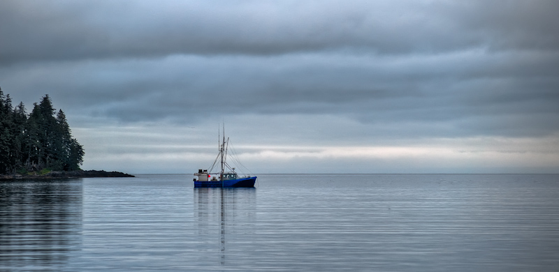
As we approached the entrance to Egg Harbor, two fishing boats that we were watching fishing south of the island headed in to the harbor. They set their anchor and we found a spot between. Egg Harbor is a very popular spot for working fishermen to overnight.

20100620_Labouchere Bay to Egg Harbor_1241

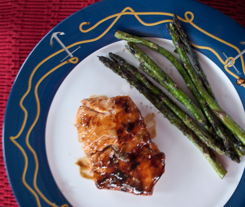
Orange-Sesame Glazed Salmon with Grilled Asparagus

After dinner we were joined by another fishing vessel, the Rosie M. She came in a little too fast for my taste and gave us a bounce or two from her wake. We watched otters play and saw a few eagles before heading off to bed.20100620_Labouchere Bay to Egg Harbor_1234_5_6_7-Edit

 Evening blankets Egg Harbor

Wrangell to Labouchere Bay


O.M.G; we awoke to sunny skies this morning. After a breakfast of scrambled eggs with sweet sausage, onions, green peppers, fresh rosemary sun-dried tomatoes and cheddar cheese (our last meal before dinner, so it had to last) we walked into town for the last time to find some more long underwear for Karen. Despite multiple layers, she’s been cold, so another layer is in order to make the remainder of our journey more comfortable.

20100619_Wrangell to Labourchere Bay_0001

The Reliance Docks in the sunshine

20100619_Wrangell to Labourchere Bay_0002_3_4

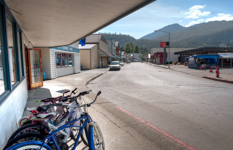
Main Street Wrangell

As we returned to the docks we passed our new friend Ken, talking with Uncle Roy on Coastal Messenger. We stopped to say goodbye and soon the conversation turned to everyone’s next destination.

20100619_Wrangell to Labourchere Bay_0006

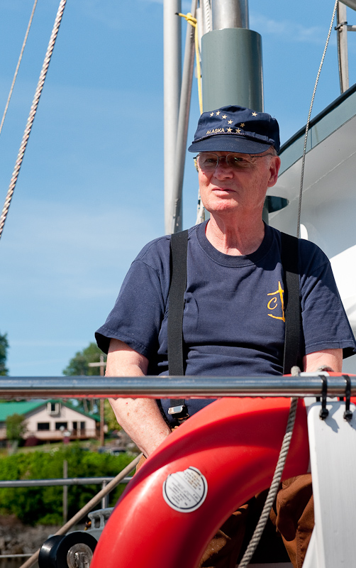
Uncle Roy of the Coastal Messenger

Petunia from the M/V Coastal Messenger invited us onboard to show us their pictures of our next destination, Labouchere Bay, or as the locals call it “Lab Bay”. After seeing the pictures and hearing the stories about the logging camp that was once at the north end  (now removed, with a road over to Port Protection the only remaining evidence that it ever existed), we were truly excited about our choice of anchorages for the night.

Petunia also brought a chart from the wheel house and pointed out the best place to anchor. She went on to inform us that as we round Point Baker we should be on the lookout for humpback whales. Apparently they always spot them as they round the Point.

20100619_Wrangell to Labourchere Bay_0008

Saying farewell to the crew of the Coastal Messenger

After clearing the entrance to harbor at Wrangell we took a southerly detour to visit the new docks at Wrangell. There are behind a massive breakwater and are large, with lots of power, water and the wonderful look and feel of “new docks”. The only problem is they are twice the distance from town as the Reliance Dock. I’m not certain the best way back into town; walk, cab, dinghy? I’ll leave that up to the industrious Wrangell Port authority to work out the details of making these docks both appealing and convenient.

20100619_Wrangell to Labourchere Bay_0016-Edit

Wrangell from the decks of Arctic Star

20100619_Wrangell to Labourchere Bay_0027_8_9

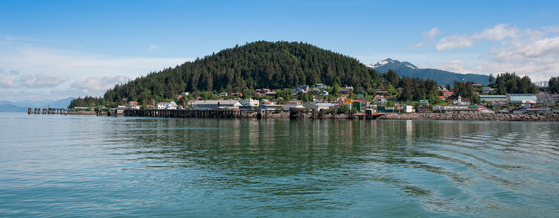
What a picturesque setting for the town of Wrangell

Our trip today is about 50 nautical miles or about 5 and a half hours. Karen and I split helm duty into two hour shifts. The time certainly passes much faster when you’re “off duty” and reading or working on this blog and sitting and watching the Alaskan wilderness pass by.

As predicted by Petunia, as we rounded Point Baker, we saw three humpbacks. No big show from these guys, just a blow or two and a half hearted peek at their tails.

The wind had picked up and the waves also, but not enough to make for an uncomfortable ride. We did turn on the stabilizers for the last third of the trip and everything settled down.

The anchorage in the Southeast end of Lab Bay is very beautiful. You look back though the trees to Sumner Strait. There is a nice stretch of beach and you can walk it on the inside and look over to the outside beach. The wind was still blowing 15-20 knots so we did not launch the dinghy to go explore as was our original plan. We waiting all evening for things to calm down but they never did.

Upon our arrival we did spot a single Kayaker who had just landed on the inside beach I mentioned. Sea kayaking is close to an extreme sport around here, but doing it solo is too much from me to consider. An hour or so later we watched as our neighbor launched his kayak, went out into the Strait and went fishing. I guess you must catch what you can’t carry.

We were joined by a small Nordhavn that anchored about 180 yards to our northeast. Like us, it took him two attempts to set the anchor.

20100619_Wrangell to Labourchere Bay_0042

Our neighbor in Labouchere Bay in full cruising regalia

The remainder of the afternoon and evening we caught up on reading and writing. The wind never did die down enough to launch the dinghy.

20100619_Wrangell to Labourchere Bay_0059

Lots of room in this anchorage

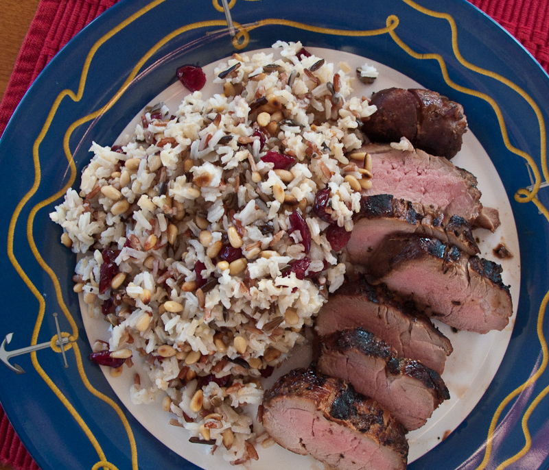
Dinner was marinated pork tenderloin accompanied by a mixed rich to which I added toasted pine nuts and dried craisins. I waited for the sunset that was good but not great for photos.

A sea otter give us some welcome entertainment as he lay on his back and floated while devouring whatever he had brought up from the bottom. As the light faded we spotted three Sitka Black Tail deer grazing on the shore line. Karen called it Mutual of Omaha’s Wild Kingdom. As least she checked off the sea otter on her critter list for this trip.

20100619_Wrangell to Labourchere Bay_0086-Edit

The day is coming to a beautiful end

We were still spinning on the hook when we went to bed around 10:30. Tomorrow we have some weather-related planning to do as the forecast is predicting the winds will start to blow toward 25 knots just about the time we want to go to Coronation Island.

20100619_Labouchere Bay to Egg Harbor_1240

Mustard Glazed Grilled Pork Tenderloin with wild rice, pine nuts, and dried cranberries

20100619_Wrangell to Labourchere Bay_0138_39_40-Edit-Edit

It doesn't get much better than this. Although you have to stay up late in Alaska to see a sunset this time of the year. And a 4am sunrise is out of the question.


Wrangell

Today our main activity was a trip to the Le Conte Glacier via jet boat. As our departure time was not until 4pm, we busied ourselves with tasks around the boat and Wrangell.

The day before, John from Alaska Charters and Adventures, www.AlaskaUpClose.com, had offered to let me draft off his wireless in order to download the upgrade patch for my Nobeltec. We waited until 12:30pm, when the visitors from the cruise ship were back on board and walked the length of town to his office and his wife’s gallery.

The patch download and installation went without a hitch and we were now equipped with Nobeltec software that should perform as advertised.

As the download process unfolded, John told us tales of hunting, fishing, trapping and catching or shooting all manner of wildlife. All of which were butchered by him and consumed during the year. In the summer, they have three large gardens at their cabin on the Stikine River where they grow and then put up vegetables for the winter. In Alaska, even in one of the top ten populated towns in Alaska, the citizens still live off the land.

We made our way back to the boat with stops in the various shops in town. Souvenirs were on the list along with a couple of fresh produce items.

The trip on the jet boat was much anticipated. Our original plan was to take the trip up the Stikine River to see the wildlife, but the river was too low to get to the spots they usually visit. The snowfall was light this winter in the mountains and the resulting limited runoff had left the river very low.

Eric from Breakaway Adventures suggested we try the 4-5 hour trip to the Le Conte Glacier instead. We were at bit disappointed as we had visited the glacier at the head of Tracy Arm in 2006 on our Grand Banks. This seemed it might be a bit “me too”, but we’re always game for adventure.

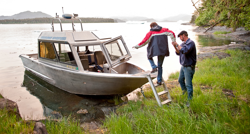
Norm and Karen and I set out in the little jet boat at 4pm. We had to cross Dry Strait (mud flats) at high enough water and must return back across before 8pm in order to have at least a foot of water in the lowest spots. The jet boat only draws 6 inches but sometimes that is not enough in these tidal flats. Norm was more excited about this trip than the “river” trip. He said we picked the best one. We were still a bit skeptical.

 20100617_Wrangell_0004

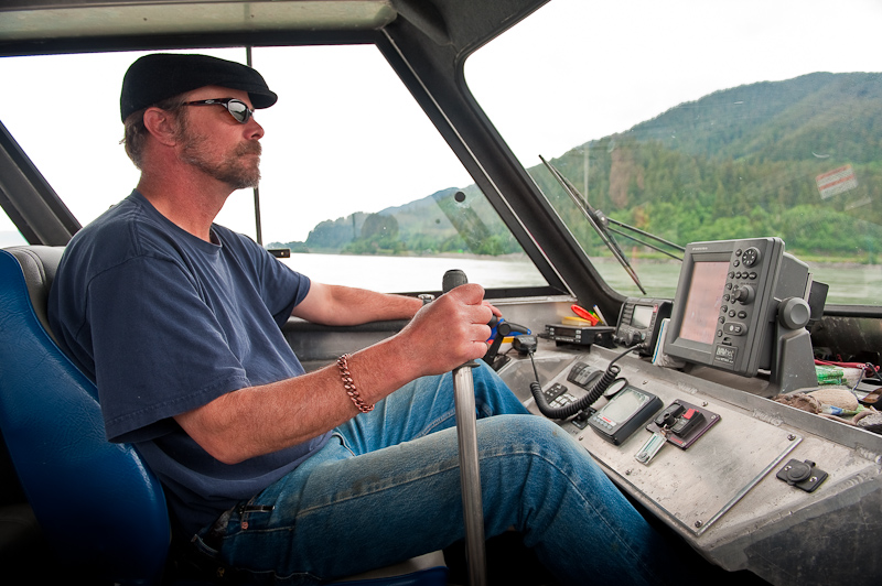
Norm at the helm of the jet boat. It steers like an air boat. Push the lever forward to go right.

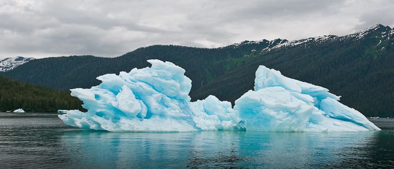
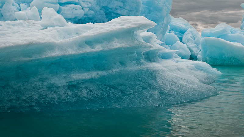
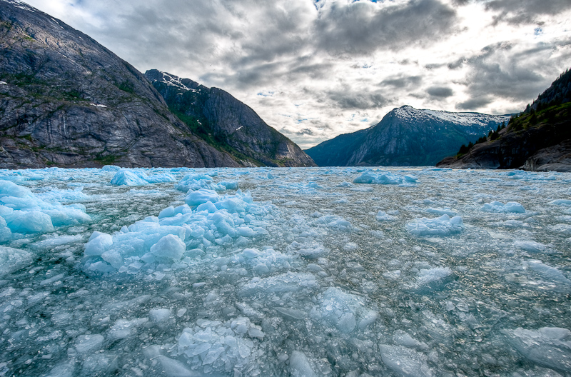
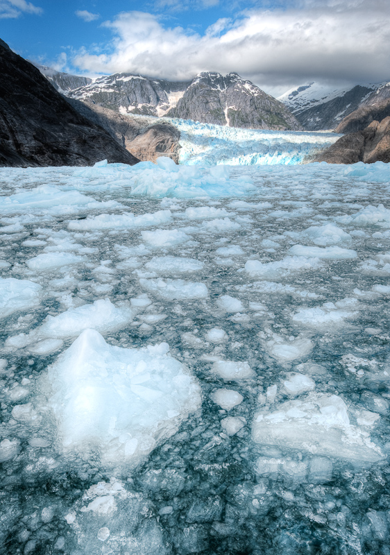
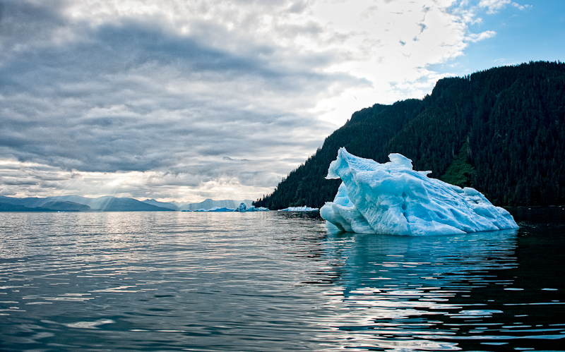
The traverse over the flats was interesting. Given that they constantly shift and move, it was great to have an experienced captain skilled in finding his way in the shallows. Our doubts quickly faded as we approached the entrance to Le Conte Bay and spotted a half dozen freight car sized glaciers stuck on the shallow terminal moraine. These were huge. Many times the size of anything we had experienced in Tracy Arm. And that beautiful blue color that signifies glacier ice.

20100617_Wrangell_0013

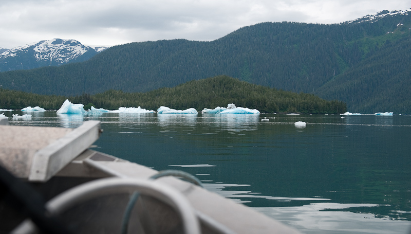
The first sign of icebergs

20100617_Wrangell_0050_1

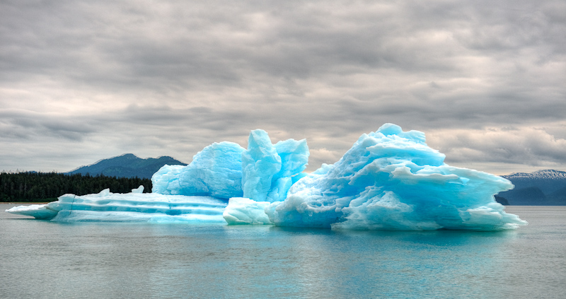
As big a freight cars is not an understatement

[Group 4]-20100617_Wrangell_0031_20100617_Wrangell_0032-2 images

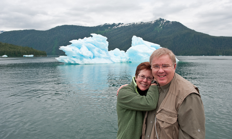
Karen and Norm picking out their next berg to visit

20100617_Wrangell_0056

Got to get the picture

20100617_Wrangell_0062

More glaciers guarding the entrance to the La Conte Bay

20100617_Wrangell_0066-Edit

I could sit and look at these for hours. There are endless variations and details.

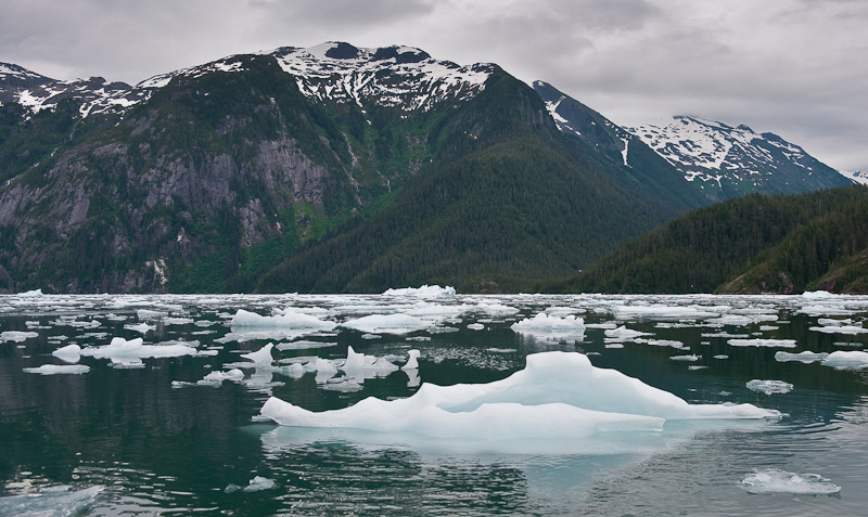
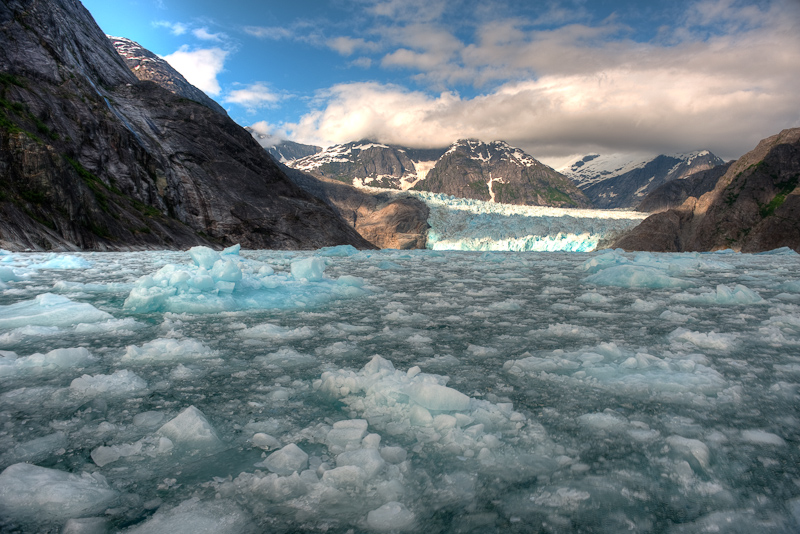
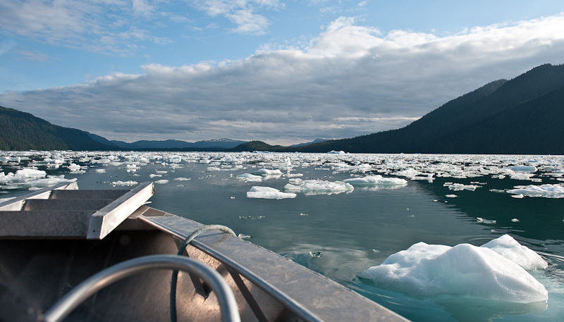
After taking a few pictures, we began the seven mile trip up the bay to the glacier. I was surprised to see the density of the ice before us. Glad this is not my boat! And I had no idea how we were going to get very far based on the amount of ice I saw.

Norm did a masterful job of weaving his way through the thinner distributions and when it got thick, he slowed done and bumped his way along from bergy bit to bergy bit.

20100617_Wrangell_0079

This was the easy stuff to get through. I would have turned around right then.

This is a very impressive valley, carved by millions of years of glacier activity. I lost track of time, but I suspect it took us an hour to go the seven miles in a boat that travels 33 miles an hour in open water.

Norm pushed on. His goal was to get in a position so we could see the complete face of the glacier. Long after I thought we could go no further, Norm found a way. “As long as you can see water, we’re OK!” Norm’s definition of water and mine diverged. I thought a spot of clear water the size of your fist might be the right unit of measure. I think Norm’s definition was more a thimble.

20100618_Wrangell_0205_6_7_8

Good to go for Norm and his jet boat

As you’ll see in the pictures, the trip exceeded our every expectation. It was a true adventure. A trip we could never have made on our own. No dinghy, no Kayak could have made it as close as we did to the face.

20100618_Wrangell_0140_1_2_3

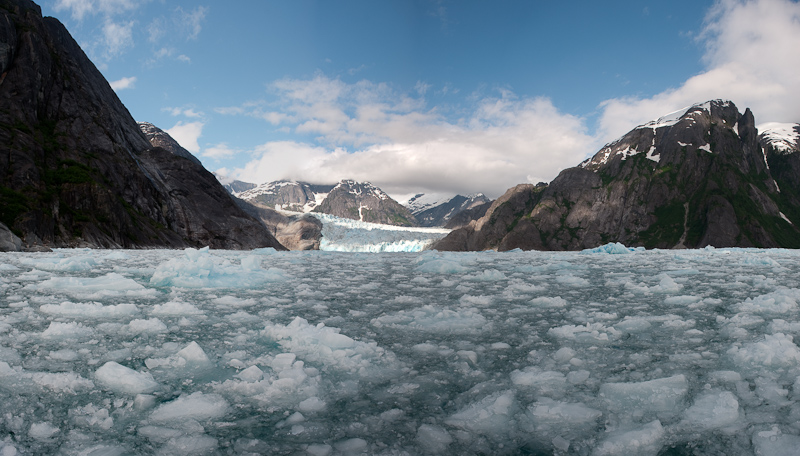
Approaching the glacier

I forgot to mention that Norm has a cell phone with God’s number in his speed dial list. As we proceeded up to the glacier face, the clouds continued to dissipate and the sun shined bright across the ice. We enjoyed blue skies and light winds. After almost a week of Alaska cloudy skies, it seemed a miracle.

20100618_Wrangell_0036

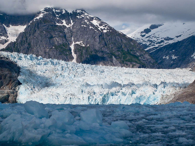
The glacier's face

20100618_Wrangell_0146-Edit

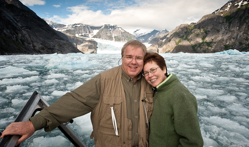
Sitting in the ice, admiring this glacier and the valley it carved over the millennium

20100618_Wrangell_0243_4_5_6-Edit

Ice, ice everywhere. I had no idea we could go though this stuff.

20100618_Wrangell_0227-Edit

The record shot, just to prove we did it

We sat for about a half an hour taking pictures and listening to the low rumbles from the glacier that echoed though the valley and just sitting in awe of such a site. 

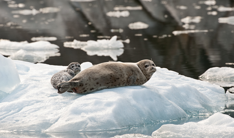
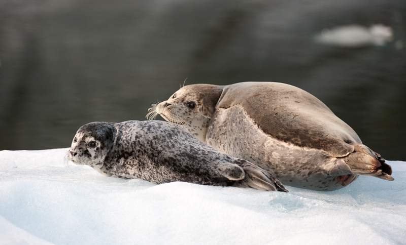
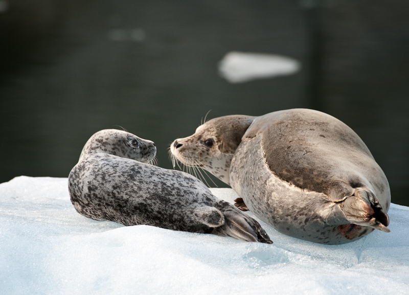
On our return we stopped and took pictures of the numerous seal pups and their moms peppered throughout the ice fields.  

20100618_Wrangell_0325

Moms and pups were hauled out everywhere

20100618_Wrangell_0354-Edit

Who you looking at?

20100618_Wrangell_0342-Edit

I would love to know what they said about us

20100618_Wrangell_0383-Edit

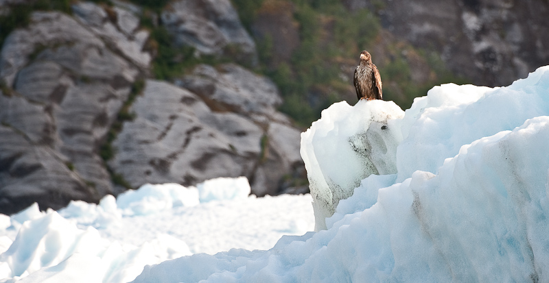
We passed one lone immature eagle on the ice. Seal pups beware!

20100618_Wrangell_1019

The ice is starting to thin our as we made our way back to the entrance of the bay

20100618_Wrangell_1042-Edit

We revisited some of the “big boys” on our departure from Le Conte Bay

20100618_Wrangell_1020

Do you think the seagull in front thinks he's the Captain of the iceberg

We stopped briefly at the seal trappers’ cabin remains to stretch our legs before heading back.

20100618_Wrangell_1036-Edit-Edit

Back on the boat after our stop. This gives you a good look at the jet boat.

20100618_Wrangell_1076-Edit-Edit

Perfect end to a perfect day of glacier exploring

Dinner? Nachos at the Hungry Beaver and 2 Alaskan Ambers!


Madan Bay To Wrangell

At my usual sunrise (4am) trip to the head, there were light showers. By the time we awoke for real at 7:30am, the rain had stopped with a low cloud deck hugging the mountains at about 1000 feet. I love to watch the clouds play among the pine trees as they make their way carried by the soft winds of morning.

We have observed so far on this trip that the amount of critters is noticeably less than in the Broughton Archipelago, the Gulf Islands or the San Juan Islands. We see the occasional Bald Eagle or a sea gull or two. We hear the passing raven and spot an occasional Murrelet and a few other small water birds. It will be interesting to see if this holds true for the entire trip or is just a function of where we are. Remember this area is considered a temperate rain forest. That may well account for the limited populations.

Madan Bay was a very peaceful anchorage. The wind lay down as sunset approached and we enjoyed a quiet night. The holding is good in silky mud with small shells in 40-50 feet of water. The land drops quickly into the water so you’ll anchor within 150 feet of shore without problem. We found no hidden obstruction in our little portion of the bay. Probably a good thing, as the charts for the bay have no depth soundings!

The trip to Wrangell was uneventful.  Karen drove most of the way. We did a little sightseeing as we approached Wrangell. A few homesteads along Eastern Passage provided some diversion. It’s always fun to scope out the locals with the binoculars. At the head of Eastern Passage you see the Wrangell airport. At the north end, they removed half a mountain to make room for the runway. We spotted two airplanes taking off. It was different to see aircraft with wheels rather than floats.

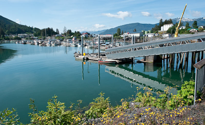
Wrangell is a busy harbor. When we arrived, the docks were mostly full with commercial vehicles and a spattering of pleasure craft. We found a spot at the south end of the Reliance docks. They offer full services with water and electricity. However, these are the only docks we’ve ever visited that had individual meters for the electricity. Our location was perfect to see all the traffic in and out of the harbor, and also for Eagle Watching. There are many to watch in the harbor.

20100617_Madan Bay to Wrangell_0168-Edit

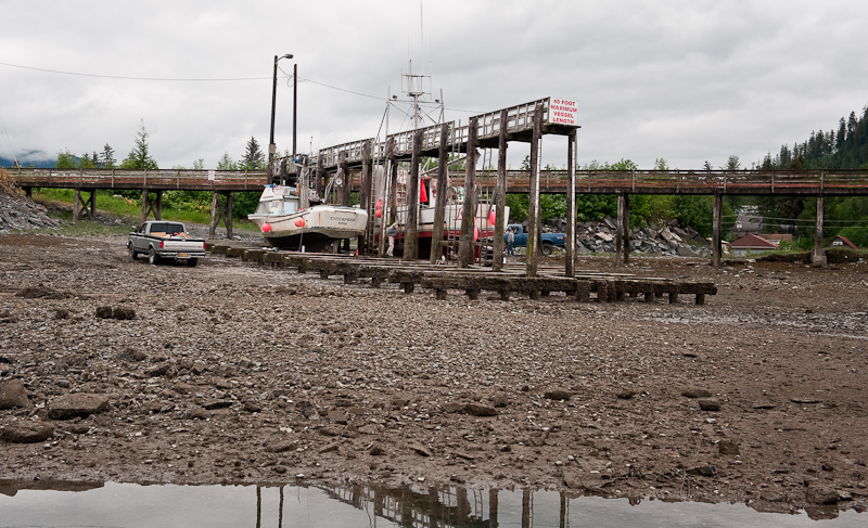
The Grid in Wrangell. It's a hard working port.

20100617_Madan Bay to Wrangell_0196_7_8-Edit-Edit

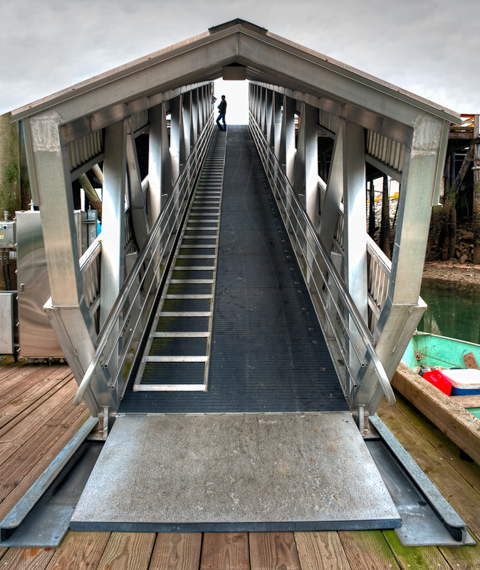
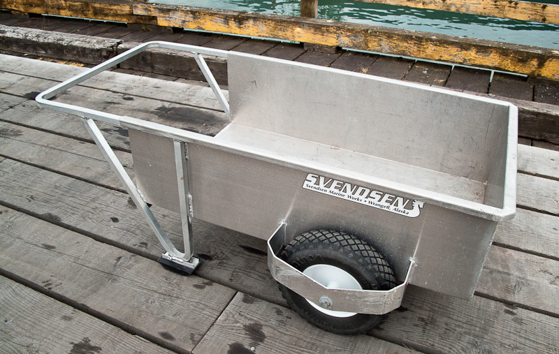
The aluminum work in Wrangell is a work of art

20100618_Wrangell_0041-Edit

Even the small aluminum constructions area work of art. I think I'll have my tender built here.

The harbor master, LaDonna, is a highlight of Wrangell. She’s friendly and knows everything there is to know about Wrangell and what to do.

The provisioning is very good here. Bob’s IGA is OK but we did best at City Market. They also deliver to the boat. One thing we have noticed is that everyone is very friendly. Sometimes the people in remote locations can be a bit standoff-ish. That is certainly not the case in Wrangell.

We walked around the town for a while. It has a nice main street flanked with some stores and several bars. 


20100617_Wrangell_0001

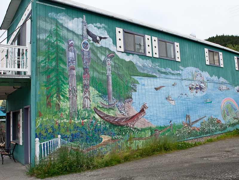
One of many murals in Wrangell

20100617_Madan Bay to Wrangell_0217-Edit

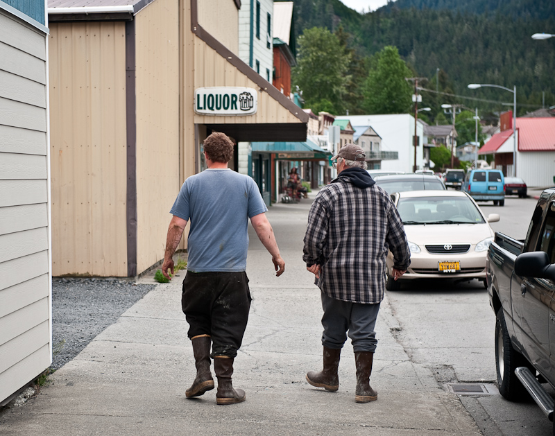
Everyone in Alaska wears Extra-tuf's. They are referred to as Alaskan Sneakers.

20100617_Madan Bay to Wrangell_0223

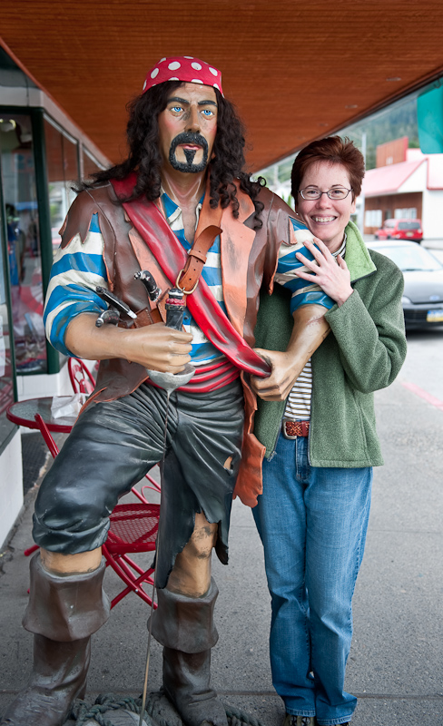
No Karen, that is Not Johnny Depp

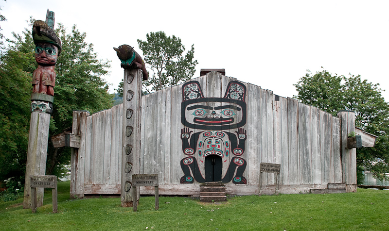
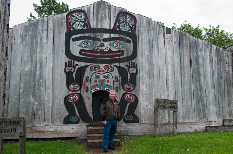
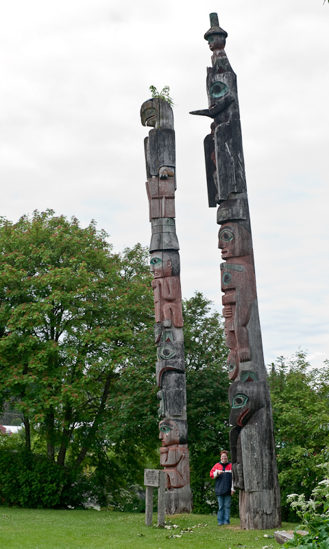
We walked out to Shakes Island to see Chief Shakes Tribal House and the totems.

20100617_Madan Bay to Wrangell_0235

Chief Shakes house

20100617_Madan Bay to Wrangell_0253

Check out the size of the door into Chief Shake's House.

20100617_Madan Bay to Wrangell_0248

Check out the size of the totems on Chief Shakes Island

20100617_Madan Bay to Wrangell_0240-Edit-Edit

The Reliance Docks at Wrangell as seen from Chief's Shake's House

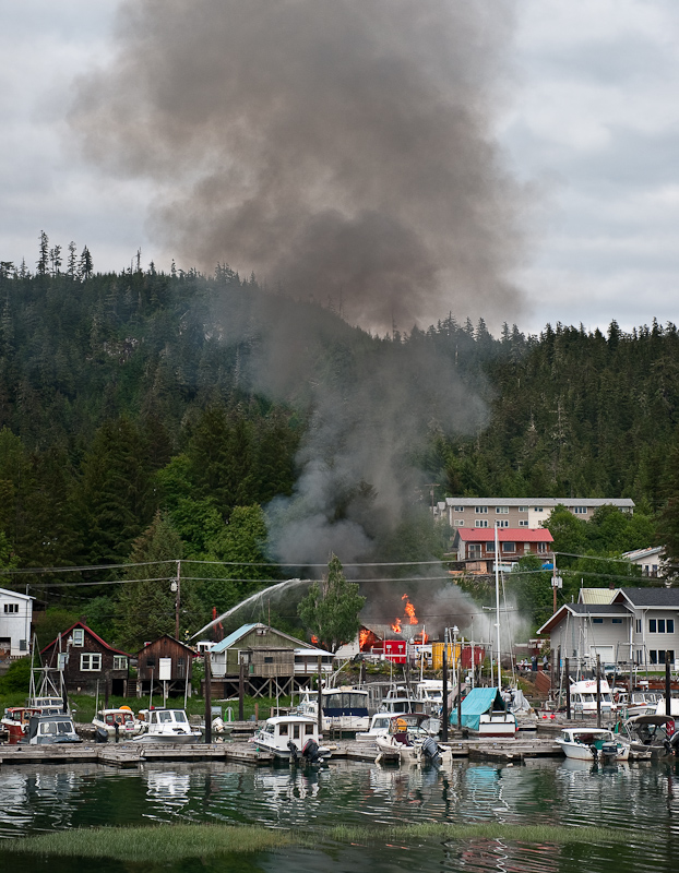
We also saw a house burning down off the inner harbor slips…apparently, it was a planned burn, but it certainly got our attention.

20100617_Madan Bay to Wrangell_0269-Edit

That got our attention before we found out it was a planned burn

20100617_Madan Bay to Wrangell_0214

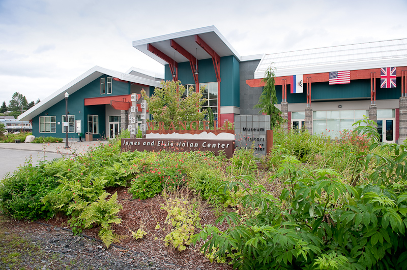
Make certain to visit the Museum. It also has a great book store inside with lots of Alaskan material.

20100617_Madan Bay to Wrangell_0212

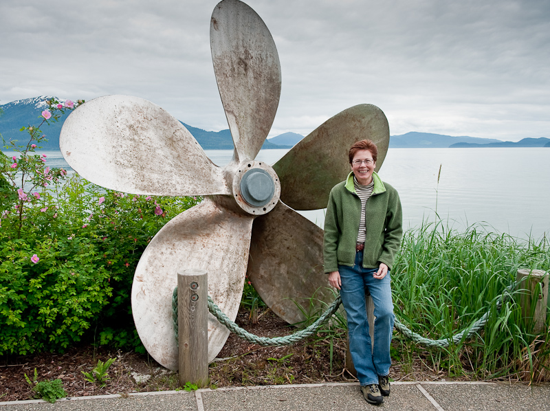
Karen wants the boat that goes with a prop this big

If you do find yourself in Wrangell, be certain to look up Alaska Charters and Adventures. (www.alaskaupclose.com). They offer exploration trips to see glaciers, or up the Stikine River and fishing trips for Salmon and Halibut.  John Yeager and his wife Brenda Schwartz (the watercolorist famous for local scenes done on marine charts) will certainly take good care of you.

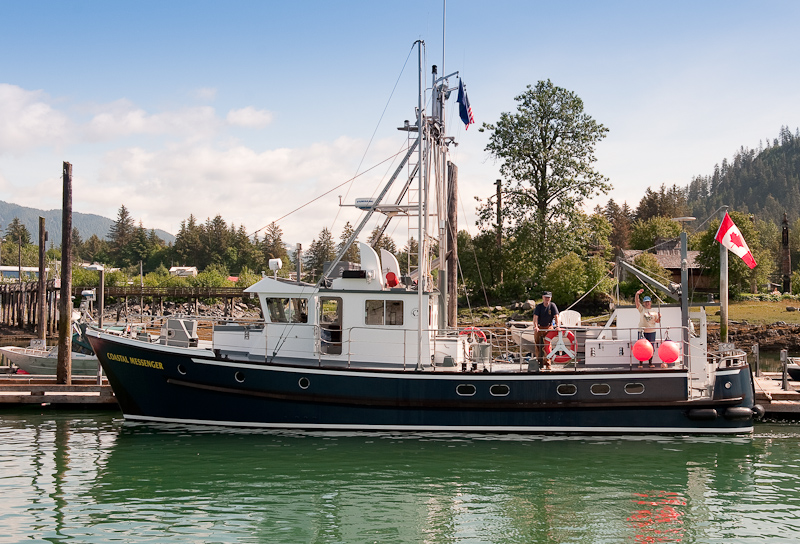
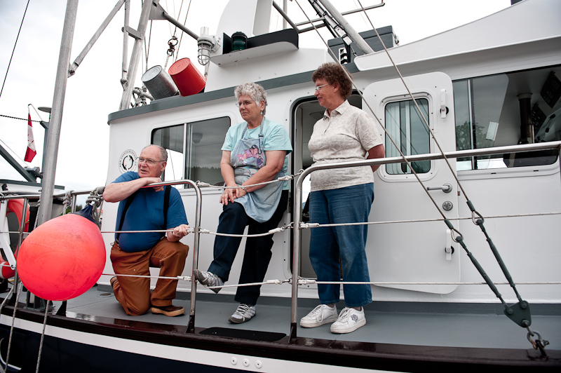
Walking the docks is always a great way to meet people. We met Uncle Roy, Petunia and Gloria aboard the Coastal Messenger, a missionary ship that is based in Chemainus, BC. This mission is about to celebrate its 30th anniversary…the area they serve runs from Olympia, WA up into SE Alaska. The stories they have about their experiences ministering to the logging and remote communities are fascinating. They know all the folks in the Broughtons that we’ve gotten to know, as well as many, many more. We also got a tour of the steel boat, which was designed by Uncle Roy and was really well thought out. You can find out more about their mission and www.CoastalMissions.ca.

20100617_Madan Bay to Wrangell_0230-Edit

The crew of the Coastal Messenger: Uncle Roy, and Petunia

We also saw the Krogen out of Comox enter the harbor. This was the same boat we saw anchored in Santa Anna Inlet. The captain was singlehanding, so we went out to help him tie up. His name is Ken, and he is cruising for a while before meeting his wife in Juneau. He knows Don from Comox Valley Kayaks, where we normally rent kayaks for our trips to the Broughtons. Small world!!

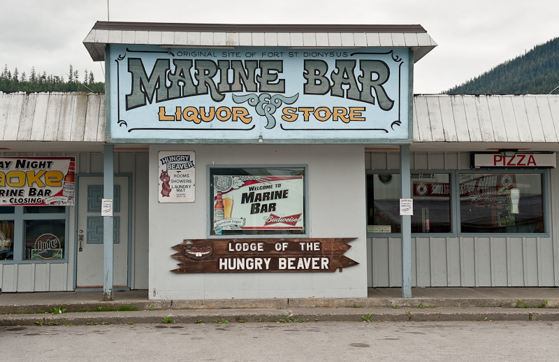
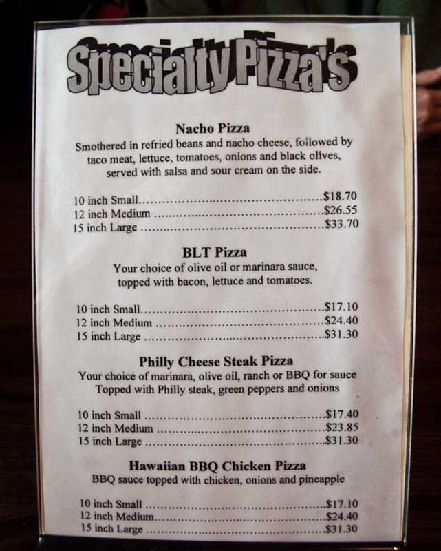
Dinner was chicken fajita pizza and Alaskan Amber ale at the Hungry Beaver, a great local bar and pizza joint with some really good pizza.

20100617_Madan Bay to Wrangell_0204

The Hungry Beaver, the best pizza in town

20100617_Madan Bay to Wrangell_0003

Pizza is not cheap in Alaska

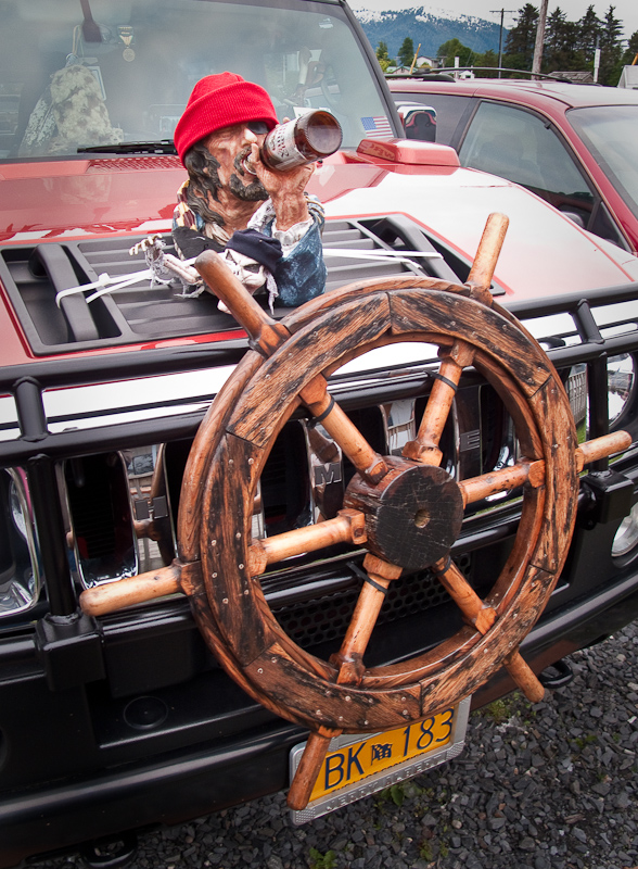
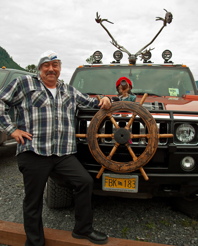
The highlight may have been the Hummer in the parking lot complete with antlers and some sort of drunken sailor on the hood with a boat’s wheel attached to the grill.

20100617_Madan Bay to Wrangell_0006

Options you can only order for an Alaskan Hummer

20100617_Madan Bay to Wrangell_0007

 He claimed he was the proud owner