Seattle Boat Show

We spent a week at the Seattle Boat show looking at what's both new and old in Pacific Northwest boating. We also mixed our nautical exploits with excursions in and around Seattle. The show also provided an opportunity for us to visit with friends. It seems we have amassed a great bunch of people who live in and around Seattle. Some are fellow cruisers we met in faraway anchorages and others are old friends from many different places and times in our lives. Everyone we talked to said the boat show traffic was up from last year, and the prices were down. I don't know if this is a reflection of better times ahead or simply a response to the more approachable price points.

The queue on opening morning


Karen takes the master head for a "dry run"


 Karen and Bob get in some "tourist time"


An evening view of the Lake Union in-water show from a 60ft Willard


Seattle skyline from Alki Beach


Seattle morning skyline from the stern of the Bainbridge Ferry


Dinner at a French Bistro overlooking the Harbor of Seattle


The main floor of the indoor show at the Quest Center


I had to pry Karen off the Krogen 58

Another great dinner in Seattle


Karen helps navigate when we lend a hand moving boats after the show closes


We had to delay our return home for one day because of the winter storm that shut down the East Coast. Even those Seattle cloudy days look good when you're shoveling two feet of snow.

Welcome Home!!!

Main Line Power Squadron

This evening, Karen and I made a presentation to the Main Line Power Squadron on our experiences cruising the Inside Passage. We had a great time. The members are warm and welcoming and seemed to enjoy seeing cruising grounds that none of them had yet experienced. Thanks again to Commander Susan Friedrichs and the members for their hospitality and kind words. You can check out this great group of mariners here.  To view the resource information pages from last night’s presentation click here.MLPS PLate

Muirhead Islands to England Point Cove

Up at eight...and we are greeted by overcast skies, mist and fog. The run of good weather was over, at least for the day. As is often the case, the timing of today’s travels will be dictated by the tides. The entrance to Actaeon Sound is guarded by Snake Passage and high slack tide at Snake was not until 11:30am. Of course this was no problem, given our predilection to sleep in and spend the morning lounging around. It’s our vacation after all.

The anchor came up clean to Karen’s delight (she is the anchor wench, after all). We had a great set to the anchor the day before, and that often means the anchor comes up filled with mud. But with a clean anchor aboard, we departed our peaceful anchorage for our next adventure.

Snake Passage is well charted with kelp that helps mark the dangers. At high slack it was an uneventful pass. Of course, at high slack this narrow fairway looks much wider, with all the dangers lurking below the water.

Behind Snake Pass, the Sound opens up. Its so peaceful and pretty, almost like a wide tree-lined river.

As we motored up the sound, we stopped at the entrance to Bond Lagoon and pointed our nose into the entrance to scope it out. The entrance looks as if the fairway is good but we did not have enough water under the keel to make the passage into the lagoon. We will save this lagoon for another visit.

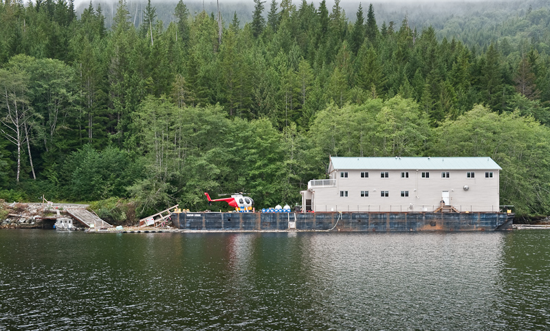
We snooped at Creasy Bay and saw the logging camp on the Venturi Logger barge, complete with a small helicopter. Behind that is a derelict barge that looks a lot shabbier than pictured in Hamilton's Secret Coast!

20090913_Muirhead Islands_England Cove_0049-Edit

Have Logging Camp Will Travel

We passed our planned anchorage at England Point Cove and continued on to explore the entrance to Tsibass Lagoon. It must have been perfect slack, as there was no strong ebb to be seen. But you can tell this entrance is very narrow and not for Arctic Star. If we had a high speed dinghy, we'd definitely have gone in to explore.

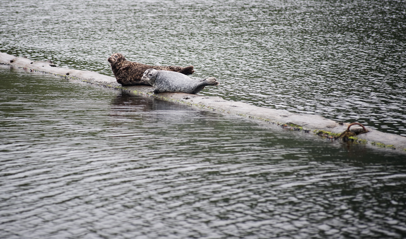
On our way back to England Point, we took a look at Gleyka Cove, which seems have an abandoned logging camp and is marked with tons of floating logs that had numerous seals hauled out on them. Predictably, Karen, the critter chaser, directed the helm to change course and go visit the local mammals. They had such soulful faces, and were in a rainbow of seal colors: grey ones, brown ones, Dalmatian colored ones and brown spotted ones.

20090913_Muirhead Islands_England Cove_0081-Edit

After the Loggers Leave, the Seals Take Over

We decided to anchor in England Point Cove, a highly recommended anchorage by the Hamilton's and by us! It's a lovely one boat (to us) anchorage. There are great views out a couple of directions and the prime anchor spot is easy to pick out. We set the anchor easily in the grey and misty skies.

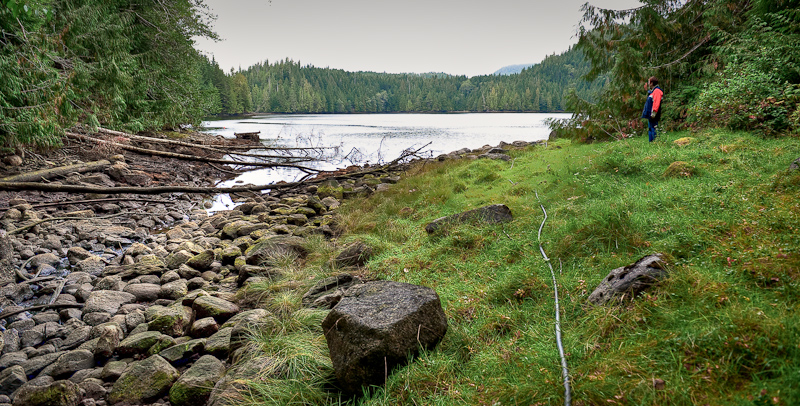
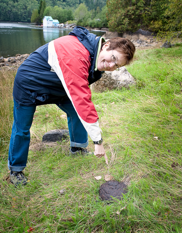
We later took the dinghy back to Gleyka Cove, because the Hamiltons said you can walk along the North Creek to some abandoned trucks and stuff from the old logging days. We landed North of the creek with no issue and tied the dinghy off to a tree. Tall grass obscured holes and unsure footing was the name of the day as we followed a bear path (complete with fresh scat) to the rocky creek. Taking a look at the creek and the underbrush, we knew this wasn't going to work as a fun and easy walk.

20090913_Muirhead Islands_England Cove_0102_3_4

Entrance to the Creek

20090913_Muirhead Islands_England Cove_0113-Edit

There Be Bear Here!!

So we retrieved the dinghy and decided to dock at the logging camp and explore the logging roads. One the way there, we almost ran over a long, just-submerged fresh water line that ran from shore to the camp. Gotta be ever vigilant! At first glance, it just seemed like a long piece of kelp.

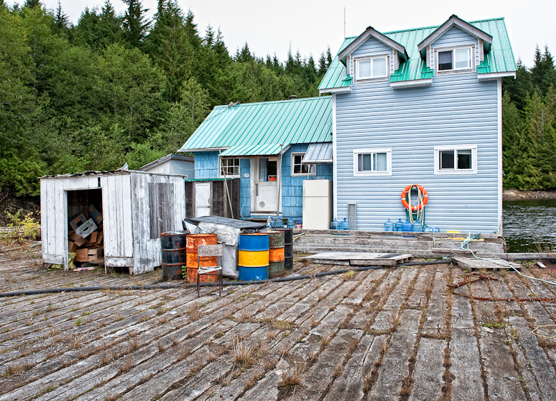
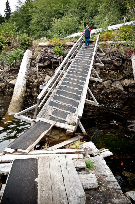
Docked at the camp, there was a rickety ramp to shore. It had a "leaning tower of Pisa" characteristic, and Karen was very skeptical because it was so askew and steep. Bob walked it with no issues and no fear, and so Karen grumblingly followed. The house at the top of the ramp was abandoned, with just a blue hard hat sitting on a log as a reminder of days gone by. We walked around and explored the log sluice that channeled logs down towards the holding pen where the seals were hauled out.

20090913_Muirhead Islands_England Cove_0143-Edit

Home Sweet Home for the Loggers that used to work at Gleyka Cove

20090913_Muirhead Islands_England Cove_0124

Of course Bob had to go first to check it out. It was a lot more stable than it looks.

20090913_Muirhead Islands_England Cove_0140_1_2-Edit

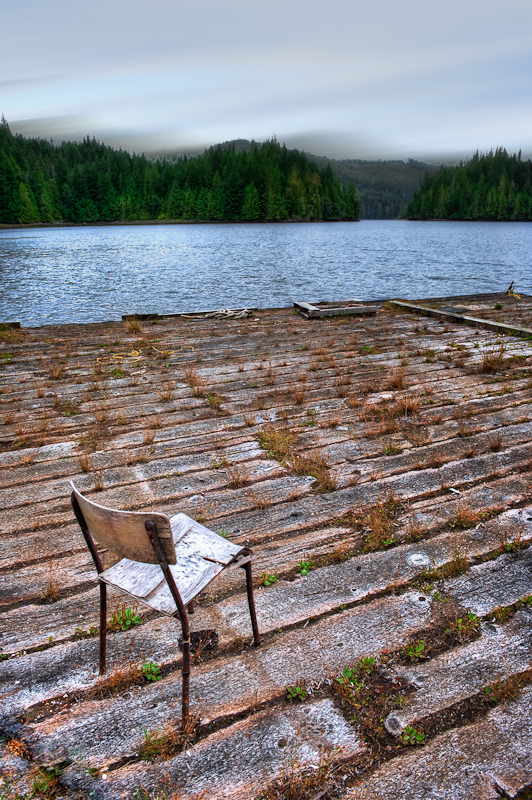
I Wonder How Many Hours were Spent in that Chair

20090913_Muirhead Islands_England Cove_0146-Edit-Edit

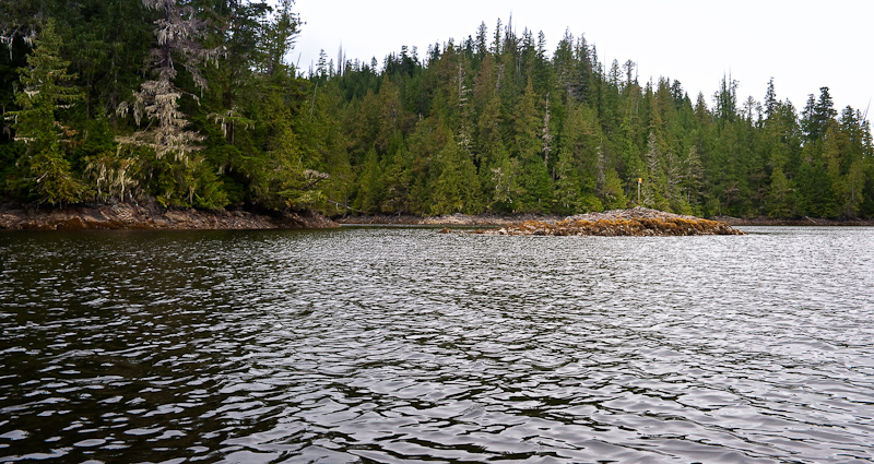
Someone Put a Flag on the Islet that Marks the Entrance to England Point Cove

We took the dinghy over to see our seal friends one more time before returning to the boat for a feast of marinated grilled pork and maple glazed carrots.

Davis Bay to Muirhead Islands

A bright light awoke us. What was that? OMG, it was the sun! The morning was crystal clear and calm. We had spent a peaceful night; no wind, no waves, no current to speak of. Davis Bay is a great spot, ample of room, good holding and beautiful views in all directions.

Davis Bay Anchorage Panorama

Karen continues to insist that the drying beach to the northeast is a perfect “bear beach”. It would be except there appears to be no bear here. That did not deter Karen from posting a lookout on the stern and enjoying a quiet morning reading what must be her 19th book of this trip.

20090912_Davis Bay_Muirhead Islands_0203-Edit

Karen Splits Her Time Between Reading and Watching the "Bear Beach"

We took it easy this morning as we attempted to chill down from our mechanical adventures and transition to vacation mood. Therefore, it was not until one o’clock when we lifted the anchor for a short cruise to the other end of Drury Inlet and the Muirhead Islands.

The last time we visited the Muirhead Islands we stern tied on the south side. This time, we planned to anchor in the one-boat anchorage in the bay on the north side. We had explored this anchorage last time in the dinghy and liked it because we could anchor without a stern tie and have the place to ourselves.

20090912_Davis Bay_Muirhead Islands_0205-Edit-Edit

A Beautiful Cruise Over to the Muirhead Islands

Shortly after we anchored, a Nauticat sailboat anchored in the south bay where we had been last year, so we were happy we chose the northern spot. After dropping anchor and enjoying the vistas on all sides, we launched the dinghy and explored the western end of Drury. The logging operation at the Western end appears to be shutting down with most of the equipment gone expect for the M/V Sir James Douglass, an old Coast Guard boat that was used as a base of operations. We later learned that a new logging camp was starting up in adjacent Actaeon Sound.

20090912_Davis Bay_Muirhead Islands_0234

Karen Takes the Bow Watch for the Dinghy Expedition

As we were heading back from checking out the logging "leftovers", we ran into Tom from the Nauticat. He was out in his dinghy trying to find a spot where his cell phone would work. He and his wife Sharon, who remained on the Nauticat, have an invalid mother at home and he was trying to check in to confirm that all was OK. I offered to lend him our satellite phone so he could make contact. He was very grateful and said he would row over later to Arctic Star to take advantage of our offer. 

We continued our explorations by checking out the lower end of Actress Passage, the entrance to Actaeon Sound. We wanted to preview because tomorrow our plan is to transit Actress Passage and enter the sound for "off the grid" exploring and secure an overnight anchorage. It all looked straightforward, though we didn't go as far north as Snake Pass in the dinghy. We were confident the next day would be fun and well within our skill set.

Not long after we had the dinghy stowed, Tom appeared on our stern in his dinghy. We invited him aboard and gave him the satellite phone and a short briefing on its operation. Good news: all was well at home. We offered Tom a beer and settled into some boat talk (I have been a fan of the Nauticat ever since I saw one at the Annapolis Boat Show twenty years ago) and exchanged information about good anchorages. He lives in Qualicum and also sails in Mexico, so he had wonderful stories to tell.

Bob's special meatloaf and roasted potatoes with fresh rosemary were on the menu. We had another lovely clear night and a good night's sleep.

Many folks pass by anchoring in the Muirheads and continue on to large Sutherland Bay. We love the Muirheads, it's a kayaker's dream (and great for exploring by dinghy, too) and has very remote feeling. Give it a try if you haven't done so yet!

20090912_Davis Bay_Muirhead Islands_0258

Arctic Star Enjoys a Peaceful Anchorage in the Muirhead Islands

Port McNeill to Davis Bay

We were up early -- and more sun!! We had time to kill before the Lugger parts would arrive in Port Hardy, so we explored Beaver Harbour and Storey Beach by car. The anchorage, written up by Dreamspeaker and Hamilton & Hamilton, definitely looked good and a nice alternative to Port Hardy. We also visited Hardy Buoys, a provider of smoked fish. We bought candy smoked Salmon bellies, which we later found were the most amazingly delicious smoked salmon ever.  We also did a little more provisioning at our favorite grocery store in the area, Overwaitea. 20090911_Port McNeill_Davis Bay_0066

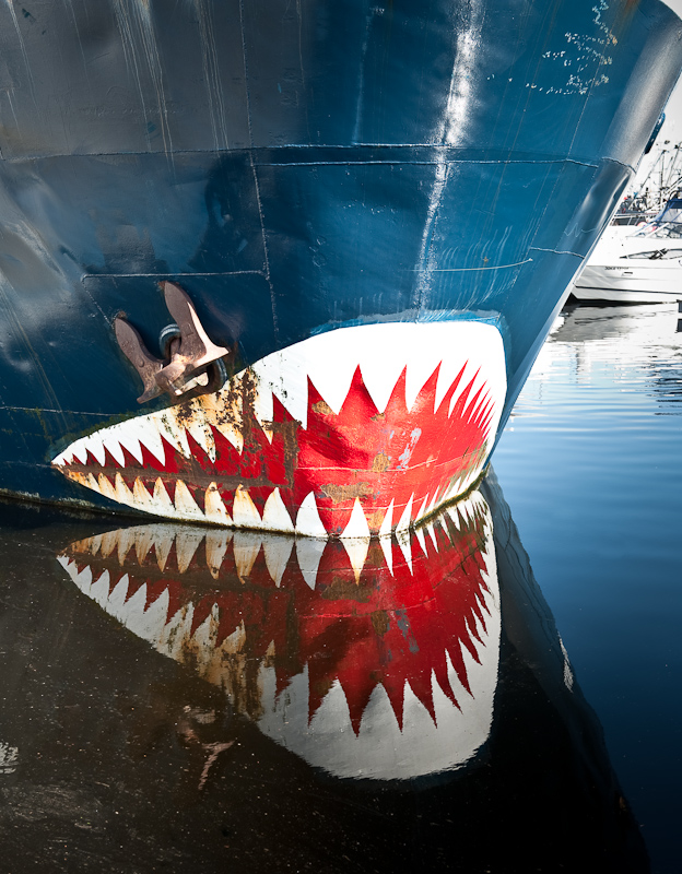
Somehow this Paint Scheme Does Not Add to the Nautical Flair of This Boat

20090910_Port McNeill_Davis Bay_0002-Edit

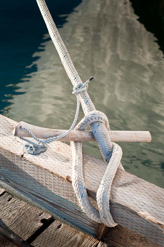
An Interesting Solution to Securing a Line to the Dock

The parts were in on time and we called Graham, arranging to meet at the boat as soon as possible. The new breaker from Lugger also didn't quite fit, but Graham made it work and left us the one that arrived by bus as a spare.

20090910_Port McNeill_0070-Edit-Edit-2

Port McNeill

We cast off of the docks at Port McNeil at 3:47pm. According to Karen the EXACT time we cast off last year! “Déjà vu all over again”, to quote the renowned New York Yankee’s philosopher, Yogi Bera.

Our crossing of Queen Charlotte Strait was the antithesis of our experience a few days ago heading back to Port McNeill. Light winds, calm seas, and one of the clearest skies we have ever seen in the Pacific Northwest.

20090911_Port McNeill_Davis Bay_0081_110_111

Under Way at Last!

20090911_Port McNeill_Davis Bay_0073

Beautiful Day on the Strait

Deciding to bag any shot at the Nakwakto, we headed for another favorite, Drury Inlet. We used our Nobeltec navigation system to time our arrival at Welde Rock and the Stuart Narrows. Based on our predicted arrival at the narrows, I fine tuned our speed across the ground (SOG) in order to arrive at slack, in this case high slack.

Once inside Drury Inlet, the biggest problem we faced was the sun. We were traveling due west into a setting sun. This made the watch for logs (of which there were many) a challenge. I would adjust our course so that I would keep the sun and the reflection of the sun on the water hidden behind one of the vertical posts of the forward windows.

The good news is that as we turned east to go into Davis Bay, the sun was at our back, making it easy to navigate the somewhat narrow entrance. We favored the North side of the channel, as all who have written about this anchorage advise. Once inside, the bay opens up and you can drop in anchor in the middle of the bay with lots of room to swing.

We were totally alone, and loved this anchorage just as much as we did last year. It's lovely and peaceful. The night was as calm as the day and the skies crystal clear. About an hour after sunset we turned off all our lights, waited for our eyes to acclimate and then moved to the bow to be awestruck by the night sky.

The Milky Way extended from horizon to horizon and starry constellations were too numerous to identify them all. The stars lit up our spirits in a way no other natural wonder can. A sigh of happiness - we were back on vacation!

Port McNeill

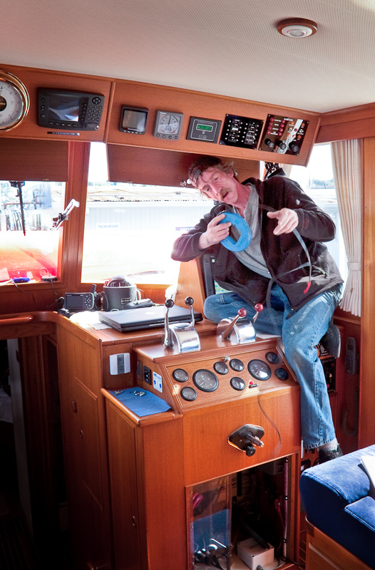
The part for the generator is not scheduled to arrive until the 3:30pm bus. So this morning’s project is to see if we can get any kind of depth reading at the lower helm station while we're waiting. It's not much fun (or prudent) to cruise the Pacific Northwest without a depth indicator in the nice and toasty warm pilothouse. As I had tried all the obvious troubleshooting steps to no avail, it was time to bring in the experts. Luckily, Stryker Marine is located in Port Hardy, only a half hour north of our location. Again, Steve Jackman came to the rescue and arranged with Stryker to have a technician come to the boat.

At the appointed time, Paul arrived. I briefed him on the steps I had taken and then opened all the access panels to the electronics so he would have a clear shot at accomplishing his diagnostics. The conclusion was that either the Raymarine depth transducer or the sounder module had gone on vacation and a field repair was not a practical option. Next is where Paul’s talents really shined.

We had an operating depth sounder on the bridge, a newly installed Furuno unit. Paul concluded that we could tap into the output side of that unit and bring a signal down to the lower helm. He did not have the needed cable to hook up to the Raymanine plotter, but he did have what it would take to bring the signal to the laptop that was running Nobeltec. On that screen we would display the depth information sent from the Furuno unit. No more jerry rigging power supply so Bob's laptop could help us navigate with good charts from the flybridge!

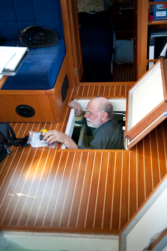
Paul set to work, snaking this slender frame under the flybrige helm, connecting the “white and blue” wire to a serial cable he had with him. From there we feed the cable into the open bays behind the lower helm's eyebrow panels were a number of electronic instruments live. Next, we connected a serial to a USB cord and existing the finger hole for the eyebrow hatch, dropped the USB cord direct to the laptop.

20090910_Port McNeill_Davis Bay_0169-Edit

Paul Sorts out the Electronic Spaghetti

So far so good, but we need to install a number of drivers so the laptop would recognize the signal from the Furuno. As fate would have it, the laptop on board would not allow us access at the administration level, which is what you need to install a new driver. Therefore, we installed the drivers on my laptop, which is also running Nobeltec and sure enough, up came our depth on the Nobeltec screen. An added bonus: water temperature.

Paul left me to complete the install on the boat’s computer once I secured the administrator’s password from Northwest Explorations. After a few hours of detective work, Brian from Northwest called with the codes and I was able to configure Arctic Star’s laptop to display the depth and water temperature. The only way you would know there had been a change to the boat was the cable that hung from the eyebrow to the laptop. This was a small aesthetic price to pay in order to display the critical depth under the keel.

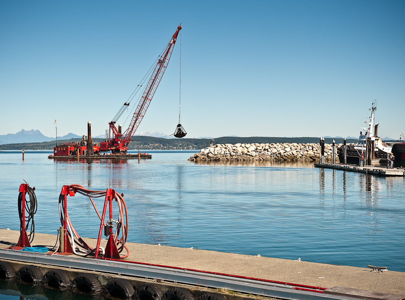
A note on Port McNeill; they are in the process on extending the south breakwater 300 feet. Scheduled to be complete in mid-October, this extension should provide additional protection from winter storms and also reduce the occasion swell that sneaks into the harbour from the ferry or other passing large vessels and storms.

20090911_Port McNeill_Davis Bay_0070

The New Extension to the Breakwater at Port McNeill

We spent the afternoon waiting for Graham to arrive after we picked up the new circuit breaker at the bus station. Boy does time drag when you're stuck in port waiting for a repair. Having already spent a great deal of time in Port McNeill, we struggled to entertain ourselves knowing that our vacation was slipping away.

To pass the time, we ran a bunch of errands while griping that we were stuck in port on what was an amazingly sunny day. The best "find" was the A Frame Church Bookstore. All the books it has are for sale for just $1 (hardback or paperback), and the shelves are full. Karen was in heaven!

20090909_Port McNeill_0035

Karen Maintains a Lookout for Graham and the New Parts

Grahan finally did arrive in the late afternoon, circuit breaker in hand. Back down into the engine room crawled Graham, uttering a few choice words for the engine room designer who had little appreciation of what it is like to work on a boat after it is built.

The breaker was not a perfect fit when it came to the mounting studs, but given that the amperage was correct, Graham proceeded to wire it up so we could determine the exact cause of the generator's problem. Once everything was in place, I fired up the generator and turned the AC selector switch to GENERATOR. Yeah! We had power, 125 volts of AC power. We continued to add load to the generator by turning on every AC device we could think of and it handled it all without missing a beat.

20090910_Port McNeill_Davis Bay_0197

The Replacement Breaker Taped in Place for Its First Test

Based on our testing, Graham proclaimed that the only problem was the circuit breaker itself and this one would work if we could not get anything else.

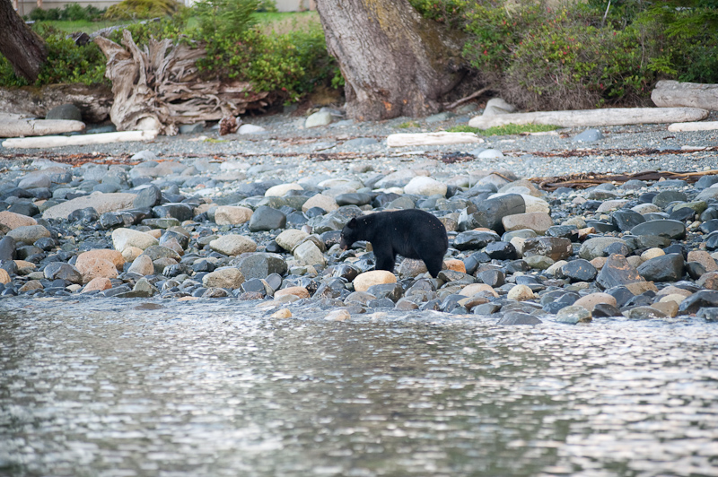
However, he strongly recommended we wait until Friday, when Lugger's care package was to arrive at Port Hardy via plane. Sadly reconciled to spending another unplanned night at Port McNeill we ran into Captain Dave and his crew, who invited us to go bear hunting with them at sunset, using their dinghy. It was so great to be back on the water, and the best part was that we saw two black bears foraging on the beaches not far south of Port McNeill.

20090910_Port McNeill_Davis Bay_0027

Foraging at Low Tide in the Port McNeill Suburbs

We also saw a lovely Crewed Charter Yacht, Northern Song, come into Port McNeill late in the day, and spent some time chatting with Captain Mike Miles and his wife/chef, Caroline. It was almost 9pm by the time we headed to Sportsman's for pizza and beer.

Murray Labyrinth back to Port McNeill

We pulled the anchor (yes, we had enough "power" in the battery banks to get this done without manual winching!) and were under way at 8:00am. We had a date with a mechanic back at Port McNeill and I wanted to traverse the channel out of the Labyrinth with a couple of more feet of water under the keel. This would also make for a slightly wider channel. Given that the winds were 15-20 knots with gusts to 25, I wanted a little more wiggle room as we negotiated the serpentine path through the rocks.

We made it out of the Labyrinth with no issues, and we really encourage like-minded boaters seeking solitude to try it. Once out, it was indeed blowing, the canvas on the flybridge roared and rumbled in protest. We hugged the mainland coast, making our way past Blunden Harbour before turning to establish a direct course to Port McNeill. If the Strait was too churned up, our plan was to tuck into Blunden and wait out the winds as they were forecast to subside during the day.

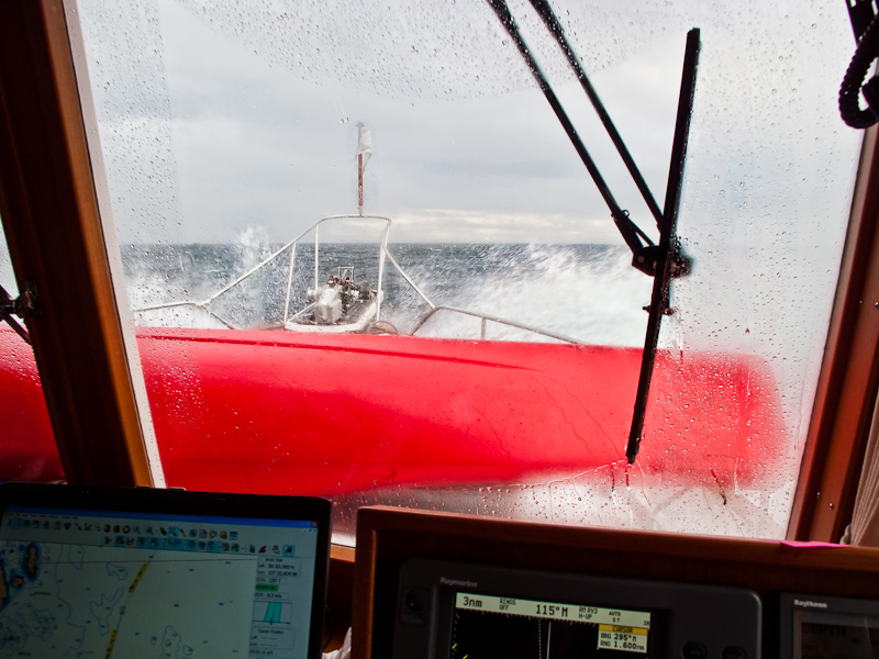
The weather was about as forecast and we headed into quartering three foot swells topped by one foot waves. With the stabilizers on, the ride was tolerable, so we continued on to our rendezvous with the mechanic.

20090909_Port McNeill_0088-Edit

The Straight Kicks Up

Steve “Batman” Jackman (General Manager of Port McNeill Fuel and Harbour. When you see Steve you'll have to ask him how he earned the Batman moniker) made arrangements to have Graham McDonald meet us on the docks upon our arrival.

Graham comes highly recommended by Steve and that’s about as strong a recommendation as you’ll find. Graham, in his sixties, seems to be able to tackle almost any electrical or mechanical problem you can throw at him. He possesses a quiet confidence built, I think, over his success in fixing almost anything that can break. We came to know this because during our three days together he regaled us with a range of stories about his exploits and his insights into the nature of us all.

20090911_Port McNeill_Davis Bay_0069

Graham to the Rescue

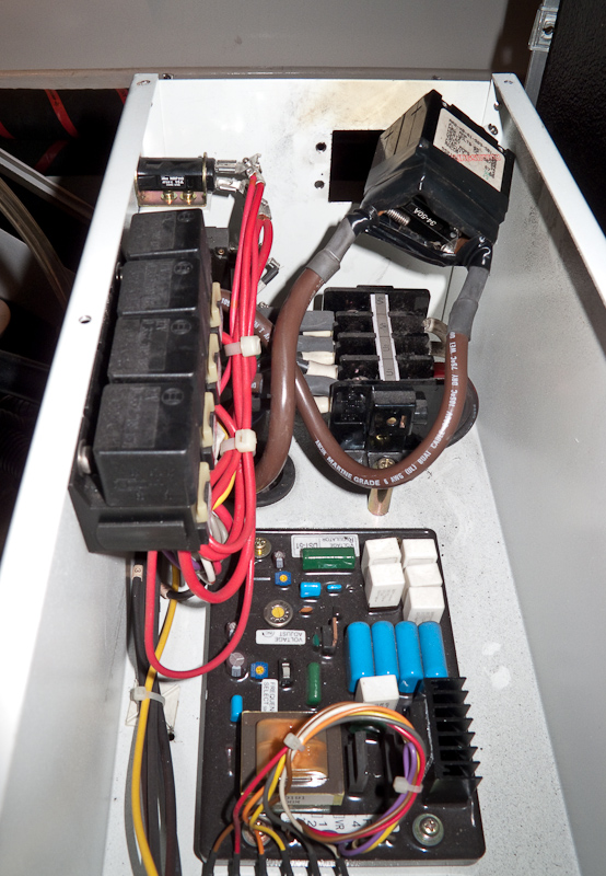
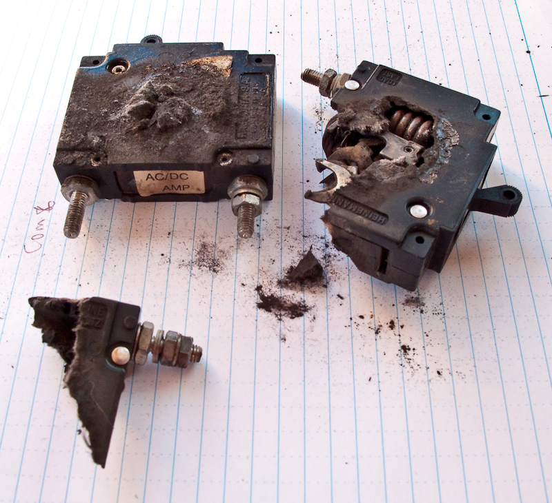
Graham set to work and shoehorned himself into the aft most reaches of the engine room where the afflicted parts of the generator reside. After a hour of dismantling the generator enclosure and the electronic control module that lives on top of the generator, Graham emerged with what was left of the circuit breaker that protected the generator's components.

20090910_Port McNeill_Davis Bay_0187

The Remains of the Circuit Breaker

I don't think even the circuit breaker's mother would have recognized this pile of debris as its own. The breaker had burst open and spewed its guts during its final death throes. The picture says it all. And about 4pm, the search for a replacement part began.

Graham called his supplier to order up a replacement which would arrive the next day on the 3:30pm bus from Qualicum. While in today’s world that would seem an eternity, remember where we are and how far we are from any major population center. At the same time Brian, from Northwest Explorations, was on the hunt to secure the same part along with anything else Graham might need to repair the afflicted power generator.

It’s important to remember that getting a new circuit breaker in place was just the beginning of the troubleshooting process. Once the breaker was in, there still existed the possibility that other components had failed and would need to be replaced.

Brian had the advantage of being in Bellingham, Washington with easy access to all the parts and dealers along the U.S. West Coast. Ultimately he had Lugger, the Northern Lights generator manufacturer, put together a “care package” of parts. The disadvantage of being in the U.S. is that there are Customs challenges when sending parts into Canada that can delay arrival. Combine this with the fact that there are few options for transportation of the parts once secured. Scheduled air service is limited and charter flights are very expensive. To Northwest Explorations' credit, they explored every possible option and all were “in the mix”. The final decision would come down to what would get the parts to us the fastest.

We were happy to plug into shore power and get our refrigeration and freezer back, as everything was stuffed to the gills with enough food for 3+ weeks. However, when we plugged in, the refrigeration/freezer units did not respond. We trouble shot some more and found that when the "genny" circuit breaker fried, the fuse went on the Grunert refrigeration control unit. Luckily, Steve Jackman's auto parts store at the head of the dock had the 10amp fuse we needed.

20090909_Port McNeill_0090

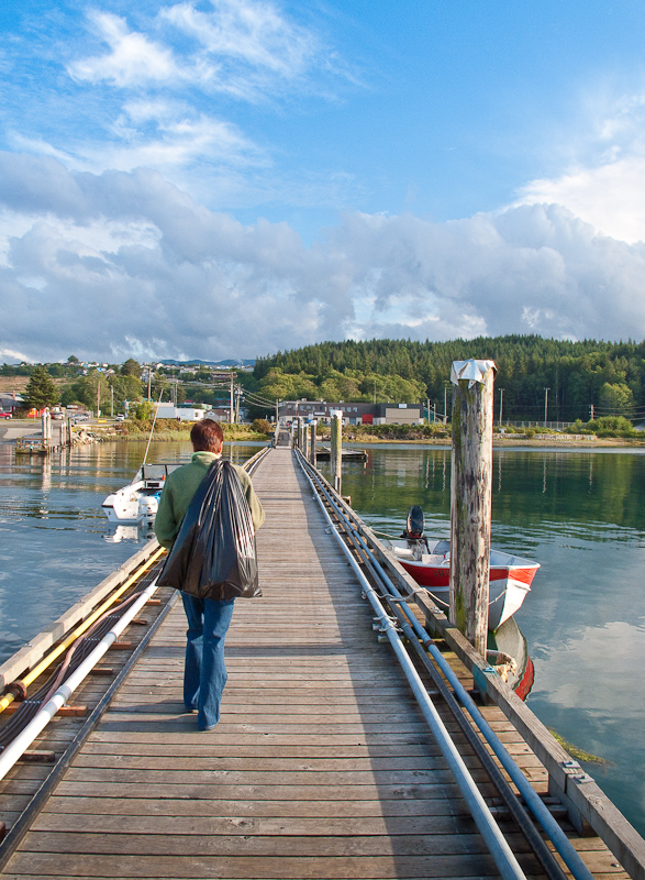
Karen Takes the Garbage "Out" on Her Way to Buy a New Fuse

Back in the town of Port McNeill, we went back to our favorite place to dine, the Northern Lights restaurant. The salmon in puff pastry was great and the Keith Alexander Amber Ale helped us shrug off the changes in our plans to some degree. The day was also made better by meeting up again with Captain Dave from the lovely 80+ foot custom yacht we had seen on the docks earlier, who offered us a tour and raised Karen's spirits by letting her live vicariously for a while. She especially admired the heated bathroom floors, under lit bathroom sinks, and killer galley with a cold room for storage. Bob? He was into the forward looking sonar.

20090909_Port McNeill_0065_6_7_8_9-Edit

Our Big Beautiful Neighbor at the Docks

Murray Labyrinth

The morning started as usual. Listen to the weather report, make breakfast and then plan the day. With breakfast complete, showers behind us and looking forward to a great day exploring Murray Labyrinth, I was standing at the helm when I looked down at the AC panel to see how the charging of the batteries was progressing.  At that moment, the voltage meter and the amp meter started to fluctuate wildly.

I immediately shut down the generator. OMG, what is going on? My first thought was that since the inverter and the refrigeration system were the only two AC power systems that were running, one of them must be having a problem.

Given the dramatic nature of the power fluctuations, I placed a call to our charter company's (Northwest Explorations) president, Brian Pemberton, to report the problem and get some considered advice before I started troubleshooting.

It's these circumstatnces when a satellite phone becomes a vital piece of safety equipment in this part of the world. There is no cell coverage, so your only choice is to rely on satellite communication. If we did not have this option, I would troubleshoot the problem on my own. However, my hope is that someone on the other end of the phone has seen this before, and that knowledge will expedite the process of resolving the problem.

Brian was a great help, but after two restarts of the generator produced the same or worse results, the volt meter and amp meter both went to zero. The generator continued to run but produced no AC power.

By the afternoon and after exhausting all possible work-a-rounds, our plan then became to arrange for a mechanic to meet us back in Port McNeill. Given the tides, the gale warnings on the Strait, and the distance back to port, we would have to wait till tomorrow morning before departing for Port McNeill. Karen was really disappointed, as she had planned the entire trip around the Nakwakto Rapids and the lovely inlets behind these rapids. Instead, it's back to Port McNeill for maintenance.

Brian was a great help in crafting a plan for the next 24 hours without the use of the generator. Our NO-GEN plan was to use ice from the DC powered icemaker to keep the refrigerators and freezer cold enough; we would cook with either the microwave or the propane grill; the DC powered diesel heater would keep us warm; and we would use the alternator on the starboard engine to keep the batteries topped off.

The rest of the day was spent monitoring the voltages of the various battery banks, running the starboard engine as needed and reducing our power requirements to a minimum.

Murray Labyrinth Anchorage Panorama (use the controls or your cursor to see 360 degrees)

At 8:44pm with all the battery banks “in the green” we went to bed, planning on a early departure tomorrow morning. The weather forecast was not great, but well within the parameters of the boat and our experience.

20090907_Murray Labyrinth_0109_10_11_12_13-Edit Beautiful Sunset in Murry Labyrinth

Miles Inlet to Murray Labyrinth

I awoke just before the alarm at 7:00am. We seldom use an alarm when on vacation, but we had a date with the tide. There is little information to be found on Murray Labyrinth. but Karen has been fascinated by the sound of any place whose name contains the word "Labyrinth". Those few mariners who have made the journey through the Labyrinth rave that if you master the challenges of the zig zag, somewhat "blind" entrance, you will be rewarded by a delightful protected anchorage with endless areas to explore via dinghy and/or kayak.

So off we went for the short 5 mile run. Along the way a humpback whale appeared on our port beam and paralleled our course until it sounded for food. It's always exciting to see a whale, and this encounter was most unexpected.

The route into Murray Labyrinth earns it name. It is narrow with many twists and turns. A zig-zag narrow channel between the rocks is intimidating. That is why we choose to make the run at low tide (it was a 3ft low tide) when more potential obstructions are visible. The trade off of running at low tide is the channel is narrower and demands the helm be diligent in choosing the course.

We supplemented our Nobeltec navigation display with a bow watch. It is a good practice, but seldom has the bow watch contributed in other narrow passages. Either the sun was in the wrong position so that its reflection on the water obscured anything below the surface or we never got close enough to the rocks or the bottom for the bow watch to issue a warning. This time was different. Twice the bow watch sounded an alarm just before the helm noticed the depth was dramatically lessening. Hats off to the bow watch, Karen!

Once inside the narrow entrance, the water opens up to a beautiful bay. The only obstruction is a rock that sits near the middle. Where else would a rock sit?

The holding is good in a mud bottom and we anchored in 21 feet about equal distance from three shores and that aforementioned rock. It’s important to note that the rock is only visible at low water and quickly covers, so be aware.

The anchorage is well protected and calm. The winds would blow from time to time but seldom exceeded 8 knots. Out on the Strait, it was blowing 20-30.

Given that our fair weather of the previous day had turned to rain, combined with the fact that we were both bone tired, made the day one of small projects around the boat, napping, reading, working on this blog and taking pictures between the raindrops. 20090907_Murray Labyrinth_0026 Karen Napping

20090907_Murray Labyrinth_0042

How Many Books Can Karen Read On a Rainy Day?

Although the forecast for tomorrow calls for a lot of rain, we still hope to get out and explore. Some of our most memorable trips in the kayaks and the dinghy have been in the rain, so we are seldom deterred by precipitation. Of course, a warm shower afterwards makes the memories even fonder. 

Right around 6PM the sun tried to make an appearance. Given the gloomy forecast for tomorrow, this is simply Mother Nature trying to tease us into optimism. For the rest of the evening it oscillated between rain, rain showers and more peeks of sun. Such is the weather in the Pacific Northwest.

20090907_Murray Labyrinth_0021-Edit

A Rainy Window Showing All our Satellite Gear: SPOT, Bluetooth GPS and XM Weather Receiver

The rain held off long enough for me to grill some sockeye salmon with an orange glaze accompanied by curried sweet potatoes.

Port McNeill to Miles Inlet

Despite our goal of an early departure, it was not until 9:29am that we cast off from the friendly docks at Port McNeill. Our host, Steve Jackman, runs a great facility. My praise is not based so much on the amenities, but on the “can do", “Do you need anything else” service that he and his staff offer. This year was noticeably different at the docks. Last year we were almost alone. This year the docks were full, and full of many large and magnificent boats. At 46 feet, our Grand Banks was definitely one of the smaller vessels tied to the docks. There was an “80ish foot”, to quote the captain, custom built motor vessel on up to a 130ft sail boat from shores afar. Steve said that he had spent the last year traveling to boat shows and other venues to “get the word out” and I think it worked. Bottom line; make a reservation, especially in season, to enjoy Port McNeill, “The Gateway to the Broughton Archipelago”, as the signs around town proclaim.

Here’s the link to The Port McNeil Fuel Dock and Marina

http://www.portmcneill.com/

The conditions on Queen Charlotte Strait were smooth seas with light winds, so we decided to combine two days into one and go direct to Miles Inlet rather than stopping first at Blunden Harbour. The total run was about 41nm. Queen Charlotte Strait, like all the large passages with a southeast/northwest orientation, can be nasty; “snotty” is the term yachties like to use, when the winds come up and work against the tide. It seems we were to be spared such conditions today. The clouds had split to the North and South, leaving us with a quiet window to make our crossing and then travel up the Strait. To the south, the clouds and wind brought heavy rain and lightening. Far to our north, the sky was dark and foreboding, filled with rain. Being in the middle of these two weather makers suited us fine. 20090906_Miles Inlet_0015-Edit

Calm Seas at Pulteney Point Lighthouse

20090906_Miles Inlet_0071 A Fellow Cruiser Enjoys A Calm Ride on Queen Charlotte Strait

Our reason to visit Miles Inlet was the expanse of quiet water that is only a short distance from Queen Charlotte Strait. Often in the Broughtons you have to travel many miles and negotiate a rapid or two to enjoy a place like Miles Inlet.

It’s location, just south of Cape Caution, makes this anchorage a popular place to bail out of Queen Charlotte Strait when heading north, and a hideaway to duck into when heading southbound after leaving Queen Charlotte Sound and passing Cape Caution.

20090906_Miles Inlet_0135-Edit Entering the Southwest Arm of Miles Inlet

20090906_Miles Inlet_0154-Edit

Arctic Star at Anchor in Miles Inlet

Miles Inlet’s other attraction is its usual double lagoons. At both the southeast and northwest arm of the “T” that is Miles Inlet you’ll find rather large tidal lagoons. The bodies of water that form behind a “bar” are always fascinating. As the tides cascade into or retreat from the lagoons, the resulting whitewater flows can be impressive. Most cruising guides suggest anchoring in the north arm or at the T (looking out at the Strait), but the tides were in our favor and we headed for the snug anchorage in the South Arm, right in front of the lagoon. It was serene and lovely. Not only were we visited by seals and an eagle, but a blue heron fished on the rocky shore just off our bow for at least an hour, entertaining us greatly. We were totally alone in Miles Inlet - just how we like it!

The North and South Lagoons of Miles Inlet

We did not leave enough time in the schedule to explore the inside of either lagoon, so next visit we'll correct that situation. It definitely looks like a great place to kayak.

20090906_Miles Inlet_0149-Edit

Outflow at the Southwest Lagoon

20090906_Miles Inlet_0164-Edit

Almost Slack at the Northwest Lagoon Entrance

Here is a link to another website featuring photos that show the bars and impressive flows of these lagoons.

http://bcmarina.com/Places/Miles_Inlet/Websize/thumbnails.html

Dusky Cove to Goat Island

This morning was only half fog with the sun working hard to break through. I awoke early so we could launch the kayaks at low tide.  This is a great cove to explore when the water is low and the drying mud flats attract the gulls and other foraging birds for breakfast.

dusky_cove_karen_rem5930_print

Exploring the mud flats with the gulls

It’s always amazing to see dry land at low tide at the same place you came through at high tide in the dinghy. We paddled around the various islets that guard Dusky Cove exploring the drying shoreline. Crabs, a few sea stars, clams and a few small fish were the highlights of the shallow water. Our friends the seals never made an appearance, much to the disappointment of Karen.

_rem6005

Lots of islets to explore in and around Dusky Cove

_rem6043

Heading back to Arctic Star

Once all were secure again on Arctic Star, we listened to the whaleboats in order to find out what the Orcas were up to at Cracroft Point. Our plan is to go sightseeing for Orcas and Humpbacks and then determine where our anchorage is going to be for the night.

Our quest was realized as we found Humpback whales in Blackfish Sound first and then found ourselves surrounded by Orcas in Broughton Strait. The area in Blackfish was almost exactly the same location we had seen humpbacks the last two days. Same for the Orcas, they are mostly local pods, so they frequent the same areas every day, making the whale watching business a success in this area. All and all, we spent a couple of hours watching both species of whales.

_rem6122

_rem6230

_rem6157

_rem6205

_rem6143

Where you find whales, you'll find gulls...Lots of gulls

_rem6146

Modern whale watching boat

_rem6242

Classic whale watching boat

After all the communing with the marine life we pointed the bow of Arctic Star to Goat Island to enjoy a quite night in one of our favorite anchorages. Maybe we’ll spot the same bear we saw a few days ago!

Pearse Islands to Dusky Cove

Fog, Fog, Fog, that’s what happens every morning in this weather pattern. Our plan is to stay on the hook until 11:15AM when the current goes to slack. That way we do not have to lift anchor in the strong current that inhabits this pass.

Pano_pearsce_islands_one_rem5450

Fog lifting in the Pearse Islands

_rem5442

Our track line (red) shows the barbell pattern as we swung in the reversing current between the islands

Although the current is predictable, the fog is not. The forecast calls for the fog to lift late morning, but the recent pattern around here is that it takes until around 1PM before the sun conquers the fog.

Arctic Star made her way from the anchorage out into Blackfish Sound (named for the Orcas) where the wind was still and the water perfectly calm. Nothing but the seabirds were out and about. During the previous two days, we spotted humpback whales in these waters, but today not a sound nor a sighting.

Dusky Cove is a small depression in Bonwick Island and lies at the east end of a group of small islets. The pass to Dusky Cove is through these islets but the channel is deep and well charted. One needs to pay attention to the charts and keep an eye to the small outcroppings of granite as they pass, but in no time you drop your anchor in one of the most visually interesting spots in the Broughtons.

Given the large number of islets we decided to make our first exploration in the dinghy. Later, during a low tide we would come back to the most promising spots.

This cove put on a spectacular show at sunset, surrounding us with tree topped granite outcroppings cast about in a sea and sky of crimson and orange.

Pano_duskey_cove_one_rem5837edit

Dusky Cove sunset

Double Bay to Pearce Islands

The fog was as thick as the preverbal “pea soup” when I awoke at 7:20AM. The forecast was for it to burn off this morning, but I’ve come to learn that in the vernacular of Environment Canada that could be any time up to and including 11:59.

The most interesting activity of the morning was listening to the whale boat reports that complained about not being able to see a thing in the fog. One boat reported that they spotted a fast approaching target on the radar only to have a seaplane land 200 meters from his boat. I thought nothing about that report, until I heard the unmistakable wine of a turbine aircraft engine.

I looked out into the fog only to eye an approaching seaplane.

_rem5357

FOG...  FOG...  FOG...

The pilot shut off his engine, got out of the plane and asked if we knew where the resort that was in Double Bay. He also asked if we could call them to send a boat out to guide him to the resort. I can only image what was going through the minds of the people who had their faces plastered to the window looking out into the murky fog.

Shortly thereafter a small boat came out and the aircraft followed him to the resort.

_rem5360

Follow Me!

It was about an hour later when the fog began to dissipate and we started our engines and the seaplane also took off right in front of us as we departed Double Bay. Such is air travel in British Columbia.

Our destination was the Pearse Islands, a small hodgepodge of islands that lay adjacent to Broughton Strait and are aligned NW to SW. The tricky part of the anchorage is the current. It changes direction evey six hours and runs almost five knots. Since wind would not be a factor, we decided to check it out, because it looked like a good place to Kayak.

_rem5378

The sun pushes the fog away

The Kayaking was more a workout that interesting due to the currents. At one point we had to “pull over” into a small, still, back water cove to rest after having paddled hard only to advance at no more than one knot. We saw lots of seals who seemed to be puzzled by our affinity to try to go into the current. They have long since learned it is smarter to go with the flow.

_rem5407

Arctic Star at anchor in the Pearse Islands

Because we had a good set to the anchor and the winds were to be calm, we decided to spend the night. A sailboat with another couple joined us later in the day and a smaller sailboat being single-handed by a local passed through the anchorage on his way to ports unknown.

The absolutely clear skies made for a brilliant yellow/orange/magenta sunset.

Goat Island to Double Bay (Hanson Island)

The alarm was set for 8am because our plan was to Kayak early, at low tide, before we departed. However, the cold and the low ceiling got the better of us and we huddled in the boat until noon. We spent the morning listening to the VHF radio on the “Whale channel” to get insight into whale activity from the whale watching boats.The reports indicated that the Orcas were resting at Robson Bight, but as the morning wore on the activity increased in the Strait. Therefore, we formed a plan that included lunch at a very small day anchorage and then down to Cracroft Point to see the Orcas.

Our lunch spot at Cedar Island had only 4 feet of water at mean low water and our boat draws 4 and half feet, so the only way we were able to anchor was the fact that we had a high spring tide. We worked our way through the kelp-lined entrance and set anchor in the muddy and sea grass laden bottom.

After lunch we took off for Cracroft Point, but as we rounded Bold Head, I called out to Karen “Whales!”

_rem5173

Whales spout at Cracroft Point

I had seen the spouts of Humpback Whales off in the distance, so we changed course and headed their way. We spent about forty-five minutes with the engines at idle watching these amazing creatures.

_rem5140

Whale Tail

_rem5116

We never tire of watching these magnificent mammals

There was a large male and a female with a calf in tow. Other Humpbacks fed off in the distance, but these three managed to stay near our boat. In fact, once the mother and calf surfaced just 50 feet from our boat. They were so close, I could only include about one square foot of mom with my long telephoto lens…but the sound and sight of them so close was unforgettable.

_rem5102

That's a close-up

We continued on with our tour’s original plan and headed to Cracroft Point, where we had watched the Orcas yesterday. By this time it was after 4pm and all but three had left the area. We sat and watched for a while before heading to our overnight anchorage in Double Bay.Today’s forecast was for the fog to lift by noon and to reform in the afternoon. It took the sun until about 2:30 to clear the skies so we could enjoy a beautiful afternoon where the temperature finally broke 60F.

Pano_larger_blackney_passage_rem520

Blackney Passage enjoys a calm day

As we made our way to Double Bay, we could see a very large fog bank approaching. It was wild to see one island after another be consumed by the white. There was a cruise ship coming down Blackney Passage and all we could see was the lower half of the boat. The poor captain must have thought he was stuck in a permanent fog. This was one time it was good to be in the cheap cabins in the lower decks.

The holding in Double Bay was good in mud and no sooner than we set anchor, the fog blanketed the bay. We saw one very large sea lion as we motored into the bay, and heard him snorting and noise-making a few times later that evening.

All in all another great day with lots of sightings of wildlife: Orcas, Humpback Whales and even a couple of Sea Lions.

Potts Lagoon to Goat Island

The alarm sounded its message at 6am, one hour before sunrise and a half hour before we wanted to weigh anchor. Our passage today would take us through Beware Passage. The information on this passage recommends low slack water as the ideal time to transition through this area. While it looks open, there are many islets and hidden rocks you must weave your way through.

Low tide affords the best possible look at the obstructions, although some never dry. We followed our plan and arrived at the start of Beware Passage right at seven. With an eye on the GPS plotter and another on the water, we had an uneventful passage. By taking it slow and following the recommended “low water” course to the north, it’s a fairly easy pass. The channel is deep, so all your attention can be directed to making good your course.

Shortly after transiting Beware Passage, we tucked into Native Anchorage on Village Island, a spot recommended by Max from Kwatsi Bay. Breakfast was on the agenda, followed by showers and a morning of doing nothing as we hoped for the skies to clear.

Except for a few dolphins that passed though the anchorage, we were alone. As has been the pattern for the last two days, the sun started to part the clouds about noon and we began to think about “where to next?”.

Our first stop was to look at the abandoned Indian settlement at Mamaliliculla. There was not much to see and we were not in the mood to make a dinghy assault on the beach and climb up to see the abandoned structures. We saw some from the boat, so we’ll save the on-shoring for another time.

Next we stopped (in the water) and looked at the Indian settlement at New Vancouver. The native Indians returned to this area in 2003 and built a very nice looking settlement with an outstanding dock and an impressive “big house”. We’ll add this to the “visit again” list to see if we can get a tour of the big house – it looks grand.

We continued a little further and dropped anchor in Mound Bay for a lunch stop. Mound was on our list as a possible overnight anchorage, but the locals gave it only an OK rating, so we decided to make this a brief layover. While having lunch, we heard on the radio that there were both Orca and Humpback whales in Blackfish Sound off Cracroft Point. As we were only 2.5 miles from there, we changed plans again and quickly made our way down Blackney Passage into Johnstone Strait. There were a few boats drifting in the area and sure enough, we saw whale spouts as we approached.

Once there, we took the engines into idle and drifted, watching and waiting. We were not disappointed. We saw numerous Orca whales. They were trying to feed on the white-sided dolphins that were there to feed on the smaller fish that congregate the confluence of Blackfish Sound and Johnstone Strait.

_rem4675

A medium sized female Orca swims by

_rem4688

Coming right at us

_rem4664

It's fun to see the different markings and to try to track specific individuals

_rem4682

Every fin is unique

When these two waters meet, large whirlpools and eddies form and the water churns and spins. As we watched the whales, our boat would spin gently in the whirlpool and bob in the turbulent waters. But that was a small price to pay for a good look at these mammals in action. We would see the dolphins moving along slowly and then suddenly they would accelerate, jump out of the water and swim for their lives with an Orca right on their tails.

After about an hour they moved on and so did we. Max from Kwatsi Bay had great things to say about the anchorage at Goat Island (off Crease Island), so we set course for his recommendation.

Max from Kwatsi Bay was correct. A beautiful panorama surrounds this special spot. As we settled in and after enjoying a beer on the flybridge, I went to the swim step to answer the call of Mother Nature. I was looking over at a nearby island and noticed a black rock. I was talking to myself about how we always hope that these black rocks are black bears, but we are always disappointed. Just then, the black rock moved.

“Bear!”, I called out to Karen, “come quick!” As it turned out, there was no need to hurry. The bear cooperated for the next hour as he went about his business. The funniest part of this experience is that there were a pair of very large ravens that were tormenting this bear.

_rem4795

Surround by noisy ravens

They would cry at him, fly mock attacks, even pick up a large piece of straw and threaten him. The two large black birds would surround him, one in the front and one behind.

_rem4786

What do you think the Raven on the right is going to do with that "stick"?

_rem4749

Air attack!

I’m not certain what the conflagration was all about, but after about 15 minutes, the bear got tired of these two, and moved on. He ate his way along the side of the island, enjoying a series of berry bushes and some hors d’oeuvres found by turning over rocks at the water’s edge.

_rem4832

The berry banquet

When he arrived at the end of the island, he proceeded to walk into the water and swim over to the next larger island.

_rem4881

Who you looking at?

_rem4905

Time for a change of venue

Once there, he continued his feasting on the berry buffet, until he disappeared in the thick forest. Watching him shake off the water like a large dog was really funny!

_rem4957

Shake it off

Needless to say, we had a great day – from now own, September 13th is officially known as “Critter Day.”

Kwatsi Bay to Potts Lagoon

Weather as predicted; as we awoke, we are greeted with low clouds and a fine mist. We are in no hurry; in fact, we spent a very lazy morning reading, working on the blog and doing a lot of nothing.  _rem4531editedit


The other boats starting leaving around 7:30 am with the last leaving just before we did; about 1 pm. We would have departed earlier, but Max wanted to chat. This is the first year that his family is gone for the winter so the kids can attend school in Port McNeill. The local school at Echo Bay was closed this year, forcing the kids and their mom to take up residence in the “big city” for the winter. Max has lots of projects on his list for winter at Kwatsi, but you can tell he is missing his loved ones. 
His loss is our gain because we were able to spend about an hour with him, listening to his stories and getting local knowledge on places to go, things to do and other destinations not worth the trouble. 

_rem4541


We’re as far Northeast as we planned to go. That leaves us with a three and half hour trip to make our way to the South Broughton Islands.

The weather was a repeat of yesterday, with the clouds clearing and the winds picking up in the early afternoon. The sun was welcomed for our spirits, but as we were traveling directly into the sun, spotting debris in the choppy water was a challenge. 

Karen made lunch in route and we shared duties at the helm because looking into the sun is very tiring.  

Right on schedule, we dropped anchor in Potts Lagoon. A nice sized lagoon tucked well off Clio Channel. There is a small community of float homes that call this lagoon home. The tidy little buildings sit on floating foundations that are tied to the shore. The largest of the buildings, and what appeared to be the oldest, was the site of much construction activity. It looks as if there was a recent addition made to the original building and the workers were busily running their saws and swinging their hammers. 

I started dinner early because we wanted to get to bed before 10pm. We are getting up at 6am tomorrow in order to make slack low water at Beware Passage. This small passage is a circuitous path around rocks, some visible, but most with their tops just below the water. It’s one of those many passages with a reputation that deserves respect. But with proper planning and careful navigation it can be traversed with safety.  

We’re going to take a look at the stars tonight, as the skies are clear. However, since we’re only three days from a full moon, the conditions are not ideal. Of course, not quite ideal here is a 1000 times better than back home with all the human light pollution. 


Simoom Sound to Ahta River then Kwatsi Bay

It was a quiet night at anchor and we both had a good night’s sleep. This was the first morning that I set an alarm because we needed to be underway by 8:30 to arrive at the Ahta River at 10:30, two hours before high tide. 

At we motored into Ahta River Valley at the end of Bond Sound, the clouds started to break. It was beautiful. We found a temporary anchorage not far from the mouth of the river and made ready the Kayaks. We had visited this river last year in the dinghy, but vowed to come back and explore in the Kayaks, hoping we could get further up the river and the creek with less draft. 

The day was chamber of commerce perfect. We enjoyed clear skies, bright sun and the temperatures actually moved past 60 degrees, but just barely. 

_rem4404


Picture perfect day in Bond Sound 

It appeared that we had timed our arrival just right, as there were numerous fishermen also converging at the river’s mouth. There were two fly fishermen with their guides, and a commercial netter was also working the water at the head of the Sound. 

_rem4425


Karen leads the way up the Ahta river 

_rem4434


We pushed as far as the shallow water would allow 

Karen and I worked our way back into the river by kayak, looking for fish and hopefully bear. Neither was to be found, but we had a great time exploring the nooks and crannies and shallows of the famous Ahta (both the River and the Creek). We did see places where the bear come down to the water to fish. It’s very obvious where the tall grasses have been trampled flat and the bear has spent time lounging by the river’s edge. You also see an occasional bear paw print in the small sandy “beaches” made when the the black bear fish in the shallows. The wind picked up, and we wanted to make sure the boat was still secure, so we headed back. 

Back on the boat, we checked our position; the boat had not moved. So we enjoyed lunch and spent the next two hours soaking up the sun’s rays, watching dolphins play, and watching the fishermen attempt to hook up. The fish seemed to taunt the poor fellows; they would jump out of the water all around the fishing boats, but no one ever caught a fish. Such is fishing. 

_rem4482


Surround by fish jumping all around, the could not get any into the boat 

All in all, we spent a glorious 5 hours at the head of Bond Sound. Around 3:30pm, it was time to make our way over to Kwatsi Bay.  

_rem4490


How Karen spent her afternoon  

We took a very minor detour over to Wahkana Bay to see what it was like. It lies at the end of a moderately long sound, so it provides very good protection in all conditions. However, there not much else to recommend it. You need to stern tie due to the deep water and the scenery is simple mountains with pine trees for 360 degrees. 

We arrived at Kwatsi Bay and were greeted by Max Kneirim. The family was at Port McNeill, having started school last week. So Max was all alone to tend the marina. After he helped us tie up, he was off to finish the prawns for the daily “happy hour” at five. Counting the boat that followed us into the bay, there were a total of 5 on the docks that evening. 

All the mariners gathered under the “party tent” shortly after five, and we spent a most pleasant 2.5 hours exchanging stories and noshing on yummies that each boat contributed to the cause. 

_rem4500


Good times at Kwatsi Bay Marina 

By 7:30pm, the declining temperatures convinced everyone to head back to their boats to warm up and start dinner. Karen and I spent some time planning the next day, as we have modified slightly her master plan. 

It seems we are in a rut with the weather and tomorrow is supposed to start off with low clouds and fog. Hopefully, that will break into sunny skies again, as it did today. 


The Burdwood Group to Simoom Sound

You guessed it! It was cloudy when we awoke. Not foggy, but we did have a low ceiling composed of our Northwest cloud companions. There was a light mist, just enough to make you say “yuck” when you walked on deck.

After breakfast, we made our way the short distance to Pierre’s at Echo Bay. The agenda at Pierre’s was to take on water, do laundry and some minor provisioning. We also needed to satisfy our curiosity. Pierre had moved his entire operation one bay south to Echo Bay. In typical Pierre fashion, he did a first class job of a major upgrade to the old Echo Bay facilities.

_rem4089edit_6

The approach to the new Pierre's. The big pig roast tent clearly visible on the right.

_rem4084edit_4

The nice new docks at Pierre's

_rem4076_4

The Canadian Coast Gurad makes a visit.

Looking ahead we needed to be at the entrance to the Ahta River in Bond Sound at noon on Thursday. Therefore, we decided to leave Pierre’s and position ourselves a little closer for an early morning launch, stopping at MacIntosh Bay in Simoom Sound.

Turns out this spot was very much to our liking. It’s cozy, but with enough little islands to explore by kayak and some great views to the Southwest and West. Plus, the skies cleared!

Explore we did. The water is very tannin; “cedar water” they call it up here. As this area is almost at the end of a long passage, there is not as much exchange of water as those anchorages in the confluence of more rapidly moving waters.

_rem4148_4

Karen checks out the local signage on the First Nation reservation

_rem4187edit_4

Simoom Sound, smooth as glass

The net of all this is that there was less wildlife to see in Simoom Sound. However, we were content to enjoy the marvelous scenery as we sat in the shadow of Bald Mountain, a large granite mountain whose west side is almost vertical and thus devoid of any vegetation.

_rem4165_4

Bald mountain peaks out from under the clouds

Hdr_simoom_sound_one_rem4229_8_3

Sunset in Simoom Sound

Waddington Bay to The Burdwood Group


Now here’s a change; we awoke to sunshine, not clouds, for the first time in three days. Admittedly it was a broken layer of clouds with Old Sol doing his best to peek though, but it was sunshine, nevertheless.

It is amazing how even this little bit of sunshine lifts the spirits. Our neighbors started getting underway shortly after 9am, a signal that they too were invigorated by the change in weather. The breaks in the clouds are being fueled by increased winds driven by a distant high pressure, and there are lots of high wind warnings in the nearby straits. Back among the islands where we are, the winds are fresh but not in the gale force category that plagues the more open waters.

Our plan is to visit The Burdwood Group of Islands. They are reputed to be a great location to Kayak, and having been boat- bound for the last three days, we are looking forward to getting out and exploring.

The Burdwood Group is known as a Kayaker’s heaven. As we would soon discover, its reputation is well deserved. From a boater’s perspective, the Burdwoods offer a challenge in finding a suitable spot to anchor. Most choose to only spend the day, with a picnic on one of the shell beaches being the main attraction. We were the only boat in the Burdwoods and, with the wind and water calm, we found a small anchorage between two islets in 30 feet.

It took two attempts, but we got a good set to the anchor, secured the “snubby” and dropped another 100 feet of rode on the bottom to make certain we held.

Next, the kayaks were placed in the water, and Karen put together lunch in anticipation of some pleasant paddle stroking this afternoon. We were not disappointed.

_rem3928edit_2 

Karen sets out to conquer the Burdwood Group

We weaved our way though the many small islands, interrupting the native critters as we went. In fact, when we came around one corner there were a couple of dozen seals on the beach that, when they saw Karen appear, took to the water with a great sound and flurry. They followed us for a while until we left their homestead.

A new bird was spotted, a Barrow’s Goldeneye. As we approached, mom led her chicks into the water and around behind a small outcropping of rock while dad stood guard. Finally, when the family was safe behind the rocks, he jumped into the water and joined them.

When we anchored, we were in sight of one of the two largest white shell beaches in the Group. The other is, in fact, a mirror image and lies just on the other side of the beach we could see from the boat. As we paddled back towards our boat, we stopped on that other beach and got out to set foot on firm land for the first time in about 6 days.

_rem3952edit_2

The Kayaks on "dry land" for the first time

_rem3955_2

Maybe this is where they got the idea for the infinity pool

_rem3957_2

Arctic Star nestled in the Burdwood Group

Just above the beach was a great Kayaker’s campsite, complete with fire pits, log “furniture” including what Karen called a breakfast bar (I simply stated that it was “The Bar”). It was easy to imagine a few Kayakers standing around in the evening sunset, beers in hand, telling tales of their adventures that day.

_rem3944_2

Can't you see a group of Kayakers gathered around this "rustic bar"

Our day ended as we watched a large seal frolic right off the boat’s bow, breaching and tail splashing like mad.

_rem3991edit_2

Karen stops in front of Arctic Star before we call it a day

Driftwood_mid_dark_light_2

The driftwood is always full of interesting patterns

Coves East of Seabreeze to Waddington Bay

No surprise, the fog is here as predicted by Environment Canada. In addition, there is a persistent mist that makes this morning’s prime goal staying put and inside. By noon, Karen and I were stir crazy and weighed anchor for a very brief cruise over to Waddington Bay. It was one year plus one day since we had dropped anchor in Waddington.

Another motivator of our decision to move was the forecasted increase in the winds. Waddington provides better protection in any wind.

As we approached the entrance, there were two boats just turning into the entrance from the other direction. We followed them and found one other boat, a sailboat named Ghoster, anchored in the bay. The two other power boats decided to raft together so we dropped anchor only forty yards from where we were last year.

The weather continued to be the same: foggy and misty, teetering on the verge of light rain. So for the next three hours we read, worked on this blog and I processed more pictures.

Pano_waddington_bay_rem3843

Waddington Bay foggy harbour

A few more boats joined us in the Bay, bringing the total to seven. The wind picked up as forecast and the afternoon entertainment began. The two boats that were rafted together began to drift under the influence of the winds. They separated and each sought their own individual anchorage. The latter of the two boats headed over to us and the sailboat that we were anchored upwind from. It took them three attempts to decide where they wanted to be and how to prevent themselves from being too close to our boat and the sailboat.

The machinations even brought the white-bearded captain of the sailboat out of his cozy cabin to evaluate his status relative to the large boat that was setting herself between him and the wind.

All told, one other boat drifted seriously near a rocky islet, and another decided to move to another spot across the bay. Whenever the winds blows at anchor, it always seems to start a domino effect of musical chairs as captains reposition, either voluntarily or not, to best advantage.

As Karen was preparing sandwiches for dinner, she called out to me to come and help determine what she was seeing in the water. Black, but certainly not a seal, we quickly determine that we were looking a black bear swimming between two islands. It was our first bear sighting, and continued the entertainment for the afternoon.

As the sun set, we began to see a break in the clouds in the distance. Hopefully the wind will die down as forecast and the clouds will give way to blue skies.