Elcho Harbour to Ocean Falls

Today we had an amendment to the float plan. I had originally planned for us to go a bit further up Dean Channel to Eucott Bay Hot Springs…but neither of us was in the mood for a soak, and it was not particularly sunny or bright today. So instead, we decided it was time to head for Ocean Falls.

As we were enjoying breakfast, Bob spotted the four Grizzlies back out on the flats again. We watched them for a long time, as we could see them better than last night. They were eating the grasses but also rolling in the creek, and the juveniles were “fake fighting” and standing up on their hind legs and cuffing each other. One tried it with the big Grizzly male, who tolerated it for a few seconds and then cuffed the youngster with meaning. The youngster desisted. Two eagles kept the bears company.

Elcho Harbour to Ocean Falls-148

Four grizzly bears entertain us

Elcho Harbour to Ocean Falls-177-Edit-Edit

The kids decide to try some bear wrestling

Elcho Harbour to Ocean Falls-180

It ends in a draw

Elcho Harbour to Ocean Falls-7

Bald eagles look much less majestic when they are scrounging on the beach

Elcho Harbour to Ocean Falls-45_6_7-Edit-Edit-Edit

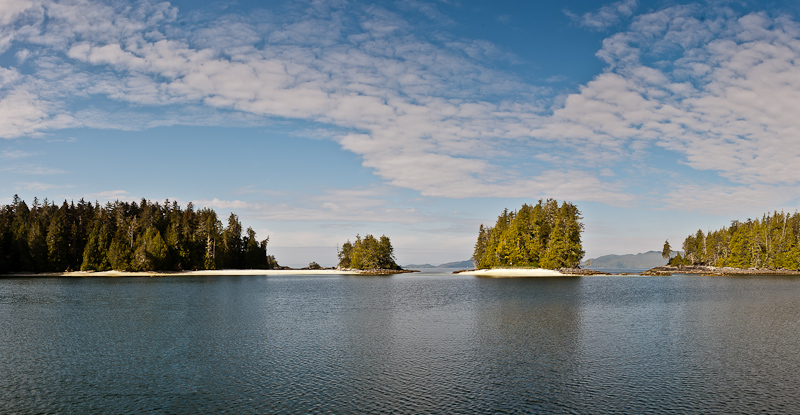
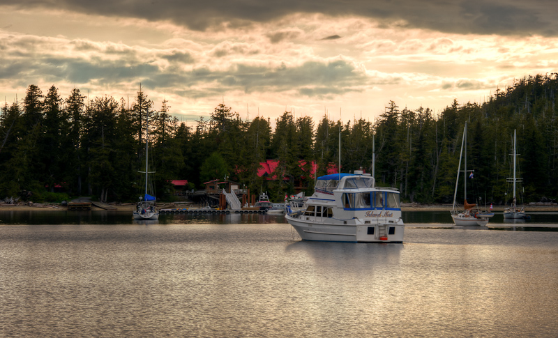
Elcho Harbour is one of the prettiest anchorages you'll find

Bob took the helm for Ocean Falls. I worked on the blog, and the waves were one foot chop in Dean Channel. Alaskan Dream took them in stride, though, and I felt no jostling as we headed back down the Channel.

Elcho Harbour to Ocean Falls-247-Edit

Waterfall along the way

As we neared the turn for Cousins Inlet, I saw a dark hulled motor vessel ahead of us, also bound for Ocean Falls, but we were too far away to tell what type of boat it was. It was windy and gray as we passed a few cabins on the shoreline and saw the small town (80 residents?) of Martin Valley in the distance. Once we got abeam Martin Valley, we could see the Ocean Falls dam. This dam provides hydroelectric power to Martin Valley, Shearwater and Bella Bella. You can see the overland power lines emanating from Ocean Falls. We passed these along out route since we left Shearwater.

Elcho Harbour to Ocean Falls-288-Edit

Karen makes ready the lines for our mooring at Ocean Falls

Elcho Harbour to Ocean Falls-315_6_7

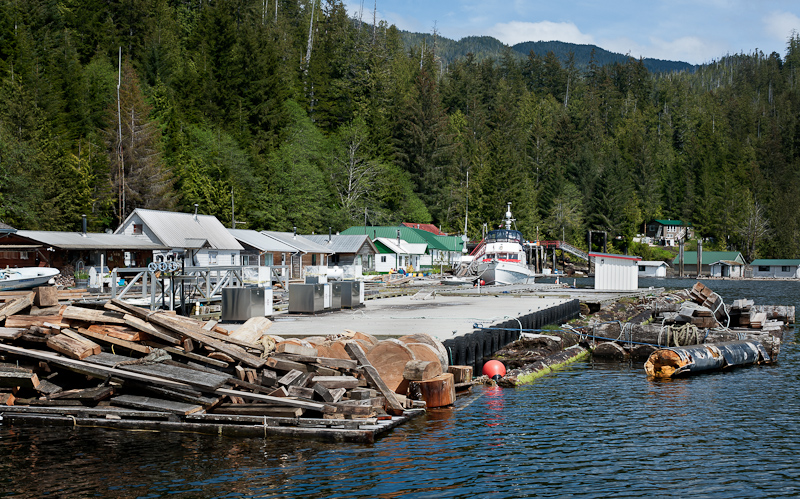
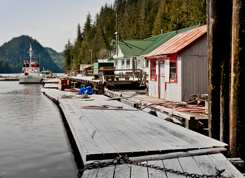
Ocean Falls, a town with a long rich history from boom to bust, and now starting to write a new chapter

Though not charted, there is a nice log breakwater protecting the Ocean Falls docks. We picked a spot on the inside of the outer dock, which turns out to be newly installed this year. The wind provided a nice assist as we tied up. And we had great 30amp power and unlimited amounts of the famous Ocean Falls water. It comes from Lake Link but it is also filters and UV treated!

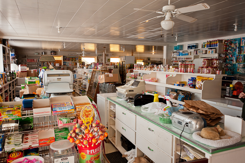
We headed to “The Shack”, which is the wharfinger’s office as well as a mini club house for boaters. It is much nicer than the name implies. Inside were 2-3 computers hooked up to the internet, a book exchange, and several tables with a view outside. Alongside were recycling containers, which I immediately took advantage of. We met Neil, the wharfinger, and paid a reasonable moorage and power fee ($23.25 for 49 feet and $8 for 30amp power), and then headed off to walk to the “grocery store”. It’s about a mile walk up the paved road to Martin Valley. It is only open Monday, Wednesday and Friday from 3-5pm, and there is an orange “light” that flashes when the store is open for business. It was fun to look at the store, and we had a nice chat with Jimmy, and ended up purchasing eggs and tomatoes before walking back. It was still overcast and windy, but no rain. As we rounded a turn in the road, I said “Oh Sh%*! There was a very large black bear ambling down the other side of the road right at us. I have read all the “bear encounter protocols”, which flew out of my head as soon as I saw that bear. Bob, luckily, kept a level head and stopped, the said “Yo Bear” so the bear saw us and heard us. The bear turned 180 degrees, then thought better of it, and turned back around to continue his walk down the road. After all, he was on the road because it did not want to bother with trudging through the thick forrest. It took one more “Yo Bear” before the bear decided it made sense for him to leave the comfortable walking path of the road to head into the forest instead. During this encounter, I stood behind Bob. I tell myself it was to avoid looking at the bear and giving off the smell of fear, not that it was to ensure the bear had a better target!

Elcho Harbour to Ocean Falls-319-Edit

The “store”. Notice the orange flashing light signaling “we're open”

We walked back to the docks, occasionally looking over our shoulders to ensure the bear was not trailing us. We met the folks on Zucchini, the green hulled motor vessel we had seen entering Cousins Inlet earlier today. They are from Connecticut, and keep their boat on the West Coast.  We chatted briefly. We also helped a sailboat with 2 fellows from Bella Coola tie up in all the wind. All they wanted to know was where they could see the first game of the Stanley Cup (Vancouver Canucks vs. Boston). I suggested they walk up the road to town to Slaggo’s Saloon (with a sharp eye out for the bear). Then Bob and I spent a nice, quiet and well-powered night in Ocean Falls. Dinner was Thai Peanut Chicken and Jasmine Rice. We were able to get Sat TV, and watched Jon Stewart and Stephen Colbert before heading off to bed.

Shearwater to Dean Channel, Elcho Harbour

We had a leisurely morning, and made our last visit to the restaurant so Bob could enjoy one more night of freedom from the galley! As we made our way back to Alaskan Dream, we stopped over to look at the new green lodge, which was the site of lots of construction (building a stone “foundation/breakwater”. The owner of Shearwater came over, introduced himself, and encouraged us to go inside the lodge and take a look. This fishing lodge is really nice, and is called Big Time Sportsfishing. It has a grand stone fireplace, large dining room, a roomy sitting area up on the second floor with leather chairs, a pool table and a bar, and then several rooms (many with views). Pretty cushy digs!

IMG_0501-Edit

The “fishing lodge on a barge”, settling into its new home on land

_RE70948-Edit

Here you can see the complete lodge as the stone breakwater/foundation nears complication

_RE70940-Edit-Edit

Shearwater, a must stop in your travels

We left Shearwater’s docks at 10am, and the sun was just starting to come out. I chose to take Gunboat Passage, the scenic route to Dean Channel. It is well marked, and not too tricky, but you need to pay attention. Bob swears he saw a humpback in the passage, but I didn’t see it, so it was an unconfirmed sighting!

_RE71014_5_6-Edit

Karen checking for wildlife from the bow

I took the helm most of the way after that, and it was glorious in Fisher Channel and then Dean Channel. The low lying islands and topography gave wave to higher mountains with snowy caps, and it was a lovely ride up Dean Channel. We saw a pod of about 20 porpoises go flying by, clearly chasing fish and not interested in stopping to play with us.

_RE70973

It not like this here everyday, but when it is, there is nothing to match the grandeur

As we got to the entrance of Elcho Harbour, we detoured to see Sir Alexander Mackenzie park, a site commemorating his accomplishments. Sir Alexander Mackenzie rock is marked by a 43’ cairn. On July 22, 1793, we completed his overland journey across Canada to the Pacific Ocean (or as close as he actually got, which wasn’t all the way), and he marked his accomplishment with vermillion paint on a rock. The inscription has since been carved into the stone. You have to look hard to see it, but we did! Apparently, MacKenzie ended his journey here because the waters beyond the rock were Bella Bella Indian territory and his Bella Coola Indian guides could not assure his safety.  (Thanks to the Waggoner Guide for this background)

_RE71022-Edit

Sir Alexander Mackenzie park

_RE71024-Edit-Edit

Here is where to look to find the inscription

IMG_0528

A beautiful cruising day

We entered Elcho Harbour and it was absolutely gorgeous, it reminded us of Gut Bay in Alaska and also of Switzerland. The inlet extends 2 miles back off Dean Channel, and ends in a grassy bowl with streams and estuary and mudflats. Several waterfalls line the way in. We spent some time seeking the right place to drop the hook, as the anchorage is either deep (80+ feet) or super shallow due to the mudflats. The sun was shining and there was absolutely no wind. We got a good set in about 80’ of water, with great views of the head as well as the mouth of the inlet (and all the snowcapped mountains in both directions).

After getting the anchor set, we were sitting inside with windows and doors wide open when several dark eyed Juncos (small birds) started flying around and dive bombing the boat. One flew in the door, and I shrieked and hid in the bathroom while Bob sat calmly as it flew back out. Ick!

We relaxed and enjoyed the scenery up on the flybridge, and hoped this might be a good place to see bear. Sure enough, about 6:00, out come FOUR Grizzly Bears, a huge male and 2-3 juveniles. They were backlit by the sun and so gorgeous. They were in all the creek beds and spend several hours out there eating grass and rolling in it and entertaining us.

Dinner was halibut tacos, wine and 2 episodes of The Good Wife.  The sunset was stunning, with alpenglow. It was quiet and peaceful and we were, once again, all alone.

_RE71161_2_3_4_5_6

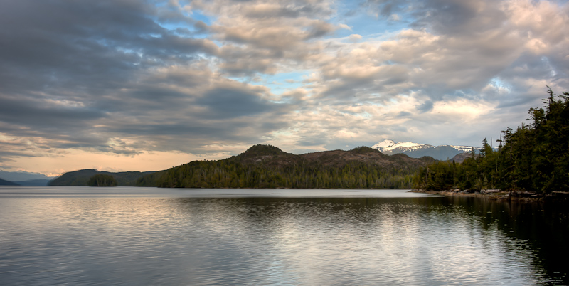
Elcho Harbour does not disappoint


Dodwell Group Inner Basin to Shearwater

Awoke to gray skies and not much wind. I could tell Bob was ready to cast off for Shearwater, where we can do lots of errands and get internet access. I think what he was really looking forward to was the fact that there was a restaurant, so we could have someone else cook for him for a change!

The anchor chain has been jamming as it entered the chain locker, so we let out another 50’ (now 200 total) and then he flaked it in as I pulled up the chain (actually, the windlass pulled up the chain, I just hit the switch). We are hoping that will minimize future jamming after we leave the marina at Shearwater. The anchor revealed that the bottom in Dodwell as mud with some grass. The holding was good.

I helmed almost all the way to Shearwater. It was low tide, and Soulsby Point at the end of Dodwell Island was definitely eye-catching, I can see how that might catch a propeller or two if someone isn’t paying attention and the tide is just a bit higher.  The water was calm, and the sky was cloudy. There was not another boat in sight or on AIS. As we entered Lama Pass and headed toward Bella Bella, the narrow part of the channel was filled with floating log debris, which had me weaving my way in and out of the detritus.  Bella Bella was a pleasant sight, a small (200 people?) native town that has a 12-bed hospital and a grocery store. We continued on past Bella Bella and headed for the docks at Shearwater.

We have never been here before, but the guidebooks indicate that the docks are nice and they have power on them…and they are usually crowded. As we approached, all three things were not exactly true. The docks looked pretty torn up, there was no power on the docks at all, and there were only a few boats there when we arrived about 10:30am. We picked a spot on the “inside” of the main dock to avoid as much swell as possible, and tied up. A nice woman from a departing sailboat gave us the access code for the internet, as it was good for another day and she was leaving. That saved us $10!

We had lots of things to accomplish in Shearwater. First, when we got on Alaskan Dream in Port McNeill, we were short two cruising guidebooks. I had called in advance to make sure they would be aboard, but there was a snafu and they were not. The remoteness of Port McNeill and Port Hardy kept us from being able to source replacements, one of which was essential as we moved north. Northwest Explorations, the wonderful charter company, had the two books shipped on Pacific Coastal Air to Bella Bella, and they were awaiting our pick up. So we took the water taxi over to Bella Bella at 11:00. The captain, Vern, was extremely friendly, and no sooner had we headed out back towards Bella Bella than out of Seaforth Channel came the large cruise ship the Disney Wonder! It was so big in the small channel; it dwarfed the channel and the water taxi. Vern delighted his passengers by detouring around the aft of the ship. Hanging off the aft was a “sculpture” of Donald Duck, who looked like he was painting the stern, suspended by a “rope”. Another Disney Duck, one of the young ones whose names I cannot remember from my days of watching cartoons, was poised above Donald, holding a pair of scissors and about to cut the line. It was so funny, we all laughed. I wonder how big those figures were? 30 feet? 40 feet?

20110529-_RE70846

The Disney Wonder fills our view from the water taxi

As we ran alongside the Disney Wonder, passengers on their decks waved, and we saw that on the top deck, an outdoor movie was being shown. We tried to get them to honk their horn (apparently, one of their horns plays “When you wish upon a star”), but we had no luck. Still, it was a very cool way to be introduced to Shearwater and Bella Bella.

Upon arrival at Bella Bella, Vern called us a taxi, and we rode the taxi van out to the small airport. Bob picked up the package while I chatted with the driver, who was an ardent Pittsburgh Steelers fan. He had Steelers dice hanging from the rear-view window. Go figure.

20110530-_RE70852-Edit-Edit

The docks at Bella Bella, the water taxi is in the distance near the ramp

Back in “town”, we went to the Band Grocery Store, which had great selection and fresh produce, and grabbed a few things before jumping back on the water taxi for Shearwater.

20110530-_RE70850

The band store is a great place to provision in Bella Bella

Back at the boat we offloaded our groceries and books, and headed for the restaurant for a killer burger and fries. Bob was in heaven.

While on the water taxi, we learned that in the winter, hurricane force winds had hit Shearwater and totally detached the docks, sending them out into the bay. Apparently some floating lodges ended up in the bay as well. Shearwater has the docks back together, a bit the worse for wear, but no power reestablished yet.

Shearwater is a big complex (for out here), and there is a grocery store/liquor store/post office, a nice Laundromat(maybe the best we’ve found cruising the northwest), a marine store and a Marine Works. We happily did 2 loads of laundry and a little grocery shopping, but we failed to find a replacement battery for the dinghy, so the electric start is no longer functional. You can still start it the old fashioned way (pulling the string), but it’s definitely more effort.

We paid our moorage ($1 a foot) for the evening, and then had beers on the flybridge with Scott Kennedy, a Montana native who moors his boat in Bellingham. He was single-handing the boat up to Alaska, where he would pick up his fiancée in early June. We had a lot of fun talking, and he is a friend of Brian Pemberton’s, the owner of Northwest Explorations. Small world!

_RE70937_8_9

Scott's fishing machine

A few more boats arrived, including the lovely Far Out, a 71’ DeFever (used to belong to Art DeFever himself). We took their lines as they approached the docks, and learned a bit about them, including the fact that they have done 30,000 miles in that boat, including the Panama Canal and South America and the East Coast.

20110530-_RE70899_900_901

Far Out on the docks in Shearwater, Alaskan Dream is to the left

20110530-_RE70890_1_2

Classic tug converted to a fishing lodge that floats

Never ones to pass up good food, we headed up to the restaurant again for a late dinner and enjoyed it while soaking in the view over the docks. The clouds had finally lifted and it was a lovely and tranquil night. At the restaurant, we met Sarah, who lives in Rivers Inlet (Sunshine Bay) but was up in Shearwater doing the census! She was great fun, and told us a lot about life “in the wilderness” and how she moved from rural England directly to Rivers Inlet. We will try to visit her next time we head up this way.

20110530-_RE70858

This prawner is very optimistic given the number of pots he managed to put onboard

On our way back to the boat to call it a night, we stopped to look at the 4-passenger Robinson R-44 maroon helicopter that is based in Shearwater. It was a sobering thought to see the 4 Mustang life vests that everyone wears when in flight – makes sense, as the majority of the flights are over water!

20110530-_RE70927_28_29_30-Edit-2-Edit

Sunset over the stern of Far Out

Dodwell Group Inner Basin

Last night before bed, we had agreed to go kayaking into Dodwell Lagoon in the morning, on a rising (near high) tide. It was overcast and kind of gloomy when we awoke, but we decided to press on, because we’ve found that as soon as we’re in the kayaks, we have fun exploring no matter the weather.

We headed out of the inner basin, around the rocky islet and off for the lagoon. It was a good ride, with favorable current and the tide still rising. We went through the first narrows in the lagoon with no issue, but when we came to the second set, it was all whitewater. We expect that was because it was so shallow. The Hamilton’s book says that you need at least a 12’ tide to explore the whole lagoon, and we’d agree. We were on a 10’ high tide, and it was about 2’ too low to get through this second set of narrows.

20110529-_RE70793_4_5-Edit-Edit-Edit

Low tide reveals lots of colors and textures

20110529-_RE70822_3_4-Edit-Edit

The fate of the trees on the bank is certain

No worries, though, because the lagoon is large and there was a lot to look at. I wonder how many people venture into this lagoon each year? We were certainly all alone except for some birds, and we felt like we could be the only people on earth, it was so quiet and still.  We realized we haven’t seen another pleasure boat, or fishing boat, or spoken with anyone else since we left Pruth Bay 5 days ago. But that’s just fine with us!

20110529-_RE70800-Edit

Karen explores a small drying area

A great place to explore is when you first enter the drying area into the lagoon. On a 10 foot tide we could paddle all around this area, which for the most part is dry at low tide. It also provided us with a current free exit when we left and the tide was still rising.

20110528-_RE70763_4_5-Edit

The tide was too low for us to enter the second lagoon, the rapids were fast and shallow

We spent the afternoon doing some chores, I worked on the blog while Bob did engine room chores.  I also cleaned the interior, as it is about 10 days since we left Port McNeill. We pretty much took it easy. Bob called the owner, Barry, on the Sat phone to find out where the multimeter was, because we needed to trouble shoot the battery on the dinghy. That was the total of our interaction with other people for the day!

As it turned out the owner had put five new batteries on the boat before the start of the season(no small expense there), but one he did not replace was the dinghy battery. I checked out the battery and the charging circuit coming from the Honda outboard and the battery was diffidently the culprit. I’ll try to find a replacement battery in Shearwater.

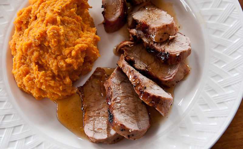
Dinner was delicious grilled pork tenderloin with orange marmalade glaze and mashed sweet potatoes, which made an excellent dinner with some good Argentinian wine. One episode of The Good Wife later, it was time for bed.

20110529-_RE70837

I can do no wrong if I serve Karen sweet potatoes

West Spitfire Cove To Dodwell Group Inner Basin

We enjoyed a peaceful night, the winds were calm, and no swells can make it into this protected cove. We awoke to clouds, but they quickly parted, revealing blue skies and bright sun. Today’s plan is a short 8 nautical mile trip to Sans Peur Cove (off Sans Peur Passage, in the McNaughton Group), so we took our time enjoying breakfast, some housekeeping and a little planning.
The route to Sans Peur takes us down Spitfire Channel to the west, on the “outside” for just a mile or so and around Superstition Point and Superstition Ledge. The combination of shallow waters and the ocean swells made for choppy seas and we certainly can understand why some kayakers choose to portage from Swordfish Bay toSuperstition Cove rather than deal with the currents and rip tides off Superstition Point. 
_RE70556-Edit
Superstition Point
We left the shore about a mile to our starboard side and with the stabilizers working, we had a good but confused ride. It honestly was the most “motion” we’ve felt on this calm-to-date trip, far more than around Cape Caution. As soon as we turned into the entrance to Cultus Sound, the seas were on our stern and everything calmed down very quickly. Karen says “Cultus” means “worthless” or “good for nothing” in Chinook jargon, but today it means sunny and beautiful. She sat for a while on the bow, just enjoying the blue skies and lack of wind.
_RE70603
Karen enjoying the peaceful ride in Cultus Sound
Sans Peur requires a few doglegs to make your way in, but the charts are pretty good and kelp marks the fairway well. It’s a small cove and requires a stern tie. I set the hook (short scope) from the helm while Karen watched our stern to make sure we did not drift back into any rocks. Then, without too much drama, we got the stern tie set to a dead tree and were back on the boat in short order. The more you do these stern ties, the better you get at it.
The wind was about 15 knots out of the Northwest, which hit our bow in the forward port quarter. The anchor and stern tie were work hard to hold us in place. We decided to have a light lunch of leftover mac & cheese and see how things held.
_RE70630_1_2_3-Edit
Little islets dot our stern tie spot
_RE70645_HDR-Edit
Great view off the stern held fast by the stern tie just to the right
Although we held well, we’re only 28 yards from the lee shore and the winds are forecast to continue at this speed or higher all night. After checking our guidebooks for an alternate anchorage in the McNaughton Group with better wind protection (and finding none),we decided to head for our next planned anchorage in the Dodwell Group, just 4.5 miles away. We brought the dinghy on board and retrieved our 300 feet of stern line. The only hiccup was the anchor chain piled up again inside the locker, requiring me to go down and flake the chain as it came onboard. Alaskan Dream has 375 feet of chain, which we love, but it is at the limit of what will go back into the locker without some help. I think once you pay out more than 150 feet, you can plan of a 50/50 chance of have to flake the rode. Next stop, I ‘m going to pay out a bunch and see if I can flake it in so that it is less likely to pile up and jam.
Back underway, we have a short trip until we anchor at the Dodwell Group in the inner basin at the northern part of the group. Here too, you make a few turns around some small islets, and then find yourself in a moderately sized cove with good protection and nice views encompassing even more islets and rocky ledges. We anchored in the northeast corner, in about 40 feet, to protect ourselves from the northwest winds that were so troublesome in Sans Peur Cove. Of course, here the winds were out of the southwest. No matter, we have lots of room to swing. However, the crazy anchor chain did jam again on the way down. Fortunately, enough was paid out that we could set the anchor before addressing the jam in the chain locker.
One breathtaking day
With the winds, we decided to hunker down til late afternoon before going exploring. About 5:30, we headed out in the dinghy to explore some of the other anchorages that the Hamiltons talk about in their guidebook.We headed first toward Soulsby Point, where there is an old, abandoned fishing camp on the 20 meter island just west of the point.
Lots of great fishing stories were told here
It is amazing how much more fun a dinghy ride is when you do not have to shout to be heard. These headsets come in handy in so many ways.
We explored Soulsby Cove, and Forbidden Basin (so named by the Hamiltons because they could not get their anchor to set there, even with a tandem anchor).All the sites are pretty, but none are better than where we are!! It was only about a 3.5 mile round trip to explore these areas.
Karen is checking the how much water we have in the shallows with our handheld depth meter
Dinner was Karen’s favorite – Curried Chicken Salad with Golden Raisins and Celery, served with hot, fresh, homemade drop biscuits. We watched a little Sat TV until the signal could’t keep up with the movement of the boat any more. An early night for all!

Kittyhawk Group to Spitfire Cove West


A very peaceful night in Kittyhawk. It was a fairly gray day, and the route plan was to head to Brydon Anchorage on Hurricane Island, with Hurricane Anchorage as an alternate depending on winds. We were supposed to have SE winds again, and Brydon did not look like the place to be, but we wanted to check it all out. And given that everything was so close – about 2-3 nautical miles at best from Kittyhawk, why not turn it into a day of exploration?

A few dogleg turns took us out of Kittyhawk and almost right into Brydon. There are 3 anchorages in Brydon, with the Northwest being the favorite of the Hamiltons. For us, the SE corner was the one we found most cozy, but we were not in a mood to stop yet. We swung around the SW tip of Hurricane Island and took a look at Hurricane Anchorage. It is big with room for lots of boats. Good wind protection too, but just not something that spoke to us. So we went up Hurricane Channel, happy for the high tide. It was easy until the narrow part at the north end, where the electronic charts were off just a bit and we were happy to have the kelp marking the fairway. Once through, we turned right, had a peek down East Spitfire Channel to the very narrow area, and turned into our new home, Spitfire West Cove.

The sunny day brings out the textures of the tidal zones

This cove is quite pretty and large, with some rocky ledges along the sides that keep you from anchoring too far towards the head. The views are great in all directions, especially when the winds orient you to look at Spitfire Channel and across to Spitfire North Cove.

Having skipped breakfast, we decided to have an early lunch up on the fly bridge, enjoying the view and the brightening skies. Then we launched the kayaks, with an eye on Spitfire Lagoon (reached through Spitfire North Cove). The paddle, as always, was into the wind, and as we crossed Spitfire Channel there were some little waves on our beam. But once we turned into the Cove, it calmed down. The entry to the Lagoon was very “kelpy”, but we had plenty of tide (it was falling, but not a big swing from high tide). The lagoon was peaceful, and we went up to the head where trees choke the stream.

Karen leads our “expedition” into the lagoon

Exiting the lagoon, we headed to the east in Spitfire Channel to check out the narrow constriction area where all the guidebooks urge caution. The current was pretty strong so we didn’t go all the way through in our kayaks, but it was definitely a challenging area for a larger boat. Doable, but you’d want the right high tide and avoid having the current pushing you as you maneuvered through.

Karen headed up to the flybridge to enjoy the sunshine and read her Nook, while I worked on pictures for the blog. Karen saw a small dinghy race up the channel – other than that, we have not seen sign of another human being since we left Pruth Bay. Not even any fishing boats. This is definitely an area where you need to be self-sufficient.

Dinner was Penne with Hot sausage, fresh peppers, onions and a little cinnamon topped with parmesan, accompanied by some good wine. Somehow we ended up watching the Disney Movie, Tangled, which tells the story of Rapunzel. It was silly, but we enjoyed it well enough.

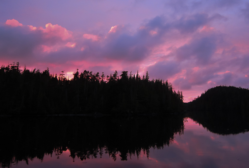
As the old salt says: "Red sky at night, sailor's delight".

Kittyhawk Group

Last night, the rain woke us at 12:43am. It is quite loud on the “roof” of the aft cabin. The anchor alarm also sounded a few times during the night, but it was a spurious GPS signal rather than worrisome anchor dragging. When I (Karen) headed up to the salon about 7:30, we were facing SE, and shortly after it started to get really gusty (as forecast).

We decided to make it a lay day, and spend another night in Kittyhawk.  We really like it here, there are interesting views on all sides, and our anchor is well set, though a bit noisy on the rocky bottom on the ledge we are perched on. With the wind shift, we have swung 180 degrees since yesterday.  In honor of our lay day, Bob made killer cinnamon raisin French toast for breakfast. I read my Nook, Bob worked on pictures from the trip so far, and we were happy to be inside.

_RE70391-Edit-Edit

Karen paddling under the cloudy skies

About 3:30 or so, the wind died down and the gray skies brightened some. We decided to kayak. The water is lovely and clear, with some shell “sand” below so you can really see what’s down there. We paddled out along the 72 meter island, go into some kelp and some swells, and then cut back into the anchorage from the Eastern side. Paddling near the rocky islands that are scattered around the anchorage is fun, and I love seeing all the purple starfish that call British Columbia home. I did let out a shriek when a Mink went scurrying along one of the rocky islets, I just wasn’t expecting it.

_RE70476-Edit

The purple sea stars of British Columbia are unmistakable

_RE70430-Edit

All the life and textures that reveal themselves at low time are remarkable

_RE70466_7_8_9-Edit

More low tide views from the kayak

IMG_0459-Edit

Bob coming around the corner after finding some more subjects for his camera

_RE70407-Edit

Noting but a kayak can get you so intimate with the environs

The highlight of the day, as always, is Bob’s cooking. Tonight’s dinner was an excellent adult version of “Mac and Cheese”, based on a dish we had in March in Nantucket. It is made with lots of different cheeses, some true Macaroni pasta, and peppadews, crispy bacon, peas, and some Chinese 5-spice, with toasted Panko Crumbs on top. Coupled with a good bottle of wine, we had a fabulous meal and you can certainly tell we are not roughing it.

_RE70508

“Mac & Cheese”

Two episodes of The Good Wife later, we called it a night. Tomorrow we plan to head Brydon Anchorage, a short 2 miles away on Hurricane Island.

Pruth Bay to Kittyhawk Group

It was a slow morning. I did not get out of bed until 8am and we did not depart until 11am. But that’s OK, we’re on vacation, and today is a short travel day. Our plan is to anchor in Lewall Inlet, only 8 miles away across Hakai Pass. And hanging out in Pruth Bay longer allowed use to use their free wi-fi to update our blog.

As we were pulling up our 200 feet of anchor rode, the chain started to foul in the hawsepipe as it entered the chain locker when we had about 15 feet or so left to pull in. Sometimes you can prevent this by paying out some chain and then bringing it back in. Not this morning. So down to the chain locker I went to un-pile the chain and re-flake it on board so there was no fouling. This requires laying prone on the forward V-berth and using gloved hands to wrestle the anchor chain. Karen remained at the helm, ensuring we did not drift anywhere undesirable. Problem fixed, we started to head out.

_RE70342

View of the Institute from Pruth Bay

We went slowly, only 4.7 knots to enjoy the reduced sound levels. It was a beautiful morning with high clouds, and light and variable winds. We saw our friends on Island Mist fishing in Hakai Pass when we entered. We headed across this often swelly pass with minimal swells to speak of. After passing the Breaker Group (aptly named islands), when then took the narrow southern entrance into Edward Channel. When we arrived at Lewall Inlet, it did not offer any great kayak opportunities or inspire us to stay (otherwise it was a fine anchorage with lots of protection from most winds), so we left this anchorage and made our way out Nalau Passage and set a course to the Kittyhawk Group.

The Kityhawk Group is a rag-tag bunch of little island and islets. Not many anchorages, but lots of good exploring either by dinghy or kayak. We found a spot in the northwest that should give us good protection from the forecast SE winds. The group as a whole is littered with debris on its shores, the results of the pacific storms that roll in through here. As a result, there is some floating junk that you need to dodge. There is also a fair amount of kelp, but at low tide (when we entered) the kelp “edges” help make the fair channel visible. We found a 33 foot ledge in the large bay and set the anchor there. The bottom must be very rocky, because as we spun around in the variable winds, we were treated to the growling of the anchor chain being pulled over the bottom.

Karen took her Nook and went up to the flybridge to read and enjoy the view, protected from wind by the canvas enclosure. I stayed down in the salon and worked on pictures. It was a nice afternoon, and the sun actually came out for a while, though the winds remained fairly active (as did the anchor chain noise).  Tonight’s meal was cheeseburgers on the grill with brown sugar glazed baked sweet potatoes, chased by a nice beer. By this time, the wind was calm, though we knew it was forecast to change to the SE 10-20. We watched some Satellite TV and saw the trail of destruction the tornadoes had left in Joplin, truly a disaster for those folks. The pictures were sobering.

At 9:30, we listened to a weather update that forecast lighter SE winds overnight and headed off to bed, confident our anchor was well set.

Fury Cove to Pruth Bay

We awoke to a lovely morning in Fury Cove. Our powerboat neighbors had already departed, but the sailing fleet was still in the anchorage. It looked like a good day to head north to Pruth Bay up Fitz Hugh Sound.

_RE79998

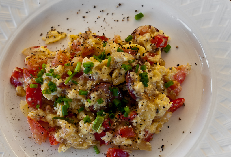
Another variation on my egg scramble holds us until dinner

_RE70010_1_2-Edit

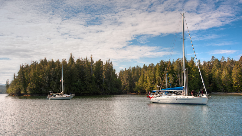
A beautiful day  -- all is great in Fury Cove

_RE79999-Edit

The famous beaches at Fury Cove

_RE70316_17_18_19_20-Edit

The contrast between sea, forest and sky continues to fascinate

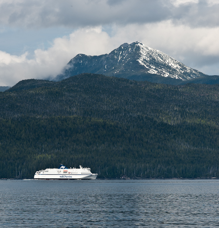
We departed at a leisurely 9:45am, and went out through narrow Breaker Pass rather than leaving Cleve Island to starboard. Karen worked on editing previous blog entries while I took the helm.I chatted briefly with the BC Ferry Northern Explorer on its way to Prince Rupert, just to clear up that we would parallel his path until he was ahead of us and we could then turn behind him toward Calvert Island.

_RE70019

B.C Ferry Northern Explorer makes its way north

As we made our way up Fitz Hugh Sound, sighting two Dall’s porpoise frolicking along the way, the ferry suddenly did a 180 degree turn, about 5 miles ahead of us. He continued around until he was abeam the Sound and stopped dead in the water. We had no idea what he was doing…and are still uncertain.He was just abeam Addenbroke Lighthouse, and we saw a dinghy come charging out to the ferry, and a high speed dinghy from the ferry head off to the north, and we suspect that they rendezvoused out of our sight to exchange either crew or supplies. Very unusual…and that hard 180 degree turn certainly made it look like it was a last minute decision. Still, very fun to watch.

_RE70032

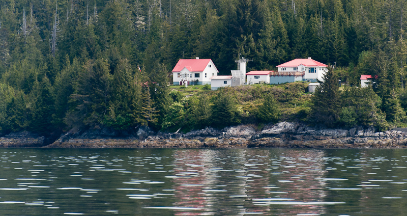
Addenbroke Lighthouse looks like a great place to be a light keeper

We continued on our way to Pruth, and as we turned into Kwakshua Channel, the winds and waves were more evident. We had decided to head to the end of the bay, where the Hakai Beach Institute is located, to see if we could pick up what is rumored to be free wi-fi so we could check email and post blog entries. There were 4 boats in the bay already, 2 sailing vessels, the Nordic Tug Sandpiper and a power boat from Bellingham, WA named Island Mist.We dropped the nook quite a ways back from the Institute’s docks and decided to head for shore to take the walk to West Beach, a true sandy beach on Pacific Ocean. Sandy beaches are hard to come by out here, most are made of shells at best!

The docks were super, and we tied up our dinghy and chatted with some Institute staff who were waiting on a float plane to take them to Port Hardy. They said the Institute was privately owned by 2 well-off scientists who wanted to create an ecological center and attract lots of scientists to come and study. They apparently bought the place from the previous owners who ran it as a high end fishing resort. The entire property is 215 acres, and has numerous buildings: welcome center, two lodges, staff housing, and a hard hat area with lots of equipment. Seems pretty self-sufficient, and was being very well landscaped when we arrived.

_RE70037-Edit-Edit

Karen greets and is greeted by some of the staff waiting for the float plane

_RE70261-Edit

Pretty nice facilities at the Hakai Beach Institute

_RE70264

The view of Pruth Bay from the Hakai Beach Institute

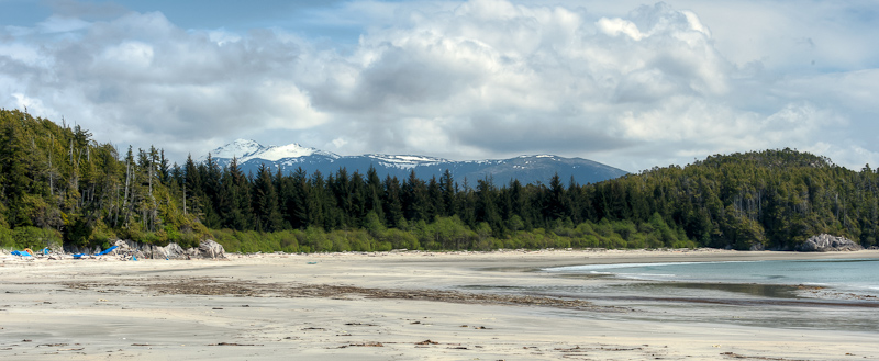
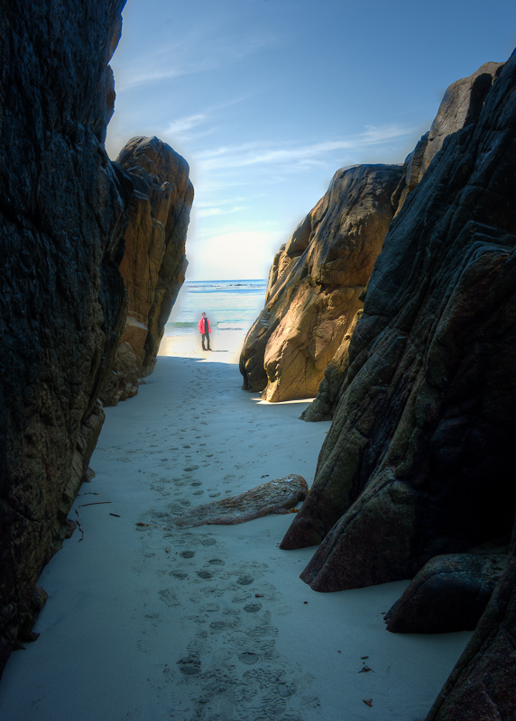
The walk to West Beach was super, flat and fairly short through the forest. You could hear the sound of breaking waves before emerging from the forest on to a very large and flat sand beach, reminiscent of the beaches we saw at Cannon Beach, OR (without the tall towering rocks).

_RE70045_6_7-Edit-Edit-Edit

Along our walk to the beach we found new life cascading down from an old-growth downed cedar

Bob's ready for action. The next photo awaits.

Instead the view oceanward was framed by several islets. We went for a long walk in hard sand, Karen looking for shells and other treasures while I took pictures. We walked to the south end and spent time in some rock cliff formations checking out tidal pools full of interesting creatures, including these odd green sea cucumber or sea anemone type critters.

_RE70057-Edit-Edit

What a beach!

Pruth Bay Beach from Robert Minkus on Vimeo.

It was completely sunny, warm and so beautiful, it was hard to believe that we were at the beach in the sun and yet could see snow-capped mountains when we turned back toward the head of Pruth Bay.

_RE70229_30_31

Beach, forest, snow-capped mountains. You'll find this nowhere else.

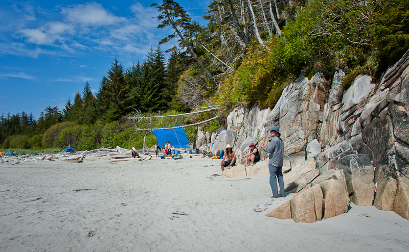
A group of kayakers from Bella Coola were on some sort of trip, and were camping on the beach. This was a huge camp, and these teens seemed as if they were having a lot of fun.

_RE70251-Edit

Weekend at the beach and kayaking day trips

_RE70078_79_80_81_82-Edit

_RE70164-Edit

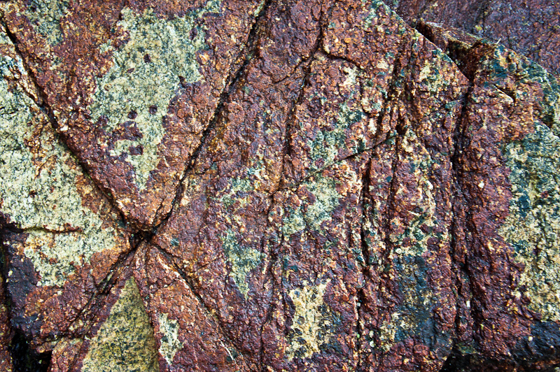
Nature is an amazing artist

_RE70180_1_2_3_4-Edit

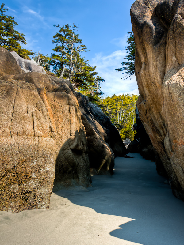
Karen looks through the wave cut granite

_RE70217

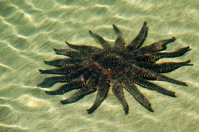
Sea star is such a perfect name for this critter

We saw the trailhead to North Beach, but were ready to head back to the boat. Next time, we’ll mountain goat our way to North Beach as well. This is a jewel of a stop, and definitely a must do in sunny weather.

_RE70256-Edit

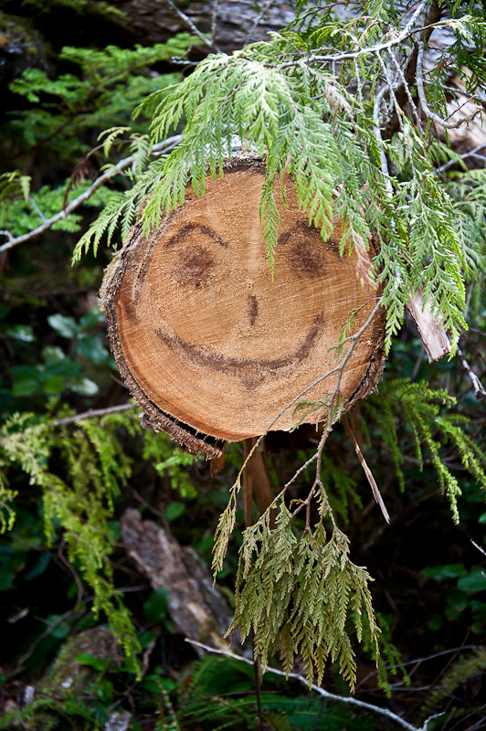
Along the path to the beach, someone with a sense of humor created this long art. We call him “Stumpy”

As we headed back to the docks, we met the couple who own Island Mist, Frank and Margo. They recognized our boat, Alaskan Dream, as having been previously Samaria, owned by “slip neighbors” of theirs in Bellingham. It is a really small world. They boat for the season, and Frank was born in Petersburg, AK with a brother who lives north of Craig. They were really nice and quite happy to see Samaria again.

Back at Alaskan Dream, we uncapped two beers and sat up on the fly bridge to look at the lovely view. Two more boats arrived and the Nordic Tug left, making for 5 boats in the bay plus us. A veritable crowd for this time of year!

_RE70034-Edit

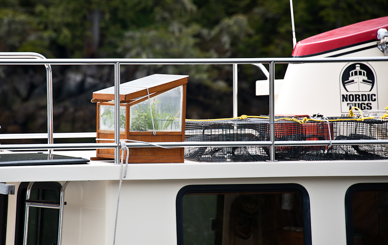
Herb garden on the Nordic Tug

I made pizza again, this time with some sweet sausage and red peppers as well as the flank steak, gorgonzola cheese and balsamic glaze. This is Karen’s favorite meal, and she was happy to have it two days in a row, which was necessary because I made enough dough for two pizzas the night before.

_RE70305-Edit

Another variation of my pizza recipe

We wound down watching 2 more episodes of The Good Wife, and headed off for a peaceful night’s sleep.

_RE70292_3_4_5_6-Edit

The sun starts to set on Island Mist in Pruth Bay

Geetla Basin to Fury Cove via Dawson’s Landing

It’s happening again. The sun is up, the skies are clear and the winds are light. Today’s route is planned with two legs. The first stop is Dawson’s Landing, and our ultimate destination is the popular Fury Cove near the junction of Rivers Inlet and Fitz Hugh Sound.

The boat has been running great. The only problem I have not resolved is that only two of the three burners on the stove work. I have a couple of ideas to check out, but as I have been getting along fine with two burners, I have not been motivated to start taking things apart.

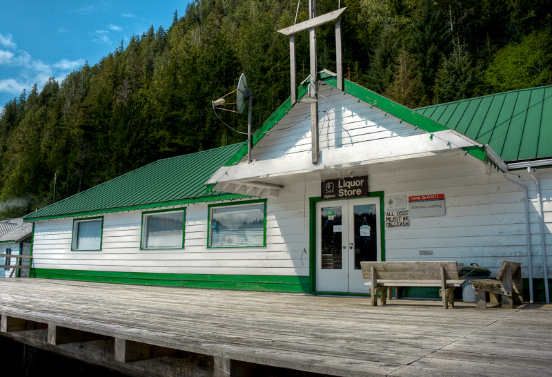
Dawson’s Landing is only a two hour hop from Geetla Basin. It has a full store with everything, and I mean everything, you could want. From fuel, to parts, to food, it’s one of the best stocked groceries you’ll find in the hinterlands.

_RE79707_8_9-Edit

The store, et. al., at Dawson's Landing

_RE79713

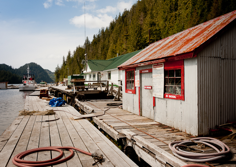
Fuel dock is just to the right of the store

_RE79692-Edit

Other cabins, fishing lodge and who knows what, line the docks at Dawson's Landing

_RE79686-Edit

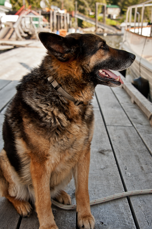
The official “greeter” on the docks. Super nice. I wonder how many boats he has seen come and go in his day?

It is Victoria Day today, a Canadian holiday, so we did not know if they would be open. We approached the docks, which were cluttered with overwintering docks and miscellaneous floating stuff from fishing lodgings in the area, but no visiting boats. It looked quiet. We easily found an open spot for Alaskan Dream and tied her up. Nora was kind enough to open the store for us and we were able to fill some needs in utensils and food, and I even found a great fleece vest. Like I said, it’s a great store, and Nora is extremely nice.

_RE79690-Edit

One amazing wilderness store. The other half, full of marine and fishing supplies, is to the right.

We also took on water, and as the tanks, filled I walked around and took some pictures of the environs. Nora said that only six of the nearby fishing lodges were opening this season. The economy has been tough on the industry. Some went bankrupt, some fell victim to the health of the owners, and others suffer from the reduction in boating and fish.

As I mentioned there were a multitude of random docks and structures that were overwintering or being repaired after the winter. It seems a never-ending job to keep all this floating equipment, lodging and whatnot in working order and good repair. It seems there is 9.5 months of maintenance for a 2.5 month season. Such is the life out here.

_RE79759-Edit

Winter storage, winter projects. Soon to be gone from the front of the docks, ready for the season to start.

_RE79753_4_5

Exploring the docks, looking for stuff to photograph

_RE79736_37_38_39_40-Edit

How's this for a helm station

_RE79747_8_9-Edit

I thought the herb garden was a nice touch

After the tanks were filled and we checked out email by using Dawson’s WIFI, we set out for Fury Cove down Darby Channel. It was a bit windy, and when we joined up with the Sound, we did see the Disney Wonder cruise ship headed south to Vancouver. Fury Cove is a popular anchorage for those enroute to Alaska this time of year. Its claim to fame is a white shell beach. Sure enough, as we pulled into the cove, you were rewarded with a view out to the West overlooking the white beaches. There was a kayaker’s area with a set of stairs that could be seen from the anchorage. We were the first to arrive, so we had our pick of places to anchor and took a spot overlooking the gap out to the West.

_RE79814-Edit-Edit

The view back into the anchorage at Fury Cove

Fury Cove panorama video

_RE79930_1_2_3

One of the cuts between Fury Cove and the ocean

_RE79942_3_4

Karen searching for shells

_RE79852_3_4-Edit-Edit

Driftwood makes a good prop for this portrait

It did not take long for use to make our way to the beach in the dinghy. It was lowish tide, so we timed our exploration well. There is a lot to explore. We walked the beaches and even checked out the rather luxurious kayaker’s cabin just in the woods.

_RE79949_50_51-Edit

Welcome to the Clam Shack. Humble, but I bet it looks like the Ritz after kayaking in the rain for a couple of days.

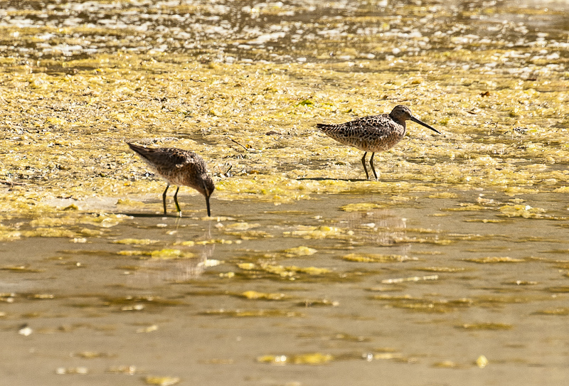
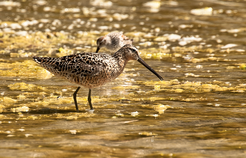
We then just sat on some driftwood and enjoyed the plentiful sunshine, watching a family of Long Billed Dowitchers (2adults and 12 babies) foraging along the shore.

_RE79956-Edit

Yummy! Bugs!

_RE79973-Edit

Dad always keep himself between me and his chicks. But for the most part, they cared little that we were there watching.

One suggestion given to us, which we did not do, was to make our way to the other side onto the southwest beach and build a bonfire and watch the sunset. Sounded like a great idea -- maybe on our next trip!

As the day wore on, we were joined by three sailboats and one other trawler. We were on the flybridge, enjoying a beer and the sunshine, watching the anchoring dance.

_RE79984-Edit

Karen could eat this every night. Not certain I could make it every night.

I made Karen’s favorite Pizza (with gorgonzola, caramelized onions and flank steak), and two episodes of The Good Wife kept us entertained until bedtime. All 5 boats in Fury Cove enjoyed a still night at anchor.

Ahclakerho Islands to Geetla Basin

I hate to start every blog post with a weather report, but it is so spectacular today that it cannot go without reporting. Clear skies and calm winds, a real treat for this time of the year.

_RE79587_88_89_90_91

What a beautiful morning, you just know it is going to be a good day

We are off for Geetla Basin, which means we need to head back down Smith Sound and round up into Rivers Inlet, while avoiding any ebb issues. We think we have the timing right, so we’re not concerned, and the wind is benign. This time, on the way out, Karen saw the pictograph. It makes you wonder – what does it mean, that “bug”?

_RE79596

I love the way life clings to even the smallest opportunity. We call these bonsai islands.

IMG_0407

Beautiful ride up the channel under the Northwest Exploration burgee

IMG_0406

Currents in the channel reflect in the sun

_RE79602-Edit

The current was running almost two knots on our stern as we departed the Ahclakerho

Today is the day we try the watermaker for the first time. One tank is down a little more than half, owing to the two loads of laundry we did enroute to Fly Basin. Alaskan Dream is equipped with a Village Marine water maker that produces about 20 gallons per hour. The only downside of this installation is that there is no remote operating panel in the salon, which means you have to go into the engine room to operate the unit. And, of course, you only operate water makers when you’re underway. Not a big deal, when you consider the flexibility it gives us in planning trips to areas where water supplies are scarce. The owner did a great job of writing up the operational instructions and with a turn of a valve here, a flip of a switch there, check the flow, turn another handle and lo and behold, we’re making fresh water.

After a couple of hours, it seemed the fill rate, which one can monitor with the water tank gauges in the salon, had stopped. When I went to check the water maker, it had switched itself from normal to “dump/cleaning”, and the psi of the outflow had dropped well below the desired target. Inspecting the 5 micron filter, it was completely encased in a 1/6 inch of green slime. That was a surprise, given that we were running in large open channels and the water is so cold (46F). I changed the filter, and all was well. Tomorrow we’re moving to different waters and we make some more water in earnest and see what the filter captures as we travel.

_RE79665-Edit

Green slime clogs the watermaker filter

The big excitement for the day was spotting a small pod of Orca. As we were entering the mouth of Rivers Inlet, Karen spotted the fin of a female. As we continued to scan the area for more activity, the larger fin of a male appeared and later another small fin. They were traveling in a straight line in the opposite direction with a sense of purpose. We watched as they departed Rivers Inlet while we began making our way up. Our destination was Geetla Basin. But on the way up, we took a short detour to check out Duncanby (a high end fishing resort that was not yet open), and we enjoyed winding our way along the small islets. We also saw the Cannery under renovation at the end of Goose Bay, but did not go down to tie up and go ashore.

Just off the open and sometimes challenging Rivers Inlet, you’ll find Geetla Basin. A quick turn in though a narrow entry and then some rocks, and you’re rewarded with a wonderful small anchorage that can handle two or three boats with ease. It was very well protected and offers good holding…and we were again alone, with the exception of a frolicking seal. This anchorage is recommended by the Hamiltons in The Secret Coast, and it’s a great spot.

Immediately after securing Alaskan Dream, we launched the dinghy to explore the east/west oriented lagoon that is at the end of Magee channel. According the Hamilton’s Cruising the Secret Coast, you can take the dinghy in there on higher tides. They were right as always and we explored, looking to the float house that they reported at the west end. It was not there, but we did find that it looked possible to go through the cut at the west end into Darby Channel. Certainly only something to be attempted in a dinghy or Kayak, but at this high a tide, it was doable.

IMG_0411-Edit

The dinghy is a great way to do a quick overview, before launching the kayaks

We swung by the entrance to Geetla Inlet, where the kayaking was supposed to be good. The tide had to be above 10’ at Bella Bella to allow entry. Saw that the dinghy path was blocked by a downed tree, so we went back to the boat to get the kayaks and wait for the tide to rise a bit.  The challenge here is that about one third of a mile up the narrow inlet channel is a section about a quarter mile long that dries.. To complicate matters further, one must manage the currents flowing in and out of the two large lagoons to avoid fighting the current on entry and exit. We left about 5:19, knowing high tide at Bella Bella was at 6:08. Our plan was to ride the current in, and then ride the current out.

We did ride the current in.  The base current was about 1.5 knots in the wider entry section, which made for a great ride. However, in the narrow, shallow, rocky sections, the current would pick up a couple of knots and some small rapids made us pay attention as we navigated between rocks and fallen trees.

We paddled into the first large lagoon and came upon twenty five or so sea gulls making the most ungodly racket. The only thing we could think of is that it was mating season, because no one was fishing.

IMG_0419

Bob backlit in “Gull Lagoon”

I decided that it was time to head back, because it was about 6:15 and the current should be changing soon to run out the inlet. Well, Karen and I fought our way up-inlet for a while and finally had to take shelter in a spot out of the current behind a fallen tree to wait for the current to slow and then reverse. We clearly did not use the correct current info! We had to wait, with me holding onto a rock and Karen holding on to my kayak, for an hour for the adverse current to slow and then stop. Karen was so impatient, she wanted to go anyway, but I convinced her to wait, and it was a good decision. We cast off at 7:21 and had a lovely paddle back to the boat, without having to fight any current. We were happy to get back to the boat, that’s for sure!

IMG_0428

Waiting for the current to go slack

After stowing the kayaks and the dinghy, we had an easy meal of Chili and homemade drop biscuits. One more episode of The Good Wife later, off to bed at 11pm…and it’s still sort of light out.


Ahclakerho Islands

Ahclakerho Islands

The Northwest weather has returned: cloudy, overcast, a little fog in the morning with a dampness in the light breeze. It has been declared by Karen “a lay day”. I did not get up until 9. Karen was up at 8 and I found her reading her Nook, drinking her second cup of coffee, nestled under her blanket on the settee. It was a perfect morning for her.

_RE79452

Breakfast scramble, lots of veggies and yummy on a sleepy morning

I did not make breakfast until 11am, after we looked at our planned schedule and decided that we would just stay here, tied to the shore and comfortable, rather than head further down the channel to Broad Basin. After a week on the go, it is good just to stop and recharge and slow down.

_RE79474

The stern tie masterfully set by Karen. It's a lot of work, but well worth it for all the small anchorages it opens up to you.

Karen had asked me to buy Season 1 of The Good Wife, and we watched the first two episodes which were quite good. I made some chili for future consumption and worked on the blog and pictures, while Karen continued to commune with her Nook.

Dinner was marinated and glazed pork loin with hoisin sauce and maple glazed carrots. Even Karen’s sweet tooth was satisfied by those carrots!

_RE79480

 Karen loves all things glazed; glazed carrots, glazed pork tenderloin

 _RE79542_3_4_5_6_7-Edit

 Sun starting to set, no wind turns the water into a mirror. What's out your window?

_RE79488

The clouds are still playing with the tops of the mountains after sunset

Fly Basin to Ahclakerho Islands

Fly Basin to Ahclakerho Islands

Our neighbor last night left about a half hour before us. We weighed anchor and began our trip at 7:57am in order to arrive at the narrow Ahclakerho Channel at low slack about 10:00am. The channel looks narrow on the chart and there are some rocks that line the fairway, but we found the Nobeltec charts to be spot on and the trip was an easy passage in beautiful sun.

_RE79086_7_8_9-Edit

Beautiful sunrise at anchor

_RE79136_37_38_39_40-Edit

We enjoyed a calm and still night at anchor

_RE79191-Edit

Sticky mud and shells make for good holding

_RE79159-Edit-Edit

Fly Basin is well protected and we enjoyed a calm night

_RE79144-Edit

There is a reason power boats got the nickname “stinkpots”

_RE79159-Edit-Edit

You never are in doubt where the high tide stops. The trees look as if they are trimmed with a laser.

_RE79205_6_7-Edit-Edit-Edit

These are the views views you see cruising nowhere else

Karen had read about some pictograph in the channel across from one of the small islets. I was able to a get a photo, Karen will have to wait for the return to see it. I find it difficult, at best, to spot these ancient symbols. Often faded, they seldom look like anything you expect. Add to that, the fact that the rocks themselves are emblazoned with marks from Mother Nature, and it’s no wonder we bat about 50/50 in spotting these. I got a picture, and when we later looked at the blow up of the pictograph, it was a crazy bug with eyes and a mouth.

_RE79213-Edit

The anchorage in the small “V” shaped notch at the eastern end of the larger of the two Ahclakerho Islands is cozy but not cramped. Because of the shoaling at the northwest end and the marked (but not seen) rock, we did what most people do and set a stern line to the south shore. We have not done a stern tie in a couple of years; add to that a new (to us) boat with different equipment than we are used to, and it took us about an hour to do the “stern tie dance.”

We set the anchor in about 15 feet of water (rocky bottom!) on a plus 2 foot tide about 85 yards from the rocks. From there we set the anchor at the 50 foot mark on the rode and then proceeded to pay out a total of 250 foot of chain. That allowed Alaskan Dream to sit 30 yards from shore in 33 feet of water.

It was low tide ant only one foot above low water, so Karen had to climb the barnacle-encrusted and slimy, slippery rocks to find a suitable place to run our stern line. We were so close to shore that I just rowed us to and from the boat in the dinghy rather than starting the engine. Our stern line was nicely long enough to get the job done, and we were finally snug in the cove.

The bonus to this anchorage is the great Kayaking to be had. At first it only looks OK, but once you get out and start to explore the north shore line of the large island, you’ll find some special small spots and passages that are a kayaker’s delight.

_RE79226-Edit

Karen loves to explore what she calls “Kayak Garages”

_RE79249_50_51_R2

I love all the different textures and colors you find as you look closely from the cockpit of the kayak

In addition, on the west end of the “v” anchorage you’ll find a drying pass that, at high water can be paddled up for about 150 yards. From there you turn around and get a great photo of your boat with snowcapped (it was May 20th) mountains in the far distance.

_RE79433_4_5-Edit-Edit

The view from the kayaks is not to be missed

_RE79443_4_5-Edit-Edit-Edit

Alaskan Dream framed by the snow capped mountains

Karen and I spent about 2 hours going in and out of every little nook and cranny we could find. Occasionally we were join by the local seals who were as least as interested in us as we they.

_RE79365-Edit-Edit 

The end of the little drying inlet was messy but still a fun paddle

There were also these triangular (like baby conch) shells everywhere with some sort of sea life inside. We have not seen these before but they were in abundance, along with lots of big clams and mussels.

_RE79334-Edit

An abundance of mussels, but it's the wrong time of the year to harvest them

Dinner selection was driven by chef Bob, who wanted “comfort food” and thus made a fusilli gorgonzola with peppers, onions and kielbasa. After dinner, we decided to check out Broad Cove by dinghy as an alternate anchorage. It was about a 3 mile ride, and it was nice, but not as cozy as where we already were. The dinghy on Alaskan Dream is so nice, very stable, and with an electric start, so easy to get going. It also gets up to 14kts, which is nice for those times when kayaking doesn’t cut it!

_RE79446-Edit-Edit

Dinner aboard Alaskan Dream

We were the only pleasure boat in the area, but we did see a fishing boat tending his prawn pots.

_RE79285-Edit

Just us and Mother Nature. Adventure the way we like it.

Main Line Power Squadron

This evening, Karen and I made a presentation to the Main Line Power Squadron on our experiences cruising the Inside Passage. We had a great time. The members are warm and welcoming and seemed to enjoy seeing cruising grounds that none of them had yet experienced. Thanks again to Commander Susan Friedrichs and the members for their hospitality and kind words. You can check out this great group of mariners here.  To view the resource information pages from last night’s presentation click here.MLPS PLate

Muirhead Islands to England Point Cove

Up at eight...and we are greeted by overcast skies, mist and fog. The run of good weather was over, at least for the day. As is often the case, the timing of today’s travels will be dictated by the tides. The entrance to Actaeon Sound is guarded by Snake Passage and high slack tide at Snake was not until 11:30am. Of course this was no problem, given our predilection to sleep in and spend the morning lounging around. It’s our vacation after all.

The anchor came up clean to Karen’s delight (she is the anchor wench, after all). We had a great set to the anchor the day before, and that often means the anchor comes up filled with mud. But with a clean anchor aboard, we departed our peaceful anchorage for our next adventure.

Snake Passage is well charted with kelp that helps mark the dangers. At high slack it was an uneventful pass. Of course, at high slack this narrow fairway looks much wider, with all the dangers lurking below the water.

Behind Snake Pass, the Sound opens up. Its so peaceful and pretty, almost like a wide tree-lined river.

As we motored up the sound, we stopped at the entrance to Bond Lagoon and pointed our nose into the entrance to scope it out. The entrance looks as if the fairway is good but we did not have enough water under the keel to make the passage into the lagoon. We will save this lagoon for another visit.

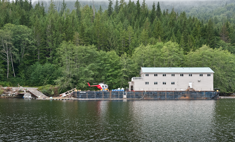
We snooped at Creasy Bay and saw the logging camp on the Venturi Logger barge, complete with a small helicopter. Behind that is a derelict barge that looks a lot shabbier than pictured in Hamilton's Secret Coast!

20090913_Muirhead Islands_England Cove_0049-Edit

Have Logging Camp Will Travel

We passed our planned anchorage at England Point Cove and continued on to explore the entrance to Tsibass Lagoon. It must have been perfect slack, as there was no strong ebb to be seen. But you can tell this entrance is very narrow and not for Arctic Star. If we had a high speed dinghy, we'd definitely have gone in to explore.

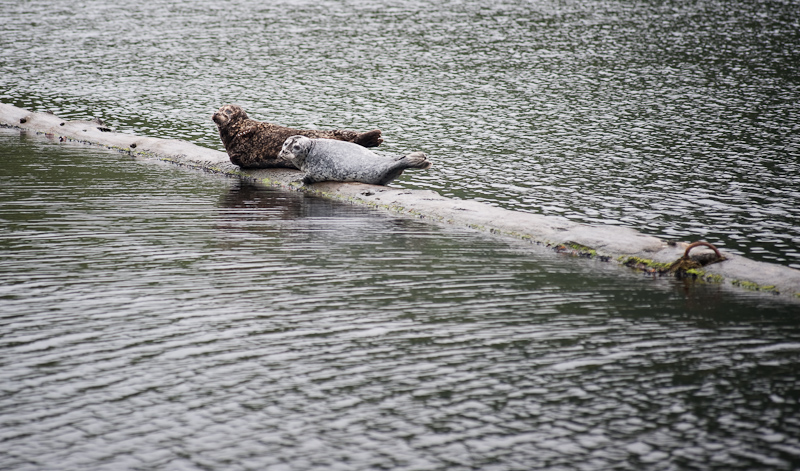
On our way back to England Point, we took a look at Gleyka Cove, which seems have an abandoned logging camp and is marked with tons of floating logs that had numerous seals hauled out on them. Predictably, Karen, the critter chaser, directed the helm to change course and go visit the local mammals. They had such soulful faces, and were in a rainbow of seal colors: grey ones, brown ones, Dalmatian colored ones and brown spotted ones.

20090913_Muirhead Islands_England Cove_0081-Edit

After the Loggers Leave, the Seals Take Over

We decided to anchor in England Point Cove, a highly recommended anchorage by the Hamilton's and by us! It's a lovely one boat (to us) anchorage. There are great views out a couple of directions and the prime anchor spot is easy to pick out. We set the anchor easily in the grey and misty skies.

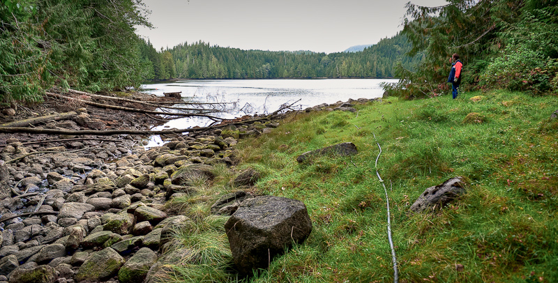
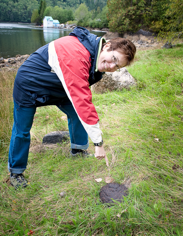
We later took the dinghy back to Gleyka Cove, because the Hamiltons said you can walk along the North Creek to some abandoned trucks and stuff from the old logging days. We landed North of the creek with no issue and tied the dinghy off to a tree. Tall grass obscured holes and unsure footing was the name of the day as we followed a bear path (complete with fresh scat) to the rocky creek. Taking a look at the creek and the underbrush, we knew this wasn't going to work as a fun and easy walk.

20090913_Muirhead Islands_England Cove_0102_3_4

Entrance to the Creek

20090913_Muirhead Islands_England Cove_0113-Edit

There Be Bear Here!!

So we retrieved the dinghy and decided to dock at the logging camp and explore the logging roads. One the way there, we almost ran over a long, just-submerged fresh water line that ran from shore to the camp. Gotta be ever vigilant! At first glance, it just seemed like a long piece of kelp.

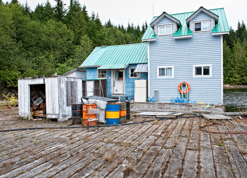
Docked at the camp, there was a rickety ramp to shore. It had a "leaning tower of Pisa" characteristic, and Karen was very skeptical because it was so askew and steep. Bob walked it with no issues and no fear, and so Karen grumblingly followed. The house at the top of the ramp was abandoned, with just a blue hard hat sitting on a log as a reminder of days gone by. We walked around and explored the log sluice that channeled logs down towards the holding pen where the seals were hauled out.

20090913_Muirhead Islands_England Cove_0143-Edit

Home Sweet Home for the Loggers that used to work at Gleyka Cove

20090913_Muirhead Islands_England Cove_0124

Of course Bob had to go first to check it out. It was a lot more stable than it looks.

20090913_Muirhead Islands_England Cove_0140_1_2-Edit

I Wonder How Many Hours were Spent in that Chair

20090913_Muirhead Islands_England Cove_0146-Edit-Edit

Someone Put a Flag on the Islet that Marks the Entrance to England Point Cove

We took the dinghy over to see our seal friends one more time before returning to the boat for a feast of marinated grilled pork and maple glazed carrots.

Davis Bay to Muirhead Islands

A bright light awoke us. What was that? OMG, it was the sun! The morning was crystal clear and calm. We had spent a peaceful night; no wind, no waves, no current to speak of. Davis Bay is a great spot, ample of room, good holding and beautiful views in all directions.

Davis Bay Anchorage Panorama

Karen continues to insist that the drying beach to the northeast is a perfect “bear beach”. It would be except there appears to be no bear here. That did not deter Karen from posting a lookout on the stern and enjoying a quiet morning reading what must be her 19th book of this trip.

20090912_Davis Bay_Muirhead Islands_0203-Edit

Karen Splits Her Time Between Reading and Watching the "Bear Beach"

We took it easy this morning as we attempted to chill down from our mechanical adventures and transition to vacation mood. Therefore, it was not until one o’clock when we lifted the anchor for a short cruise to the other end of Drury Inlet and the Muirhead Islands.

The last time we visited the Muirhead Islands we stern tied on the south side. This time, we planned to anchor in the one-boat anchorage in the bay on the north side. We had explored this anchorage last time in the dinghy and liked it because we could anchor without a stern tie and have the place to ourselves.

20090912_Davis Bay_Muirhead Islands_0205-Edit-Edit

A Beautiful Cruise Over to the Muirhead Islands

Shortly after we anchored, a Nauticat sailboat anchored in the south bay where we had been last year, so we were happy we chose the northern spot. After dropping anchor and enjoying the vistas on all sides, we launched the dinghy and explored the western end of Drury. The logging operation at the Western end appears to be shutting down with most of the equipment gone expect for the M/V Sir James Douglass, an old Coast Guard boat that was used as a base of operations. We later learned that a new logging camp was starting up in adjacent Actaeon Sound.

20090912_Davis Bay_Muirhead Islands_0234

Karen Takes the Bow Watch for the Dinghy Expedition

As we were heading back from checking out the logging "leftovers", we ran into Tom from the Nauticat. He was out in his dinghy trying to find a spot where his cell phone would work. He and his wife Sharon, who remained on the Nauticat, have an invalid mother at home and he was trying to check in to confirm that all was OK. I offered to lend him our satellite phone so he could make contact. He was very grateful and said he would row over later to Arctic Star to take advantage of our offer. 

We continued our explorations by checking out the lower end of Actress Passage, the entrance to Actaeon Sound. We wanted to preview because tomorrow our plan is to transit Actress Passage and enter the sound for "off the grid" exploring and secure an overnight anchorage. It all looked straightforward, though we didn't go as far north as Snake Pass in the dinghy. We were confident the next day would be fun and well within our skill set.

Not long after we had the dinghy stowed, Tom appeared on our stern in his dinghy. We invited him aboard and gave him the satellite phone and a short briefing on its operation. Good news: all was well at home. We offered Tom a beer and settled into some boat talk (I have been a fan of the Nauticat ever since I saw one at the Annapolis Boat Show twenty years ago) and exchanged information about good anchorages. He lives in Qualicum and also sails in Mexico, so he had wonderful stories to tell.

Bob's special meatloaf and roasted potatoes with fresh rosemary were on the menu. We had another lovely clear night and a good night's sleep.

Many folks pass by anchoring in the Muirheads and continue on to large Sutherland Bay. We love the Muirheads, it's a kayaker's dream (and great for exploring by dinghy, too) and has very remote feeling. Give it a try if you haven't done so yet!

20090912_Davis Bay_Muirhead Islands_0258

Arctic Star Enjoys a Peaceful Anchorage in the Muirhead Islands

Port McNeill to Davis Bay

We were up early -- and more sun!! We had time to kill before the Lugger parts would arrive in Port Hardy, so we explored Beaver Harbour and Storey Beach by car. The anchorage, written up by Dreamspeaker and Hamilton & Hamilton, definitely looked good and a nice alternative to Port Hardy. We also visited Hardy Buoys, a provider of smoked fish. We bought candy smoked Salmon bellies, which we later found were the most amazingly delicious smoked salmon ever.  We also did a little more provisioning at our favorite grocery store in the area, Overwaitea. 20090911_Port McNeill_Davis Bay_0066

Somehow this Paint Scheme Does Not Add to the Nautical Flair of This Boat

20090910_Port McNeill_Davis Bay_0002-Edit

An Interesting Solution to Securing a Line to the Dock

The parts were in on time and we called Graham, arranging to meet at the boat as soon as possible. The new breaker from Lugger also didn't quite fit, but Graham made it work and left us the one that arrived by bus as a spare.

20090910_Port McNeill_0070-Edit-Edit-2

Port McNeill

We cast off of the docks at Port McNeil at 3:47pm. According to Karen the EXACT time we cast off last year! “Déjà vu all over again”, to quote the renowned New York Yankee’s philosopher, Yogi Bera.

Our crossing of Queen Charlotte Strait was the antithesis of our experience a few days ago heading back to Port McNeill. Light winds, calm seas, and one of the clearest skies we have ever seen in the Pacific Northwest.

20090911_Port McNeill_Davis Bay_0081_110_111

Under Way at Last!

20090911_Port McNeill_Davis Bay_0073

Beautiful Day on the Strait

Deciding to bag any shot at the Nakwakto, we headed for another favorite, Drury Inlet. We used our Nobeltec navigation system to time our arrival at Welde Rock and the Stuart Narrows. Based on our predicted arrival at the narrows, I fine tuned our speed across the ground (SOG) in order to arrive at slack, in this case high slack.

Once inside Drury Inlet, the biggest problem we faced was the sun. We were traveling due west into a setting sun. This made the watch for logs (of which there were many) a challenge. I would adjust our course so that I would keep the sun and the reflection of the sun on the water hidden behind one of the vertical posts of the forward windows.

The good news is that as we turned east to go into Davis Bay, the sun was at our back, making it easy to navigate the somewhat narrow entrance. We favored the North side of the channel, as all who have written about this anchorage advise. Once inside, the bay opens up and you can drop in anchor in the middle of the bay with lots of room to swing.

We were totally alone, and loved this anchorage just as much as we did last year. It's lovely and peaceful. The night was as calm as the day and the skies crystal clear. About an hour after sunset we turned off all our lights, waited for our eyes to acclimate and then moved to the bow to be awestruck by the night sky.

The Milky Way extended from horizon to horizon and starry constellations were too numerous to identify them all. The stars lit up our spirits in a way no other natural wonder can. A sigh of happiness - we were back on vacation!

Murray Labyrinth back to Port McNeill

We pulled the anchor (yes, we had enough "power" in the battery banks to get this done without manual winching!) and were under way at 8:00am. We had a date with a mechanic back at Port McNeill and I wanted to traverse the channel out of the Labyrinth with a couple of more feet of water under the keel. This would also make for a slightly wider channel. Given that the winds were 15-20 knots with gusts to 25, I wanted a little more wiggle room as we negotiated the serpentine path through the rocks.

We made it out of the Labyrinth with no issues, and we really encourage like-minded boaters seeking solitude to try it. Once out, it was indeed blowing, the canvas on the flybridge roared and rumbled in protest. We hugged the mainland coast, making our way past Blunden Harbour before turning to establish a direct course to Port McNeill. If the Strait was too churned up, our plan was to tuck into Blunden and wait out the winds as they were forecast to subside during the day.

The weather was about as forecast and we headed into quartering three foot swells topped by one foot waves. With the stabilizers on, the ride was tolerable, so we continued on to our rendezvous with the mechanic.

20090909_Port McNeill_0088-Edit

The Straight Kicks Up

Steve “Batman” Jackman (General Manager of Port McNeill Fuel and Harbour. When you see Steve you'll have to ask him how he earned the Batman moniker) made arrangements to have Graham McDonald meet us on the docks upon our arrival.

Graham comes highly recommended by Steve and that’s about as strong a recommendation as you’ll find. Graham, in his sixties, seems to be able to tackle almost any electrical or mechanical problem you can throw at him. He possesses a quiet confidence built, I think, over his success in fixing almost anything that can break. We came to know this because during our three days together he regaled us with a range of stories about his exploits and his insights into the nature of us all.

20090911_Port McNeill_Davis Bay_0069

Graham to the Rescue

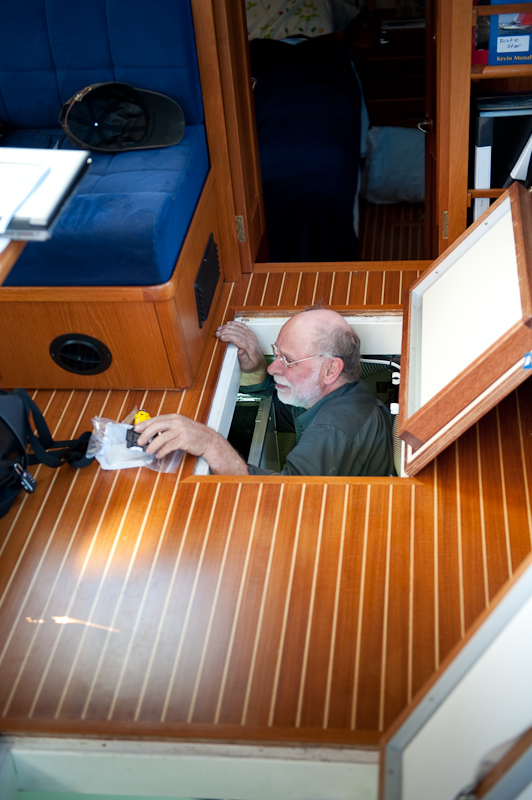
Graham set to work and shoehorned himself into the aft most reaches of the engine room where the afflicted parts of the generator reside. After a hour of dismantling the generator enclosure and the electronic control module that lives on top of the generator, Graham emerged with what was left of the circuit breaker that protected the generator's components.

20090910_Port McNeill_Davis Bay_0187

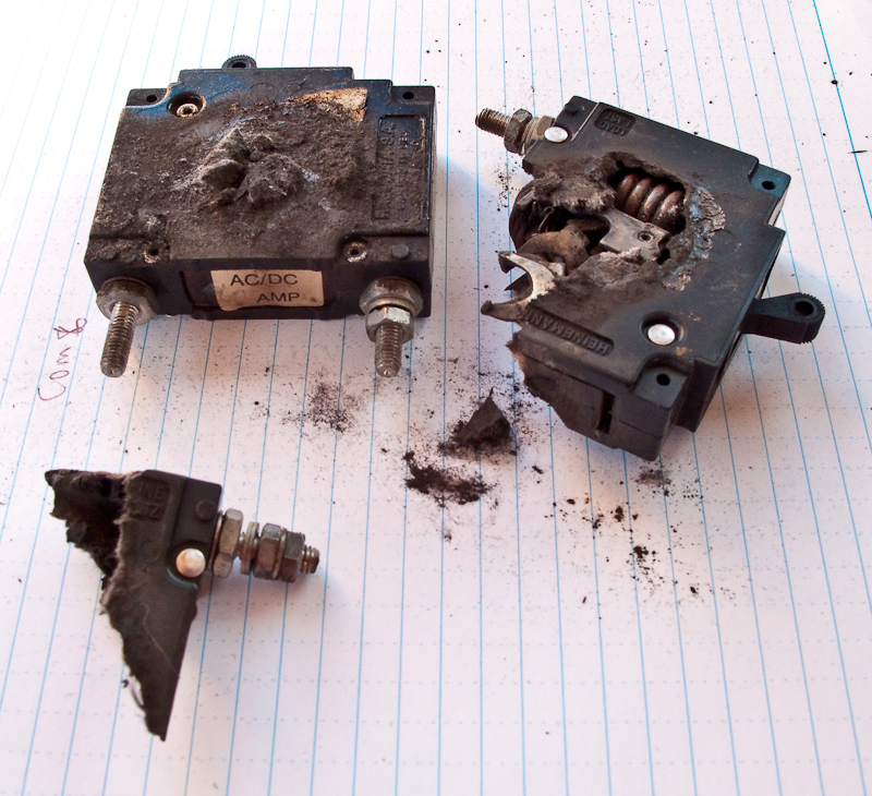
The Remains of the Circuit Breaker

I don't think even the circuit breaker's mother would have recognized this pile of debris as its own. The breaker had burst open and spewed its guts during its final death throes. The picture says it all. And about 4pm, the search for a replacement part began.

Graham called his supplier to order up a replacement which would arrive the next day on the 3:30pm bus from Qualicum. While in today’s world that would seem an eternity, remember where we are and how far we are from any major population center. At the same time Brian, from Northwest Explorations, was on the hunt to secure the same part along with anything else Graham might need to repair the afflicted power generator.

It’s important to remember that getting a new circuit breaker in place was just the beginning of the troubleshooting process. Once the breaker was in, there still existed the possibility that other components had failed and would need to be replaced.

Brian had the advantage of being in Bellingham, Washington with easy access to all the parts and dealers along the U.S. West Coast. Ultimately he had Lugger, the Northern Lights generator manufacturer, put together a “care package” of parts. The disadvantage of being in the U.S. is that there are Customs challenges when sending parts into Canada that can delay arrival. Combine this with the fact that there are few options for transportation of the parts once secured. Scheduled air service is limited and charter flights are very expensive. To Northwest Explorations' credit, they explored every possible option and all were “in the mix”. The final decision would come down to what would get the parts to us the fastest.

We were happy to plug into shore power and get our refrigeration and freezer back, as everything was stuffed to the gills with enough food for 3+ weeks. However, when we plugged in, the refrigeration/freezer units did not respond. We trouble shot some more and found that when the "genny" circuit breaker fried, the fuse went on the Grunert refrigeration control unit. Luckily, Steve Jackman's auto parts store at the head of the dock had the 10amp fuse we needed.

20090909_Port McNeill_0090

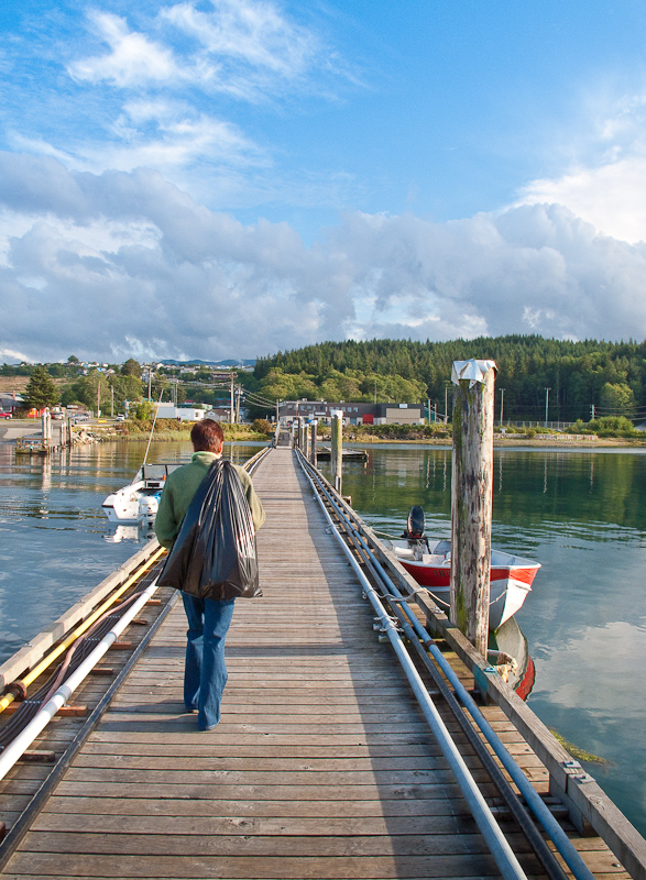
Karen Takes the Garbage "Out" on Her Way to Buy a New Fuse

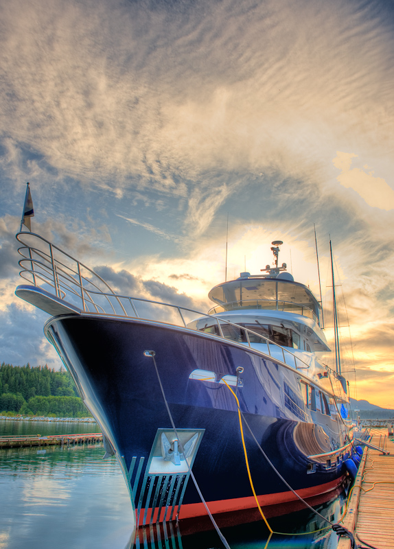
Back in the town of Port McNeill, we went back to our favorite place to dine, the Northern Lights restaurant. The salmon in puff pastry was great and the Keith Alexander Amber Ale helped us shrug off the changes in our plans to some degree. The day was also made better by meeting up again with Captain Dave from the lovely 80+ foot custom yacht we had seen on the docks earlier, who offered us a tour and raised Karen's spirits by letting her live vicariously for a while. She especially admired the heated bathroom floors, under lit bathroom sinks, and killer galley with a cold room for storage. Bob? He was into the forward looking sonar.

20090909_Port McNeill_0065_6_7_8_9-Edit

Our Big Beautiful Neighbor at the Docks

Murray Labyrinth

The morning started as usual. Listen to the weather report, make breakfast and then plan the day. With breakfast complete, showers behind us and looking forward to a great day exploring Murray Labyrinth, I was standing at the helm when I looked down at the AC panel to see how the charging of the batteries was progressing.  At that moment, the voltage meter and the amp meter started to fluctuate wildly.

I immediately shut down the generator. OMG, what is going on? My first thought was that since the inverter and the refrigeration system were the only two AC power systems that were running, one of them must be having a problem.

Given the dramatic nature of the power fluctuations, I placed a call to our charter company's (Northwest Explorations) president, Brian Pemberton, to report the problem and get some considered advice before I started troubleshooting.

It's these circumstatnces when a satellite phone becomes a vital piece of safety equipment in this part of the world. There is no cell coverage, so your only choice is to rely on satellite communication. If we did not have this option, I would troubleshoot the problem on my own. However, my hope is that someone on the other end of the phone has seen this before, and that knowledge will expedite the process of resolving the problem.

Brian was a great help, but after two restarts of the generator produced the same or worse results, the volt meter and amp meter both went to zero. The generator continued to run but produced no AC power.

By the afternoon and after exhausting all possible work-a-rounds, our plan then became to arrange for a mechanic to meet us back in Port McNeill. Given the tides, the gale warnings on the Strait, and the distance back to port, we would have to wait till tomorrow morning before departing for Port McNeill. Karen was really disappointed, as she had planned the entire trip around the Nakwakto Rapids and the lovely inlets behind these rapids. Instead, it's back to Port McNeill for maintenance.

Brian was a great help in crafting a plan for the next 24 hours without the use of the generator. Our NO-GEN plan was to use ice from the DC powered icemaker to keep the refrigerators and freezer cold enough; we would cook with either the microwave or the propane grill; the DC powered diesel heater would keep us warm; and we would use the alternator on the starboard engine to keep the batteries topped off.

The rest of the day was spent monitoring the voltages of the various battery banks, running the starboard engine as needed and reducing our power requirements to a minimum.

Murray Labyrinth Anchorage Panorama (use the controls or your cursor to see 360 degrees)

At 8:44pm with all the battery banks “in the green” we went to bed, planning on a early departure tomorrow morning. The weather forecast was not great, but well within the parameters of the boat and our experience.

20090907_Murray Labyrinth_0109_10_11_12_13-Edit Beautiful Sunset in Murry Labyrinth

Miles Inlet to Murray Labyrinth

I awoke just before the alarm at 7:00am. We seldom use an alarm when on vacation, but we had a date with the tide. There is little information to be found on Murray Labyrinth. but Karen has been fascinated by the sound of any place whose name contains the word "Labyrinth". Those few mariners who have made the journey through the Labyrinth rave that if you master the challenges of the zig zag, somewhat "blind" entrance, you will be rewarded by a delightful protected anchorage with endless areas to explore via dinghy and/or kayak.

So off we went for the short 5 mile run. Along the way a humpback whale appeared on our port beam and paralleled our course until it sounded for food. It's always exciting to see a whale, and this encounter was most unexpected.

The route into Murray Labyrinth earns it name. It is narrow with many twists and turns. A zig-zag narrow channel between the rocks is intimidating. That is why we choose to make the run at low tide (it was a 3ft low tide) when more potential obstructions are visible. The trade off of running at low tide is the channel is narrower and demands the helm be diligent in choosing the course.

We supplemented our Nobeltec navigation display with a bow watch. It is a good practice, but seldom has the bow watch contributed in other narrow passages. Either the sun was in the wrong position so that its reflection on the water obscured anything below the surface or we never got close enough to the rocks or the bottom for the bow watch to issue a warning. This time was different. Twice the bow watch sounded an alarm just before the helm noticed the depth was dramatically lessening. Hats off to the bow watch, Karen!

Once inside the narrow entrance, the water opens up to a beautiful bay. The only obstruction is a rock that sits near the middle. Where else would a rock sit?

The holding is good in a mud bottom and we anchored in 21 feet about equal distance from three shores and that aforementioned rock. It’s important to note that the rock is only visible at low water and quickly covers, so be aware.

The anchorage is well protected and calm. The winds would blow from time to time but seldom exceeded 8 knots. Out on the Strait, it was blowing 20-30.

Given that our fair weather of the previous day had turned to rain, combined with the fact that we were both bone tired, made the day one of small projects around the boat, napping, reading, working on this blog and taking pictures between the raindrops. 20090907_Murray Labyrinth_0026 Karen Napping

20090907_Murray Labyrinth_0042

How Many Books Can Karen Read On a Rainy Day?

Although the forecast for tomorrow calls for a lot of rain, we still hope to get out and explore. Some of our most memorable trips in the kayaks and the dinghy have been in the rain, so we are seldom deterred by precipitation. Of course, a warm shower afterwards makes the memories even fonder. 

Right around 6PM the sun tried to make an appearance. Given the gloomy forecast for tomorrow, this is simply Mother Nature trying to tease us into optimism. For the rest of the evening it oscillated between rain, rain showers and more peeks of sun. Such is the weather in the Pacific Northwest.

20090907_Murray Labyrinth_0021-Edit

A Rainy Window Showing All our Satellite Gear: SPOT, Bluetooth GPS and XM Weather Receiver

The rain held off long enough for me to grill some sockeye salmon with an orange glaze accompanied by curried sweet potatoes.