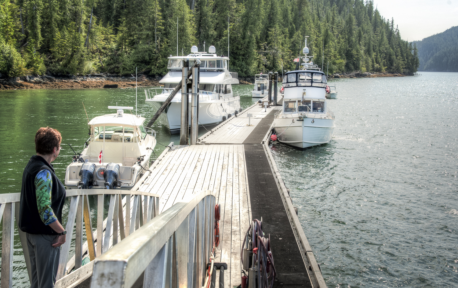
Bull Harbour to Winter Harbour via Cape Scott

The morning was still. The forecast was reasonably good for our rounding of Cape Scott. The winds were to be from the northwest later changing to south. The northwest part we liked but not the forecast for south, because that would put the seas on our bow with the current on our stern. The weather radio was also using a new term we had never heard before: “near gales”, is that like almost pregnant? The terminology mariners have be using for generations has served us well. Parsing between near gale and gale seems to solve a problem that does not exist.

Looking at the big picture though, I could not see that any of this forecast was going to happen quite as Environment Canada was predicting. The ridges and troughs we have been under the influence of for most of our trip have moved slower and dissipated more quickly than the weatherman has predicted.

We’ll find out soon enough.

While on the subject of weather, I am making good us of GRIB weather files on this trip. GRIB files are relatively small text files that you can download even with slow satellite connections speeds for any geographic area you define. You need some software on your computer to translate the text into a graphical presentation, but once you do you get a great view of weather patterns for multiple days. Pressure, winds, wave heights, cloud cover, precipitation -- are all there. This is what I call raw data. It is the same information the meteorologists are looking at to make their predictions.

I am much happier looking at the data myself and making my own predictions. So far, I’m doing better than the very conservative Environment Canada. I’ll continue to refine my skills, but I see the GRIB files along with actual buoy and reporting stations updates as being my primary source of weather info.

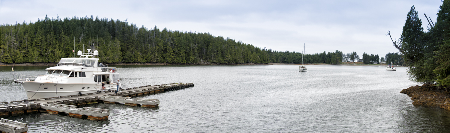
We started pulling the anchor up a few minutes early, perhaps anxious to get the rounding done. Just before us, Kodiak left the dock heading south down the inside and the Duffy Morgan (steel sailboat) made headway just before us. Apparently they had researched Karen’s suggestion of going behind the Tattnall Reefs to avoid the Nahwitti Bar because they are on our schedule now. I hope it works out for them. You like to share information freely, but if they have a bad ride, you feel a little guilty.

Everybody leaves Bull Harbour

Everybody leaves Bull Harbour

Karen described the Tatnall Reefs route as "most excellent". The Nahwitti Bar looked passable, but there was a continuous one meter swell from the northwest. . The low swells continued and the calm winds persisted as we approached Cape Scott. 

All in all, it was a nice ride

With Karen at the helm, the rounding of Cape Scott was uneventful with a low swell from the northwest and some ripples from the developing south winds.

The seas were cooperative

The seas were cooperative

As we proceeded down the coast we were in and out of rain showers with corresponding decreases and increases in visibility. Sometimes we could see the coast and sometimes not.

Rounding Cape Scott

Rounding Cape Scott

Soon the Canadian Coast Guard cutterTanu appeared as an AIS target. Good, something to do! I explored the features of tracking AIS targets in the Nobeltec Odyssey program. I could track the Tanu and display all its pertinent information in a separate window. I don’t know if the cutter had a planned heading change or if the captain ordered someone to come take look at us, but the ship changed its course slightly and the AIS predicted a passing of about one mile. Coincidentally that was the prevailing visibility.

As the Tanu passed abeam we could make out her red hull in the fog and mist.

When the weather would lift and the beaches appeared, we would do a little sightseeing. Then the visibility would come down and we would return to our cocoon of mist.

Karen was reading when she got up and announced “where’s the critters?” At the same time a group of sea lions popped up of our port forward beam not 30 yards away. “Over there”, I replied. The group was spy-hopping us for a good look. Then they would dive and pop up again about half the distance to the boat. One more time they appeared. This time, within 10 feet and abeam our port. They were definitely checking us out. They would lift themselves out of the water showing almost 40% of their body length. That was fun, now back to watching the miles tick away as the swells pushed us south.

The rain and mist continued all the way into the anchorage. We changed our destination slightly from Winter Harbour to North Harbour just inside the entrance to Winter Harbour. Alaskan Dream tucked in behind the island and dropped her anchor in front of a small sailboat with Honolulu printed on its side. I could swear it is the same that was tied up behind us in Queen Charlotte City. We’ll hang here overnight and then go up to Winter Harbour to provision and take on water before we go to our next anchorage. 

North Harbour anchorage neighbor 

North Harbour anchorage neighbor


Duncanby Landing to Bull Harbour

We’re up at six for a planned 7am departure. We had planned our departure time to pick up some push from the tide as we rounded Cape Caution. There is not much current to be had on our intended course, but any help is appreciated.

Some of the fishing boats from the Lodge had already departed, but most were still tied to the docks.

I topped of the water tanks after we showered and released the lines that held us to the docks. As we departed Duncanby, one boat from the Lodge after the other rushed past us in search of salmon.

The forecast called for one foot chop with a low westerly swell. Alaskan Dream rode the swells up and down, but there was no chop. As we made our way toward Cape Caution, we saw a few humpbacks whales. First we saw a solo whale, then a larger group of five to six. I think two of them were mother and calf owing to the close proximity of their spouts.

Later we spotted three sea otters and a sea lion who was devouring a meal of fresh fish on the surface.

We spotted a cruise ship on the AIS and a couple of tugs with their tows. A BC Ferry graced our route headed northeast.

The low westerly swells continued with no chop and we were tempted to adjust our course a little west and make the run for Cape Scott. But our taste for extremely long days was gone after our 16 hours coming from the Haida Gwaii. Add to that a reasonable forecast for the next day, and we were pleased to make good our course for Bull Harbor.

After my first two hour watch, I made breakfast. My original plans included eggs, but the swells dictated a menu change to toasted peanut butter and jelly sandwiches along with fresh cantaloupe. Sugar, carbs and protein with some fresh fruit makes it seem like a well-balanced breakfast and we are set until after we drop anchor about 1pm.

No one likes sea gulls except when they mark the log in the water

No one likes sea gulls except when they mark the log in the water

The swells stayed with us for the entire passage although they diminished the closes we got to our destination. We also chased the fog as we proceeded southwest, never quite catching it. All in all, it was a peaceful crossing.

No question where the prevailing winds come from

No question where the prevailing winds come from

Bull Harbor is a popular stopping point for boats to stage before they go around Cape Scott. Karen thinks there will be 10 boats there tonight. I think 5 or less.

As we make our way up the channel to Bull Harbour we were greeted with no other boats in the anchorage. We set our anchor; had a little snack of goat cheese, pepperoni and cherry chutney.

In the late afternoon, Karen and I took the dingy over to the community docks to start our walk to Breakers Beach. The walk is about 1 mile with first three-quarters on a nice gravel road and the last quarter through a well-marked and easy trail. Given the extremely calm conditions, there were little or no breakers to be seen. Apparently these beaches are renowned for massive breaking waves when the conditions are favorable.

We are very happy from a great walk over to the east beach

We are very happy from a great walk over to the east beach

We talked with the people aboard Kodiak, a 59 Grand Banks Aleutian headed to Anacortes that was tied to the community docks. On our dinghy ride back, we stop at the steel hulled sailboat and discussed with cruisers about the rounding of Cape Scott tomorrow. They did not know about the passage through the Tattnall Reefs that lets you avoid most of the nasty stuff at the Nahwitti Bar.

Karen exploring the rocks

Karen exploring the rocks

Bob sticks to the grassy knoll, for a great view of the bay

Bob sticks to the grassy knoll, for a great view of the bay

The beach at the end of the walk

The beach at the end of the walk

Bull Harbour

Bull Harbour

Tomorrow we are leaving at 8:30am in order to arrive at Cape Scott at high slack and then round the cape and ride the ebb to Winter Harbour.

Dinner was grilled Halibut tacos.


Pruth Bay to Duncanby Landing

I awoke at 7am to find low clouds and grey skies. However by 8, the sun was out and Karen came up from below complaining of the sun in her eyes.

It’s going to be a relaxing morning. I want to get underway by 10am, but I think Karen may extend that a little longer. This is more the type of morning we enjoy. The slower pace is nice after so many days of covering so many miles every day.

Breakfast was not until 9. We toasted some leftover biscuits under the broiler, then added butter and topped them with honey. Karen was in heaven.

As we made our way down Fitz Hugh Sound Karen shouted: “Blows”. I turned Alaskan Dream in the direction of the humpbacks so we could take a closer look. There were multiple humpbacks in the area abeam the light on Addenbroke Island. We had slowed to about two knots when a mother and her calf surfaced about twenty five feet from our port beam. I put the engine in neutral as the whales had surprised both us and themselves. We lingered in the area for a short time and saw at least five animals. No flukes, just humps, we moved on.

Duncanby Lodge, our destination, is a high end fly-in fishing lodge. They do have docks for mariners with fuel, water and 30 & 50 amp power. They will also serve breakfast, lunch and dinner to boaters in their lodge.

We were greeted at the fuel dock and topped off the tanks and also added a few liters of gas to the dinghy. From the fuel dock we walked Alaskan Dream 75 feet down the docks and tried up for the evening.

Great guest dock at Duncanby Landing

Great guest dock at Duncanby Landing

In with the new (guests), out with the old

In with the new (guests), out with the old

It was changeover day at the lodge and about the time we tied up in came 40 fishing guests aboard a squadron of seaplanes. They are part of a corporate outing. The dock hand informed us that 30 is their normal capacity, and this was the exception. Apparently they have been here before and are known to be a rowdy bunch. My experience is that even if you are rowdy, after a day on the water and with a early wake-up call facing you the next morning, rowdy tends to end early. 

Karen spent the afternoon doing laundry and cleaning the interior of the boat. We had dinner at the lodge, which gave me a nice respite from cooking duty.

The boys ride the luggage cart, the girl pushes (no comment) 

The boys ride the luggage cart, the girl pushes (no comment) 

When in full swing, this is a very busy fish cleaning station

When in full swing, this is a very busy fish cleaning station

Rose Inlet to Pruth Bay

Up at 4pm in the dark, throw on some clothes and prepare to depart. Last night I configured all the electronics to be as dim as possible. This was to protect our “night vision” in the pre-dawn morning. On those items that I could not dim enough, I covered them with whatever would block the light but still be able to be removed for a quick check. Although I dimmed the laptop as much as possible, it was still too bright, so I placed a sheet of paper over portions of the screen. If I placed the paper right up against the screen, I was still able to see the course line to steer.

This was important because as we left the anchorage, it was still too dark to clearly differentiatte the sea, land and sky. We motored at idle, about 2.5 knots, as we waited for there to be enough light to see any logs along our route.

Using the plotter and radar for navigation, we made our way east. I had to do a little hand steering though the turbulent waters as we turned eastbound. The current was on our stern at 2 knots and the same disturbed waters we had experience two days before were still there.

Thirty minutes into the trip, about 5am, there was sufficient light to clearly see any debris in the water so we advanced the throttles to cruise speed and set off on our 16-hour journey.

The weather was as forecast: “winds from the west 10-15 knots and seas less than one meter.” For the entire trip we had very little relative wind since it was traveling at the same speed and in the same direction as Alaskan Dream. The seas too were on our stern and ranged from flat to 2-3 foot swells in the afternoon. All and all, we could have not asked for a better day.

After my first two hour watch, I went back to bed and Karen let me sleep for three hours. I woke up on my own, but I suspect that Karen’s bladder was about to call me to the helm anyway.

I made breakfast and dinner en-route and Karen took care of making lunch. Her signature tuna melts hit the spot. They are so quick and easy to make while underway, they often are our fall back if we have not made something in advance.

Karen enjoys her off-duty time from the helm

Karen enjoys her off-duty time from the helm

Not much to report, we did see a couple of new critters for us. We spotted albatross and a few sharks. Except for the rest of Mother Goose fleet that was an hour behind us and on a course two degrees further north, we saw only a couple of working boats and a cruise ship. The fleet did pass us about half way across and were about ten miles ahead as they set anchor in Hurricane Anchorage. We could follow them on the AIS and make out the occasional voice transmission that broke through the squelch. Karen called out “Land Ho” at 2:36pm with 50 miles still remaining.

Our destination of Pruth Bay is off Hakai Passage which is renowned for its great fishing. As we entered the passage we found a small skiff bouncing in the waves just off the rocks; probably angling for rockfish. They were from Hakai Lodge just around the corner. We did find many pleasure boats and a few fishing vessels tucked into little coves all along our route. I suspect they are used as base camps from which the crews go out into the Passage to fish in their dinghies or skiffs.

For some, it's all about fishing

For some, it's all about fishing

Just before sunset we anchored in flat and calm Pruth Bay along with eight other boats. Soon it was time to go to bed after accomplishing what has been our longest single leg of cruising ever.


Rose Inlet, Lay Day

Today we are going to stay at anchor in Rose Inlet. It’s an hour ride over to SGang Gwaii and since there is limited space in the small cove at this UNESCO World Heritage site, we are all going to travel over in two boats rather than six.

Jordan picked us up in the dinghy at 7:30 and dropped us aboard Dream Catcher along with the crew of four from Patos. With Deception in the lead and carrying the rest of the party, we made our way to this unique World Heritage Site. We dropped anchor in 45 feet, with good holding on the northwest corner of the island, designated as the access point. Jordan stayed aboard Deception to watch the boats as this area is listed as having marginal holding. Given the ideal conditions today, I would have no problem leaving my boat unattended for a couple of hours. Though the day started off cloudy with a little rain, the sun peeked through the clouds on our trip over from Rose Inlet and began to seriously shine as we landed on the beach.

Through the woods we go

Through the woods we go

The United Nations Education and Science Organization (UNESCO) declared this island a World Heritage site because it is the best representation of a Northwest Coast First Nations village. It is the last village in the Gwaii Hannas to be occupied full-time. In its final years of occupation, there were 20 longhouses, along with many memorial, frontal and mortuary poles.

That was in the late 1800’s. Little remains now. The mortuary poles were “re-raised” in the 1960’s when the larger frontal poles were removed by Canada and placed in museums for preservation.

The Haida people intend for all these poles to decay and return to the earth, that is part of their belief system. The mortuary poles, raised in honor of Haida of high standing, contained the remains and the “spirit” of the individual. As the poles fall and are reclaimed by the earth, the Haida believe the spirit is set free. Thus, all remaining mortuary poles will be allowed to fall over time.

All that is left of the houses is the large beams

All that is left of the houses is the large beams

Therefore it was a great privilege to see this site; so few have the opportunity to visit such a remote location. With only 1,000 to 1,500 visitors a year, it will only be a few more generations who will be able to gaze upon this village before it returns completely to the earth.

Our Watchman guide for today is Doug. His mom was a Watchman before him, and he spent his summers growing up on this island. He brought a very unique perspective as he explained the Haida culture and the various details of this village. It was not hard to imagine visitors to this Haida clan as they came into the small protected bay in front of the village.  Doug described in detail the customs that the visiting chiefs would perform to show respect for their host.

Doug tells the story of his ancestors

Doug tells the story of his ancestors

I tried to imagine living in this spot 200 years ago

I tried to imagine living in this spot 200 years ago

Karen was particularly taken by the mortuary poles, and the beautiful carvings on them that told key stories of importance to the person they were raised to honor. While the poles have decayed, you can still see the Black Bear, or Grizzly Bear, or Eagle figures, and Doug shared the story of many of the poles. If the “head” and “body” of the figures were of equal size, it implied the pole was post-contact with Europeans. If the “head” was bigger than the “body”, that pole was typically pre-contact. We also learned that Black Bears on these poles have their tongues out and claws that look like fingers, while "Grizzlies" have teeth and more claw-like appendages.

This is a rare sight, soon to return to nature and be no more

This is a rare sight, soon to return to nature and be no more

The little things can be amazing

The little things can be amazing

After a spectacular time on shore, it was back into the dinghy, and then a sunny return to our anchorage in Rose Inlet aboard Dream Catcher.

Karen and I spent the afternoon determining our destination for tomorrow. This is where we part ways with the rest of Mother Goose. They are heading to Hurricane Anchorage just off the BC mainland, but we want to head as far south as practical. Because the watermaker is not working, we added a stop on Saturday at Duncanby Landing, and tomorrow we will anchor in Pruth Bay, leaving us just 27 miles to travel on Saturday where we understand there is water, power and even a restaurant! Tomorrow our trip is 120 miles, the longest single leg we have ever done, crossing the notorious southern half of Hecate Strait.

The rest of the afternoon was spent processing photos  I can give to Emmelina aboard Deception that she’ll use in the DVD she prepares for every Mother Goose leg as a souvenir.

The evening was spent aboard Dream Catcher with Lance and Kathy, sharing thoughts on this trip and planning another in the fall. We also said goodbye to the other crews and got into bed at 9:30 for a 4:00am wake up tomorrow. Our last weather check said that we would have a fairly calm crossing – let’s hope it holds true! 

SGang Gwaii looks like the enchanted place it is

SGang Gwaii looks like the enchanted place it is